Maps of Poland
- Maps are also available as part of the
 Wikimedia Atlas of the World project in the Atlas of Poland.
-
Satellite image of Poland in February 2003
-
Satellite photo taken from Landsat7
-
English: Hydrography of PolandPolski: Hydrografia Polski
-
Polish borders
-
Overview map of Poland
-
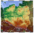
English: Topography Map of Poland 2005Polski: Topografia Polski
-
Poland
Location maps
edit-
Location map of Poland
-
Location map of Poland in Europe
Maps of the history of Poland
edit-
English: Historical MapPolski: Mapa historyczna
-
English: Historical MapPolski: Mapa historyczna
-
English: Historical MapPolski: Mapa historyczna
-
English: Historical MapPolski: Mapa historyczna
-
English: Historical MapPolski: Mapa historyczna
-
English: Historical MapPolski: Mapa historyczna
-
English: Historical MapPolski: Mapa historyczna
-
English: Historical MapPolski: Mapa historyczna
-
Poland 1201-1241
-
Poland 1275-1300
-
Poland 1304-1333
-
English: Jagiellonian Europe in the late 15th centuryPolski: Jagiellońskiego imperium pod koniec 15-gie wiek
-
Polish-Lithuanian Commonwealth in 17th and 18th century
-
Polish-Lithuanian Commonwealth - administrative division
-
Poland in 1939
-
Poland between 1921 and 1939
-
Map of Slavic peoples in the 8/9c.
-
Map of Poland in 992
-
Map of Poland 982-1025
-
Map of Poland 1138
-
Map of Poland - Fragmentation Period
-
Map of Poland - reign of Casimir the Great
-
Poland and Lithuania Commonwealth
-
Poland in 1569
-
Poland 1634-1660
-
Poland 1772
-
Poland 1793
-
Partitions of Poland 1772, 1793 and 1795
-
Poland 1815-30 (Congress Poland)
-
Poland 1921-1939
-
Poland Galicia Volynia
-
Curzon line
-
Curzon line (Polish labels)
-
Curzon line (English labels)
-
Border changes after WW2 (English text)
-
Border changes after WW2 (Russian text)
-
Duchy of Warsaw
-
Administrative division ad 1922
-
Administrative division ad 1957
-
Administrative division ad 1975
-
Administrative division ad 1999 - Matrix for locator maps
Voivodships
edit-
English: Map of administrative divisions of PolandPolski: Mapa podziału administracyjnego Polski


