Category:Heřmanice (Náchod District)
Jump to navigation
Jump to search
village in Náchod District of Hradec Králové region | |||||
| Upload media | |||||
| Instance of | |||||
|---|---|---|---|---|---|
| Location |
| ||||
| Located in or next to body of water | |||||
| Population |
| ||||
| Area |
| ||||
| Elevation above sea level |
| ||||
| official website | |||||
 | |||||
Subcategories
This category has the following 6 subcategories, out of 6 total.
B
- Brod (Heřmanice) (31 F)
- Běluň (Heřmanice) (15 F)
S
Media in category "Heřmanice (Náchod District)"
The following 20 files are in this category, out of 20 total.
-
Heřmanice (okres Náchod) vlajka.jpg 600 × 400; 40 KB
-
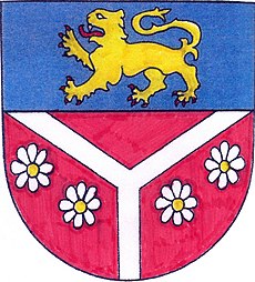
Heřmanice (okres Náchod) znak.jpg 1,078 × 1,192; 603 KB
-
Heřmanice from air 1.jpg 2,800 × 1,671; 2.88 MB
-
Heřmanice mlýn.JPG 3,504 × 2,336; 3.01 MB
-
Heřmanice mlýn1.JPG 3,504 × 2,336; 2.94 MB
-
Heřmanice obecní úřad.JPG 2,336 × 3,504; 2.95 MB
-
Heřmanice pošta.JPG 3,504 × 2,336; 3.18 MB
-
Heřmanice čp. 1.JPG 3,504 × 2,336; 3.1 MB
-
Heřmanice čp. 15.JPG 3,504 × 2,336; 1.27 MB
-
Heřmanice čp. 18.JPG 3,504 × 2,336; 1.18 MB
-
Heřmanice čp. 2.JPG 3,504 × 2,336; 3.03 MB
-
Heřmanice čp. 22.JPG 3,504 × 2,336; 3.05 MB
-
Heřmanice čp. 23.JPG 3,504 × 2,336; 3.52 MB
-
Heřmanice čp. 24.JPG 3,504 × 2,336; 3.24 MB
-
Heřmanice čp. 26.JPG 3,504 × 2,336; 2.88 MB
-
Heřmanice čp. 3.JPG 3,504 × 2,336; 3.48 MB
-
Heřmanice čp. 35.JPG 3,504 × 2,336; 2.76 MB
-
Heřmanice čp. 49.JPG 3,504 × 2,336; 3.11 MB
-
Heřmanice čp. 8.JPG 3,504 × 2,336; 3.33 MB
-
Heřmanice školka.JPG 3,504 × 2,336; 3.84 MB


