This article needs additional citations for verification. (February 2022) |
Waldbillig (Luxembourgish: Waldbëlleg or locally Bëlleg [ˈbələɕ]) is a commune and small town in the canton of Echternach, Luxembourg.
Waldbillig
Waldbëlleg (Luxembourgish) | |
|---|---|
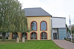
 Town hall | |
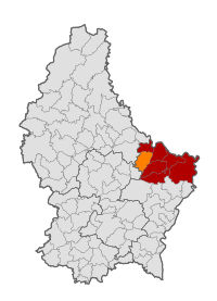
 Map of Luxembourg with Waldbillig highlighted in orange, and the canton in dark red | |
| Coordinates: 49°47′45″N 6°17′10″E / 49.7958°N 6.2861°E | |
| Country | |
| Canton | Echternach |
| Government | |
| • Mayor | Andrée Henx-Greischer |
| Area | |
| • Total | 23.28 km2 (8.99 sq mi) |
| • Rank | 40th of 100 |
| Highest elevation | 387 m (1,270 ft) |
| • Rank | 63rd of 100 |
| Lowest elevation | 186 m (610 ft) |
| • Rank | 18th of 100 |
| Population (2023) | |
| • Total | 1,960 |
| • Rank | 82nd of 100 |
| • Density | 84/km2 (220/sq mi) |
| • Rank | 78th of 100 |
| Time zone | UTC+1 (CET) |
| • Summer (DST) | UTC+2 (CEST) |
| LAU 2 | LU0001008 |
| Website | waldbillig.lu |
As of 2024[update], the town of Waldbillig, which lies in the centre of the commune, has a population of 599.[1]
Populated places
editThe commune consists of the following villages, alongside their population:
- Christnach (Chrëschtnech; population: 822)
- Freckeisen (Freckeisen; population: 24)
- Haller (Haler; population: 427)
- Mullerthal (Mëllerdall; population: 62)
- Niesenthal (Nisendaller Haff; population: ?)
- Waldbillig (Waldbëlleg; population: 599)
- Fléckenhaff (lieu-dit)
- Grondhaff-Schlass (lieu-dit)
- Haarthaff (lieu-dit)
- Kelleschhaff (lieu-dit)
- Savelborn[a] (Suewelbuer) (lieu-dit)
- Uelegsmillen (lieu-dit)
- Notes
- ^ Part of the farm belongs to the section of Medernach of the commune of Vallée de l'Ernz.
History
editPopulation
editGraphs are unavailable due to technical issues. There is more info on Phabricator and on MediaWiki.org. |
References
edit- ^ "Registre national des personnes physiques RNPP : Population par localité". data.public.lu. 2024-01-07.
- ^ "Population par canton et commune". statistiques.public.lu. Retrieved 11 January 2022.
External links
edit- Media related to Waldbillig at Wikimedia Commons
