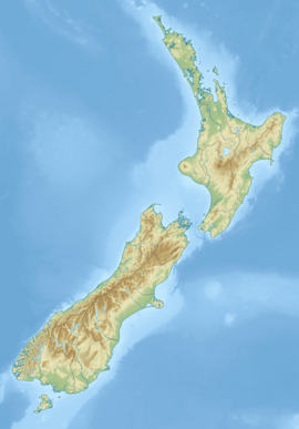
The Pūkaki Creek, also known as the Pūkaki Inlet, is an estuarine river of the Auckland Region of New Zealand's North Island. It flows south from its sources in Māngere and Papatoetoe, entering into the Manukau Harbour. The creek is adjacent to Auckland Airport and Pūkaki Marae.
| Pūkaki Creek | |
|---|---|
 The mouth of the Pūkaki Creek and Wiroa Island | |
 Route of the Pūkaki Creek | |
| Location | |
| Country | New Zealand |
| Region | Auckland Region |
| Physical characteristics | |
| Source | |
| • location | Māngere |
| • coordinates | 36°58′46″S 174°47′54″E / 36.97938°S 174.79841°E |
| Mouth | Manukau Harbour |
• coordinates | 37°00′37″S 174°48′44″E / 37.01036°S 174.81234°E |
| Basin features | |
| Progression | Pūkaki Creek → Manukau Harbour → Tasman Sea |
| Landmarks | Crater Hill, Pukaki Lagoon, Wiroa Island |
| Tributaries | |
| • left | Waokauri Creek, Otaimako Creek |
| • right | Tautauroa Creek |
| Bridges | Pūkaki Bridge |
Geography
editThe Pūkaki Creek is fed by various waterways in South Auckland, including the Tautauroa Creek,[1] the Waokauri Creek[2] (also known as the Waiokauri Creek)[3] and the Otaimako Creek.[4] Adjacent to the creek is the volcanic Pukaki Lagoon. At the mouth of the Pūkaki Creek is Wiroa Island, which is connected to the Auckland Airport complex by road.
History
editTāmaki Māori peoples were present along the Māngere-Ihumātao-Pūkaki coastline from at least 1450, establishing settlements later in the 15th century.[5] The creek formed an important part of the Waokauri / Pūkaki portage, connecting the Manukau Harbour and Tāmaki River via Papatoetoe, and was often used by Tāmaki Māori to avoid the Te Tō Waka and Karetu portages, controlled by the people who lived at Ōtāhuhu / Mount Richmond.[6] The creek formed a part of what was known as Ngā Tapuwae a Mataoho ("The Sacred Footprints of Mataoho"), referring to the volcano God who was said to have created the Auckland volcanic field.[7][8][9]
During the Waiohua confederation era of the 17th and 18th centuries, the area was farmed.[10] After the defeat of Waiohua paramount chief Kiwi Tāmaki circa 1740, many Waiohua people fled the region. When the Waiohua people began to re-establish themselves in the Tāmaki Makaurau area in the later 18th century, most settled around the Manukau Harbour and South Auckland. Those who settled along the Pūkaki Creek became known as Te Ākitai Waiohua.[10]
In the 1850s, Lieutenant-Colonel Marmaduke Nixon lived on the western shores of Pūkaki Creek, while Te Ākitai Waiohua lived on the eastern shores.[11] In 1863 immediately prior to the Invasion of the Waikato, Te Ākitai Waiohua and other iwi in the South Auckland area were made to evict the area, or swear fealty to the New Zealand Government.[12] Nixon arrested his neighbour, the Te Ākitai Waiohua rangatira Ihaka Takanini, who later died on Rakino Island.[11] Following the war and land confiscations, much of the land adjacent to the Pūkaki Creek was sold to British immigrant farmers.[12] Te Ākitai Waiohua began returning to the area in 1866, settling to the west of Pūkaki Creek and at Ihumātao.[10] In the 1890s, Te Ākitai Waiohua built a marae on the land, which was used until the 1950s, when the Auckland International Airport was developed on the land.[10]
In the 1950s, the area adjacent to the Pūkaki Creek became market gardens, run by Chinese New Zealand gardeners Fay Gock and Joe Gock.[13] The Gocks began to cultivate kūmara (sweet potatoes), using plant donated to them by their neighbours at Pūkaki Marae. In the 1950s, the Gocks developed a disease-resistant variety of kūmara that became the modern Owairaka Red variety.[14][13]
In 1993, Pūkaki Creek became a Māori reservations under the Te Ture Whenua Māori Act 1993.[3] Te Ākitai Waiohua's principal marae, Pūkaki Marae, opened in 2004, adjacent to the Pūkaki Creek.[15][16][10]
Panorama
editSee also
editReferences
edit- ^ "Tautauroa Creek". New Zealand Gazetteer. Land Information New Zealand. Retrieved 16 May 2022.
- ^ "Waokauri Creek". New Zealand Gazetteer. Land Information New Zealand. Retrieved 16 May 2022.
- ^ a b "Mana Whenua Management Precinct" (PDF). Auckland Council. Retrieved 16 May 2022.
- ^ "Otaimako Creek". New Zealand Gazetteer. Land Information New Zealand. Retrieved 16 May 2022.
- ^ Mackintosh 2021, pp. 28.
- ^ "Papatoetoe street names". Auckland Libraries. Retrieved 16 May 2022.
- ^ Simmons, D. R. (1979). "George Graham's Maori Place Names of Auckland". Records of the Auckland Institute and Museum. 16: 11–39. ISSN 0067-0464. JSTOR 42906272. Wikidata Q58677091.
- ^ New Zealand Government; Te Ākitai Waiohua (2020). "Te Ākitai Waiohua and Te Ākitai Waiohua Settlement Trust and The Crown Deed of Settlement Schedule: Documents (Initialling Version)" (PDF). New Zealand Government. Retrieved 1 September 2021.
- ^ "The History of Our Marae". Makaurau Marae. Retrieved 1 September 2021.
- ^ a b c d e Gibb, Russell (1 September 2015). "Archaeological Assessment of Self Farm / Crater Hill, Papatoetoe, Auckland". Geometria Limited. Retrieved 16 May 2022.
- ^ a b Mackintosh 2021, pp. 100–101, 107.
- ^ a b Mackintosh 2021, pp. 106.
- ^ a b Lee, Lily (18 April 2016). "The Joe Gock Story". Auckland Zhong Shan Clan Association. Retrieved 24 December 2018.
- ^ Lewthwaite, S. L.; Fletcher, P. J.; Fletcher, J. D.; Triggs, C. M. (2011). "Cultivar decline in sweetpotato (Ipomoea batatas)". New Zealand Plant Protection. 64: 160–167. doi:10.30843/nzpp.2011.64.5976.
- ^ "Te Ākitai Waiohua". Te Kāhui Māngai. Te Puni Kōkiri. Retrieved 20 August 2019.
- ^ "Pūkaki". Māori Maps. Te Potiki National Trust. Retrieved 20 August 2019.
Print references
edit- Mackintosh, Lucy (2021). Shifting Grounds: Deep Histories of Tāmaki Makaurau Auckland. Bridget Williams Books. doi:10.7810/9781988587332. ISBN 978-1-988587-33-2.

