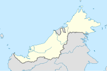
Ba'kelalan Airport
Appearance
Ba'kelalan Airport Lapangan Terbang Bakelalan | |||||||||||
|---|---|---|---|---|---|---|---|---|---|---|---|
| Summary | |||||||||||
| Airport type | Public | ||||||||||
| Operator | Malaysia Airports Berhad | ||||||||||
| Serves | Bakelalan, Sarawak, Malaysia | ||||||||||
| Time zone | MST (UTC+08:00) | ||||||||||
| Elevation AMSL | 2,900 ft / 884 m | ||||||||||
| Coordinates | 03°59′19″N 115°37′08″E / 3.98861°N 115.61889°E | ||||||||||
| Map | |||||||||||
 | |||||||||||
| Runways | |||||||||||
| |||||||||||
| Statistics (2015) | |||||||||||
| |||||||||||
Ba'kelalan Airport (IATA: BKM, ICAO: WBGQ) is an airport in Ba'kelalan, a town in the state of Sarawak in Malaysia.
Airlines and destinations
| Airlines | Destinations |
|---|---|
| MASwings | Bario, Lawas, Miri |
Incidents
- On 13 September 2008 a DHC-6 Twin Otter overshot the runway while landing. All fourteen people on board survived.[3]
See also
References
- ^ Airport information for BKM at Great Circle Mapper.
- ^ AIP Malaysia: Index to Aerodromes Archived 2011-07-22 at the Wayback Machine at Department of Civil Aviation Malaysia
- ^ "Aircraft overshoots runway in Ba'Kelalan". NST Online. 2008-09-13. Archived from the original on 14 September 2008. Retrieved 2008-09-13.
External links
- Short Take-Off and Landing Airports (STOL) at Malaysia Airports Holdings Berhad
- Accident history for BKM at Aviation Safety Network

