Kotor Municipality: Difference between revisions
Appearance
Content deleted Content added
m cleanup (wikitables, html markup, layout, etc.) |
JJMC89 bot (talk | contribs) Migrate {{Infobox settlement}} coordinates parameters to {{Coord}}, see Wikipedia:Coordinates in infoboxes |
||
| Line 13: | Line 13: | ||
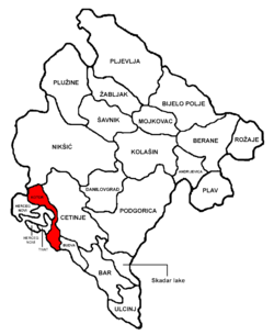
| map_caption = Kotor Municipality in [[Montenegro]] |
| map_caption = Kotor Municipality in [[Montenegro]] |
||
| pushpin_map = |
| pushpin_map = |
||
| ⚫ | |||
| latd = 42.4333 | latNS = N |
|||
| longd = 18.7667 | longEW = E |
|||
| ⚫ | |||
| coordinates_display = title |
|||
| subdivision_type = [[Country]] |
| subdivision_type = [[Country]] |
||
| subdivision_name = [[Montenegro]] |
| subdivision_name = [[Montenegro]] |
||
Revision as of 10:49, 8 March 2017
Kotor Municipality
Opština Kotor | |
|---|---|
 Kotor Municipality in Montenegro | |
| Coordinates: 42°26′00″N 18°46′00″E / 42.4333°N 18.7667°E | |
| Country | Montenegro |
| Area | |
| • Total | 335 km2 (129 sq mi) |
| Population | |
| • Total | 22,601 |
| • Density | 67/km2 (170/sq mi) |
| ISO 3166 code | ME-10 |
| Website | www |
Kotor Municipality is one of the municipalities of Montenegro. The center is Kotor.

