Pårup railway halt
Appearance
Pårup | |||||||||||
|---|---|---|---|---|---|---|---|---|---|---|---|
| Railway halt | |||||||||||
 Pårup railway halt in 1983 | |||||||||||
| General information | |||||||||||
| Location | Ålekistevej 3230 Græsted Denmark | ||||||||||
| Coordinates | 56°06′3″N 12°18′5″E / 56.10083°N 12.30139°E | ||||||||||
| Owned by | Hovedstadens Lokalbaner | ||||||||||
| Operated by | Lokaltog[1] | ||||||||||
| Line(s) | Gribskov Line | ||||||||||
| Platforms | 1 | ||||||||||
| Tracks | 1 | ||||||||||
| Services | |||||||||||
| |||||||||||
| |||||||||||
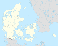
Pårup railway halt is a railway halt serving the small settlement of Pårup near Gilleleje in North Zealand, Denmark.
Pårup halt is located on the Gribskov Line from Hillerød to Gilleleje. The train services are currently operated by the railway company Lokaltog which runs frequent local train services between Hillerød station and Gilleleje station.[1]
The station was opened in 1896 with the opening of the Græsted-Gilleleje section of the Gribskov Line. The original station building was designed by architect Heinrich Wenck. The station building has since been torn down.[2]
References
- ^ a b "Om Lokaltog". lokaltog.dk (in Danish). Lokaltog A/S. Retrieved 20 July 2016.
- ^ "Gribskovbanens Driftselskab (Gribskovbanen)". jernbanen.dk (in Danish). Retrieved 20 July 2016.
External links
Wikimedia Commons has media related to Pårup Station.

