Xnaheb
Appearance
| This article is part of a series on the |
| Maya civilization |
|---|
 |
| History |
| Spanish conquest of the Maya |
|
|

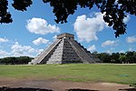
Xnaheb[pronunciation?] is an archaeological site of the pre-Columbian Maya civilization, one of five primary sites identified in the southern Belize region.[1] The center is built on a ridge of foothills that extends from the Maya Mountains, in what is now the Toledo District of Belize.[2] Based on certain architectural similarities between the two sites, it is possible that Xnaheb was founded as an offshoot of Nim Li Punit.[3]
See also
Notes
- ^ Leventhal (1992, pp.145,152); see also "The Glyphic Corpus of Xnaheb" (PDF). (3390 KiB), section report in Wanyerka (2004).
- ^ Pemberton (2005, p.10)
- ^ Dunham et al. (1989, p.275).
References
- Dunham, Peter S.; Thomas R. Jamison; Richard M. Leventhal (1989). "Secondary development and settlement economics: The Classic Maya of Southern Belize". In Patricia A. McAnany and Barry L. Isaac (ed.). Prehistoric Maya Economies of Belize. Research in Economic Anthropology, Supplement 4. Greenwich, CT: JAI Press. pp. 255–292. ISBN 1-55938-051-9. OCLC 20029874.
- Levanthal, Richard M. (1992). "The Development of a Regional Tradition in Southern Belize". In Elin C. Danien and Robert J. Sharer (ed.). New Theories on the Ancient Maya. University Museum Monograph series, #77. Philadelphia: University Museum, University of Pennsylvania. pp. 145–154. ISBN 0-924171-13-8. OCLC 25510312.
- Pemberton, Keith Michael (August 2005). Models for Ancient Maya Coastal Site Development and Economy: Examination of Pork and Doughboy Point, Port Honduras, Belize (PDF) (MA thesis). Louisiana State University. doi:10.31390/gradschool_theses.507. Retrieved 2023-04-06.
- Wanyerka, Phillip J. (2004). "The Southern Belize Epigraphic Project: The Hieroglyphic Inscriptions of Southern Belize" (PDF online publication). The Foundation Granting Department: Reports Submitted to FAMSI. Foundation for the Advancement of Mesoamerican Studies, Inc. (FAMSI). Retrieved 2008-03-18.
16°19′00″N 88°48′00″W / 16.3167°N 88.8°W

