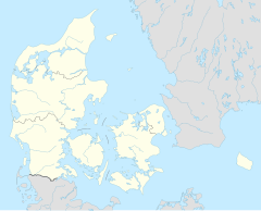
Amager Strand station
Appearance
This article relies largely or entirely on a single source. (October 2024) |
Amager Strand | |||||||||||
|---|---|---|---|---|---|---|---|---|---|---|---|
| Copenhagen Metro station | |||||||||||
 | |||||||||||
| General information | |||||||||||
| Location | Italiensvej 72A, 2300 Copenhagen S Copenhagen Municipality | ||||||||||
| Coordinates | 55°39′22″N 12°37′54″E / 55.65611°N 12.63167°E | ||||||||||
| Owned by | Metroselskabet | ||||||||||
| Platforms | 1 island platform | ||||||||||
| Tracks | 2 | ||||||||||
| Bus routes | |||||||||||
| Construction | |||||||||||
| Structure type | At grade | ||||||||||
| Accessible | Yes | ||||||||||
| Other information | |||||||||||
| Station code | Ams | ||||||||||
| Fare zone | 3 | ||||||||||
| History | |||||||||||
| Opened | 28 September 2007 | ||||||||||
| Passengers | |||||||||||
| 1000 | |||||||||||
| Services | |||||||||||
| |||||||||||
| |||||||||||
Amager Strand station is a rapid transit station on the Copenhagen Metro, located in the Sundbyøster district of Copenhagen. It opened on 28 September 2007. It is named after the nearby beach at Amager Strandpark.[1]
The station serves the M2 line, in fare zone 3.
References
[edit]- ^ "Amager Strandpark | OplevByen.dk" (in Danish). 2015-04-19. Retrieved 2024-09-25.
External links
[edit]- Amager Strand station on www.m.dk[permanent dead link] (in Danish)
- Amager Strand station on www.m.dk[permanent dead link] (in English)


