Anderson, Dorset
Appearance
| Anderson | |
|---|---|
 Anderson Manor | |
Location within Dorset | |
| Population | 60 [1] |
| OS grid reference | SY880975 |
| District | |
| Shire county | |
| Region | |
| Country | England |
| Sovereign state | United Kingdom |
| Post town | Blandford Forum |
| Postcode district | DT11 |
| Police | Dorset |
| Fire | Dorset and Wiltshire |
| Ambulance | South Western |
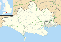
Anderson, sometimes known as Winterborne Anderson, is a small village and civil parish in Dorset, England, situated in the North Dorset administrative district about 9 miles (14 km) northwest of Poole. To the west are Winterborne Muston and Winterborne Kingston and to the east are Winterborne Tomson (which is also within Anderson parish) and Winterborne Zelston. In 2013 the estimated population of the parish was 60.[1]
Anderson Manor was built for the third John Tregonwell of Milton Abbas in 1622. It is constructed out of dark red brick with bands of vitrified headers.[2]
The civil parish was formed in 1933, following the merger of Winterborne Anderson and Winterborne Tomsom. [3]
References
[edit]- ^ a b "Parish Population Data". Dorset County Council. 20 January 2015. Archived from the original on 2 November 2014. Retrieved 20 January 2015.
- ^ Roland Gant (1980). Dorset Villages. Robert Hale Ltd. p. 182. ISBN 0-7091-8135-3.
- ^ "Anderson | British History Online". www.british-history.ac.uk. Retrieved 20 March 2022.
External links
[edit]![]() Media related to Anderson, Dorset at Wikimedia Commons
Media related to Anderson, Dorset at Wikimedia Commons


