Krabčice
Krabčice | |
|---|---|
 View of Krabčice from Říp | |
| Coordinates: 50°24′20″N 14°18′5″E / 50.40556°N 14.30139°E | |
| Country | |
| Region | Ústí nad Labem |
| District | Litoměřice |
| First mentioned | 1226 |
| Area | |
• Total | 10.31 km2 (3.98 sq mi) |
| Elevation | 268 m (879 ft) |
| Population (2024-01-01)[1] | |
• Total | 947 |
| • Density | 92/km2 (240/sq mi) |
| Time zone | UTC+1 (CET) |
| • Summer (DST) | UTC+2 (CEST) |
| Postal code | 411 87 |
| Website | www |
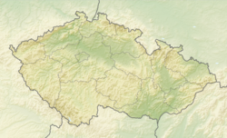
Krabčice (German: Krabschitz) is a municipality and village in Litoměřice District in the Ústí nad Labem Region of the Czech Republic. It has about 900 inhabitants.
Administrative parts
[edit]The villages of Rovné and Vesce are administrative parts of Krabčice.
Geography
[edit]Krabčice is located about 19 kilometres (12 mi) southeast of Litoměřice and 33 km (21 mi) north of Prague. It lies in the Lower Ohře Table, in the Polabí lowlands. The highest point is a contour line at the northern slope of the Říp Mountain at 320 m (1,050 ft) above sea level.
History
[edit]The first written mention of Krabčice is from 1226, when Matěj and Václav Nemoj from the Vršovci family gave the land to the monastery in Doksany. However, it was taken away from Doksany by Emperor Sigismund in order to assign it as a pledge to the Lords Rous of Svinov. At the end of the 16th century, it was purchased by William of Rosenberg. Then it was acquired by the Lobkowicz family, who owned it until 1850.[2]
Demographics
[edit]
|
|
| ||||||||||||||||||||||||||||||||||||||||||||||||||||||
| Source: Censuses[3][4] | ||||||||||||||||||||||||||||||||||||||||||||||||||||||||
Transport
[edit]There are no railways or major roads passing through the municipality.
Sights
[edit]
The main landmark of Krabčice is the Evangelic church. It was built in the neo-Renaissance style in 1885, when it replaced a church from 1790.[5]
References
[edit]- ^ "Population of Municipalities – 1 January 2024". Czech Statistical Office. 2024-05-17.
- ^ "Historie" (in Czech). Obec Krabčice. Retrieved 2022-09-08.
- ^ "Historický lexikon obcí České republiky 1869–2011" (in Czech). Czech Statistical Office. 2015-12-21.
- ^ "Population Census 2021: Population by sex". Public Database. Czech Statistical Office. 2021-03-27.
- ^ "Evangelický kostel" (in Czech). Obec Líbeznice. Retrieved 2023-12-28.


