Lake Manyara Airport
Appearance
Lake Manyara Airport | |||||||||||
|---|---|---|---|---|---|---|---|---|---|---|---|
 | |||||||||||
 Lake Manyara Airport terminal building. | |||||||||||
| Summary | |||||||||||
| Airport type | Public | ||||||||||
| Owner | Government of Tanzania | ||||||||||
| Operator | Tanzania Airports Authority | ||||||||||
| Serves | Lake Manyara National Park | ||||||||||
| Elevation AMSL | 4,150 ft / 1,265 m | ||||||||||
| Coordinates | 3°22′35″S 35°49′05″E / 3.37639°S 35.81806°E | ||||||||||
| Website | www | ||||||||||
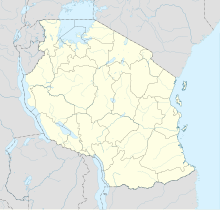
| Map | |||||||||||
 | |||||||||||
| Runways | |||||||||||
| |||||||||||
Lake Manyara Airport (IATA: LKY, ICAO: HTLM) is an airport serving the Lake Manyara National Park in the Arusha Region of Tanzania.
Airlines and destinations
[edit]| Airlines | Destinations |
|---|---|
| Coastal Aviation | Arusha, Dar es Salaam, Dodoma, Mwanza, Ruaha, Selous, Seronera, Tarangire, Zanzibar |
| Flightlink | Arusha, Dar es Salaam, Selous, Seronera, Zanzibar |
See also
[edit]References
[edit]- ^ "Airport information for Lake Manyara Airport". World Aero Data. Archived from the original on 2019-03-05.
{{cite web}}: CS1 maint: unfit URL (link) Data current as of October 2006. - ^ Google Maps - Lake Manyara
- ^ "List of Aerodromes in Tanzania" (PDF). Tanzania Civil Aviation Authority. Archived from the original (PDF) on 2013-10-17.
External links
[edit]- Airport information for Lake Manyara Airport at Great Circle Mapper.
- OurAirports - Lake Manyara
- Accident history for Lake Manyara Airport at Aviation Safety Network
- Takeoff from Lake Manyara Airport on YouTube

