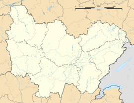
Massy, Saône-et-Loire
Appearance
Massy | |
|---|---|
Part of La Vineuse sur Fregande | |
 | |
| Coordinates: 46°29′06″N 4°36′21″E / 46.485°N 4.6058°E | |
| Country | France |
| Region | Bourgogne-Franche-Comté |
| Department | Saône-et-Loire |
| Arrondissement | Mâcon |
| Canton | Cluny |
| Commune | La Vineuse sur Fregande |
Area 1 | 5.07 km2 (1.96 sq mi) |
| Population (2019)[1] | 67 |
| • Density | 13/km2 (34/sq mi) |
| Time zone | UTC+01:00 (CET) |
| • Summer (DST) | UTC+02:00 (CEST) |
| Postal code | 71250 |
| Elevation | 222–389 m (728–1,276 ft) (avg. 250 m or 820 ft) |
| 1 French Land Register data, which excludes lakes, ponds, glaciers > 1 km2 (0.386 sq mi or 247 acres) and river estuaries. | |
Massy (French pronunciation: [masi] ) is a former commune in the Saône-et-Loire department in the region of Bourgogne-Franche-Comté in eastern France. On 1 January 2017, it was merged into the new commune La Vineuse sur Fregande.[2]
Sights
[edit]- Church Saint-Denis, dating from the eleventh century, listed as a historic monument since 1991.[3]
- Ruins from Roman times, including a small bridge crossing the river.
- An old fortified middle-age castle build on the base of Roman constructions. It used to be a subsidiary of the Cluny Monastery
See also
[edit]References
[edit]- ^ Téléchargement du fichier d'ensemble des populations légales en 2019, INSEE
- ^ Arrêté préfectoral 28 July 2016 (in French)
- ^ Base Mérimée: PA00113350, Ministère français de la Culture. (in French)
Wikimedia Commons has media related to Massy (Saône-et-Loire).


