RAF Peplow
Appearance
(Redirected from RAF Child's Ercall)
| RAF Peplow RNAS Peplow (HMS Godwit II / HMS Godwit) | |||||||||||
|---|---|---|---|---|---|---|---|---|---|---|---|
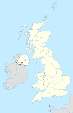
| Peplow, Shropshire in England | |||||||||||
 Aerial View of RAF Peplow (2024) | |||||||||||
| Coordinates | 52°48′20″N 2°30′16″W / 52.80556°N 2.50444°W | ||||||||||
| Type | Royal Air Force station Royal Naval Air Station | ||||||||||
| Site information | |||||||||||
| Owner | Air Ministry | ||||||||||
| Operator | Royal Air Force Royal Navy | ||||||||||
| Controlled by | RAF Flying Training Command Fleet Air Arm | ||||||||||
| Site history | |||||||||||
| Built | 1940 | ||||||||||
| In use | 1941-1945 (Royal Air Force) 1945-1949 (Royal Navy) | ||||||||||
| Airfield information | |||||||||||
| |||||||||||
Royal Air Force Peplow, or more simply RAF Peplow, is a former Royal Air Force located, located 7 miles (11 km) South of Market Drayton in Shropshire, England. It was operational between 1941 and 1949, being used by both the Royal Air Force (1942-1945) and the Royal Navy (1945–1947).[1]
The following units were here at some point:[2]
- No. 5 Service Flying Training School RAF
- No. 11 Service Flying Training School RAF
- No. 21 (Pilots) Advanced Flying Unit RAF
- No. 83 Operational Training Unit RAF
- 734 Naval Air Squadron
- 758 Naval Air Squadron
- 772 Naval Air Squadron
- 780 Naval Air Squadron
- 798 Naval Air Squadron
- No. 1515 (Beam Approach Training) Flight RAF
References
[edit]Citations
[edit]- ^ Delve 2007, p. 228.
- ^ "Peplow (Child's Ercall)". Airfields of Britain Conservation Trust. Retrieved 12 May 2020.
Bibliography
[edit]- Delve, Ken (2007). The Military Airfields of Britain Wales and West Midlands. Marlborough, Wiltshire UK: The Crowood Press Ltd. ISBN 978-1-86126-917-1.


