The most powerful and efficient way to manage your data on-the-go
QField is the leading professional fieldwork app, revolutionizing geospatial data collection and management. Recognized as a Digital Public Good, QField not only excels in enterprise and professional applications but also advances six United Nations Sustainable Development Goals (SDGs), promoting a sustainable and equitable future.
Streamline your processes and boost productivity with QField's seamless ecosystem. Whether you're in remote locations or managing large-scale projects, our tools have you covered.
Work efficiently

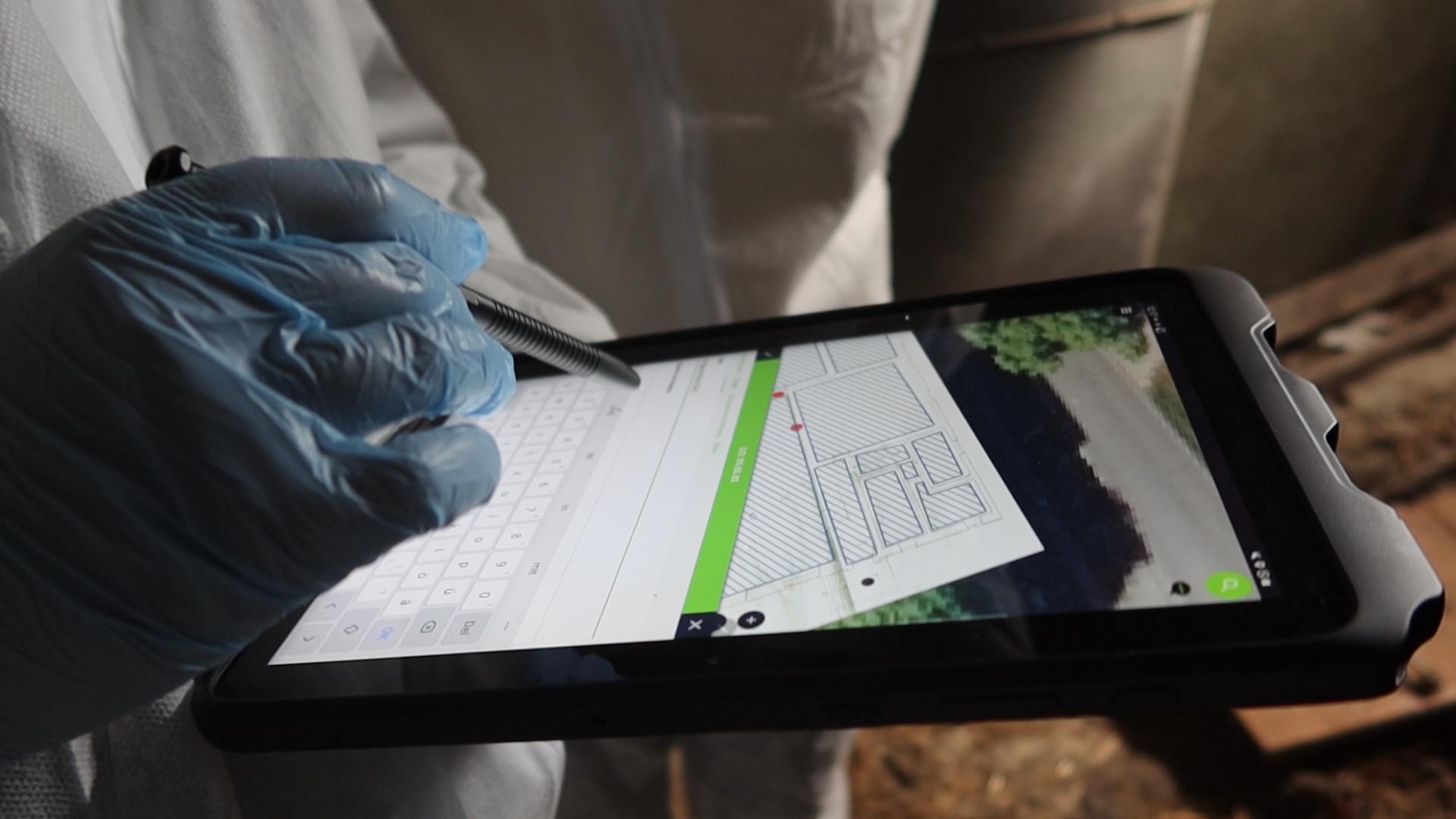
Survey and digitise data in no time. QField is the professional mobile app for QGIS, allowing users to deploy their existing projects to the field.
Be anywhere

Edit your data on the go. Seamless integration with QFieldCloud allows your team to work on your projects anywhere anytime.
Open anything

Open a wide range of spatial data formats, connect to industry-leading spatial databases and consume standardised geowebservices.
QField Success Stories


German Archaeological Institute
The KulturGutRetter project (Cultural Heritage Response Unit) has successfully completed its latest field tests, demonstrating the effectiveness of its innovative approach to the emergency rescue of cultural heritage.
Utilizing cutting-edge data acquisition and management techniques, Kulturgutretter is leading the way in preserving invaluable cultural treasures and to safeguard heritage for future generations.
DB Fahrwegdienste
« With QField, we at DB Fahrwegdienste have found a simple and cost-effective way to allow our forestry employees to collect data in the field. By working closely with the developers at OPENGIS.ch, we've tailored QField to precisely address our users' evolving needs. Staying true to the open-source philosophy, all new features are integrated into new versions, avoiding the creation of isolated solutions. »
Katrin Willms - Leiterin GeoinformationssystemeNational Land Survey of Finland
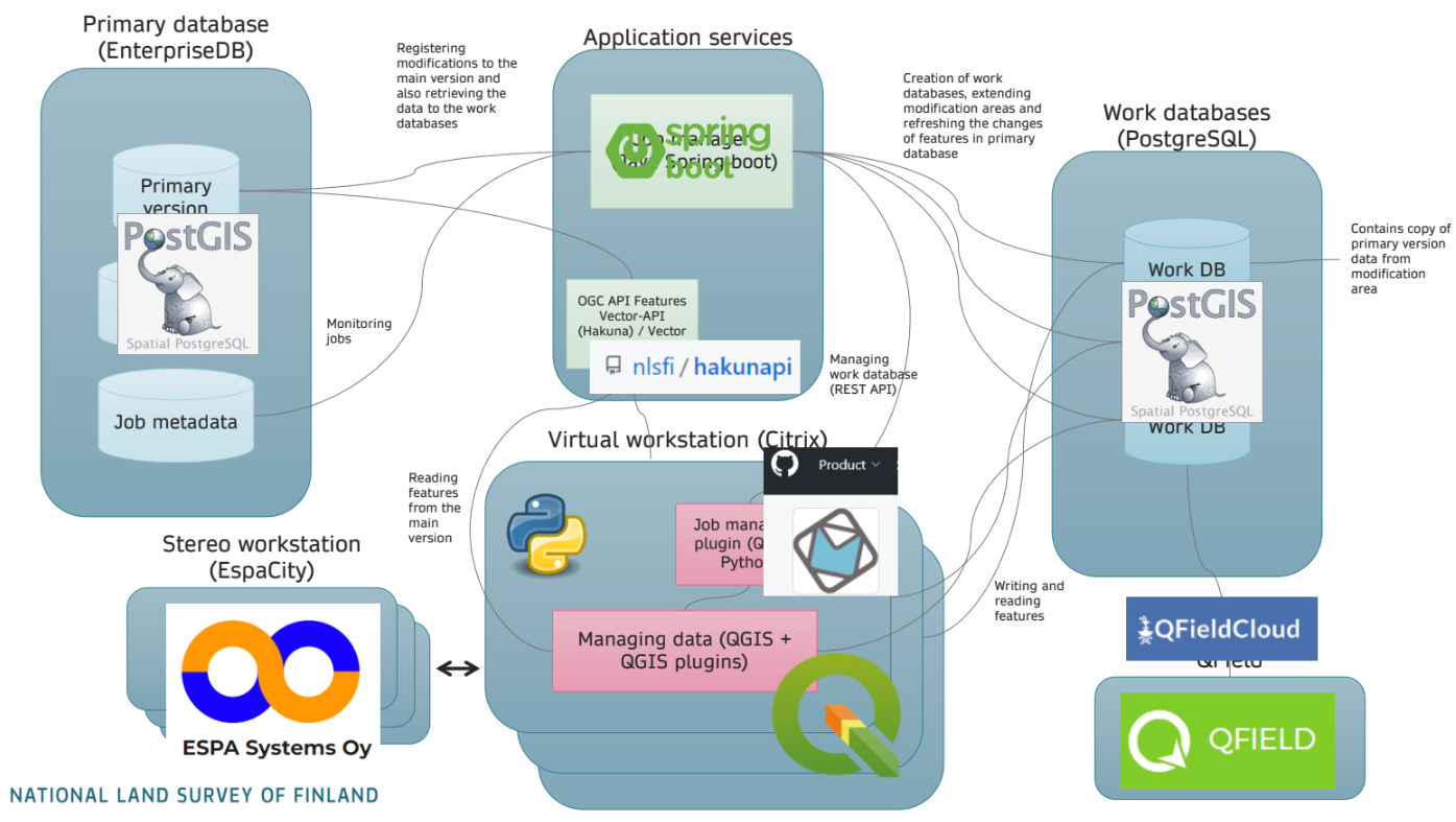
« The National Land Survey of Finland (NLS) is revolutionizing its topographic data management system with a new infrastructure entirely based on open-source components. As part of this transformation, NLS is integrating QField and QFieldCloud to meet their specific field mapping requirements. This integration enables NLS operators to efficiently manage large quantities of data while working offline in the field. With QField, NLS ensures precise and reliable data collection in various environments, enhancing the overall efficiency and accuracy of their topographic surveys. »
UN Open GIS Initiative
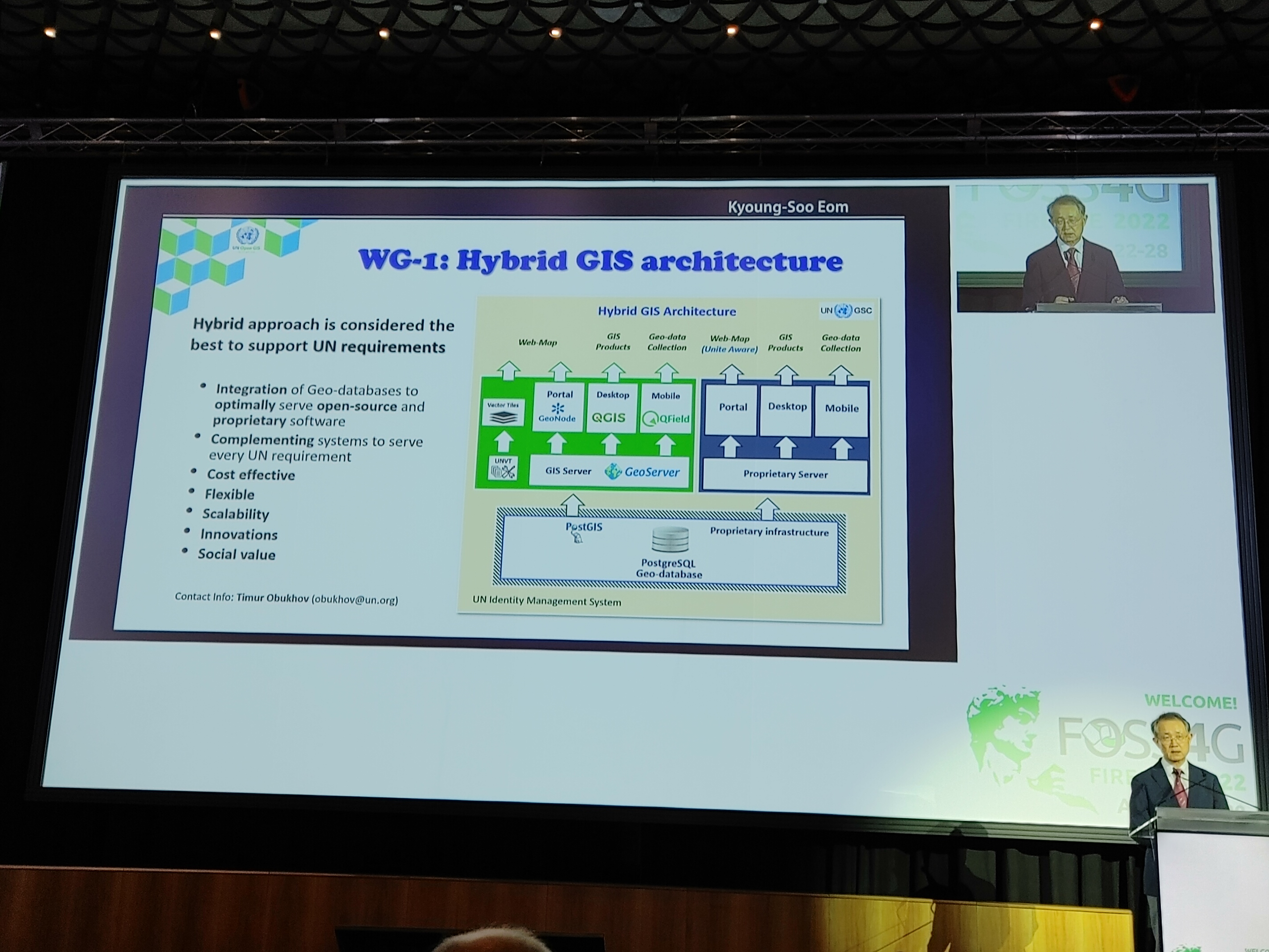
« QField has been spotlighted by the UN OpenGIS initiative as a crucial part of their hybrid GIS system. This recognition underscores QField's superior capabilities in supporting multiple United Nations Sustainable Development Goals (SDGs) and revolutionizing geospatial data collection. »
Ministry of Agriculture & Food, Forests and Fisheries of Tonga
In January 2022 the Hunga Tonga-Hunga Ha’apai submarine volcano erupted. Ash clouds from the eruption and the subsequent tsunami damaged croplands on the Tongatapu and Ha’apai island groups. The internet cable to Tonga was severed during the eruption. In particular, QField was used to generate maps of where fields had been cleared and re-ploughed using government support.

QField Testimonials
Collaborating with Tonga's Ministry of Agriculture, Food, and Forests, we developed a farm monitoring workflow for Pacific Island agricultural landscapes with QField as the primary data collection tool and using QFieldCloud to support large team collaborative surveys. This workflow has been used to survey over 10,000 farms across Tonga for applications ranging from national scale crop surveys to targeted disaster response. We used the QFieldCloud API to build custom applications that enable data collected with QField to be used in automated reporting tasks and be quickly accessible to support decision makers.
John Duncan - The University of Western AustraliaThe National Land Survey of Finland is preparing to start collecting their topographic database by open-source solutions in 2025. Since field work is an integral part of making sure certain object classes are precise and on the right place, we needed to integrate field work solution for our topographic data management system. QField provided to be an answer for our needs, and we have been able to acquire solutions for our operators’ typical workflows. For example, being able to orthogonalize building polygons and having tools to undo modifications. Also, we have received essential support to integrate Qfield for our system. Working with OPENGIS.ch has been easy, beneficial and their consultancy has helped us a lot!
Olli Rantanen - National Land Survey of FinlandMobile data acquisition with QField opens up new possibilities for all researchers at the German Archaeological Institute to easily and precisely document cultural heritage and excavation results. Thanks to the excellent and uncomplicated cooperation with the developers of OPENGIS.ch, we were able to carry out several further developments for QField, which also benefit areas outside the archaeological community in the spirit of open source.
Eva Götting-Martin - German Archaeological InstituteThe Ministry of Agriculture, Food, and Forests in the Kingdom of Tonga has been using QField since 2020 for surveys and data collection. It’s transformed a process of paper-based surveys and manual data entry to digital capture of key geospatial farm management information. It’s been used for national scale crop surveys in 2020-2021 and focused applications such as an impact assessment to the agricultural sector after the Hunga Tonga Hunga Ha’apai eruption. The crop survey data captured before the eruption was used to generate early estimates of crop loss; QField’s offline capabilities meant cropland damage mapping could be undertaken while the country was offline when the undersea cables were severed; and, QField was used to survey community leaders for estimates of loss of agricultural produce and infrastructure.
Ahi Saipaia - Ministry of Agriculture, Food, and Forests of TongaAbout QField
QField is the leading professional fieldwork app used in enterprise settings for efficient geospatial data collection and management. As a Digital Public Good, QField not only excels in enterprise and professional applications but also contributes significantly to advancing at least six of the United Nations Sustainable Development Goals (SDGs), promoting a more sustainable and equitable future.
Opensource
QField is released under the GNU Public License (GPL) Version 2 or above. Developing QField under this license means that you can inspect and modify the source code and guarantees that you will always have access to a QGIS based field data collection app that is free of cost and can be freely modified.
Credits
QField, QFieldCloud and QFieldSync are developped by OPENGIS.ch. OPENGIS.ch offers consulting, development, training and support for open source software including QField, QGIS and PostGIS.


