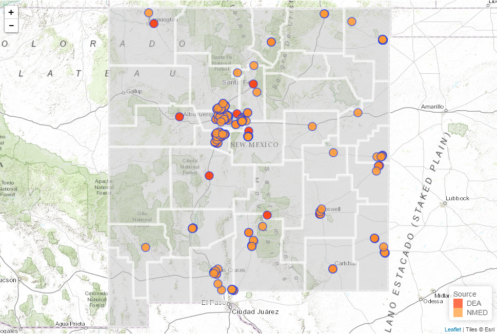
New Mexico Lidar Data Status Map

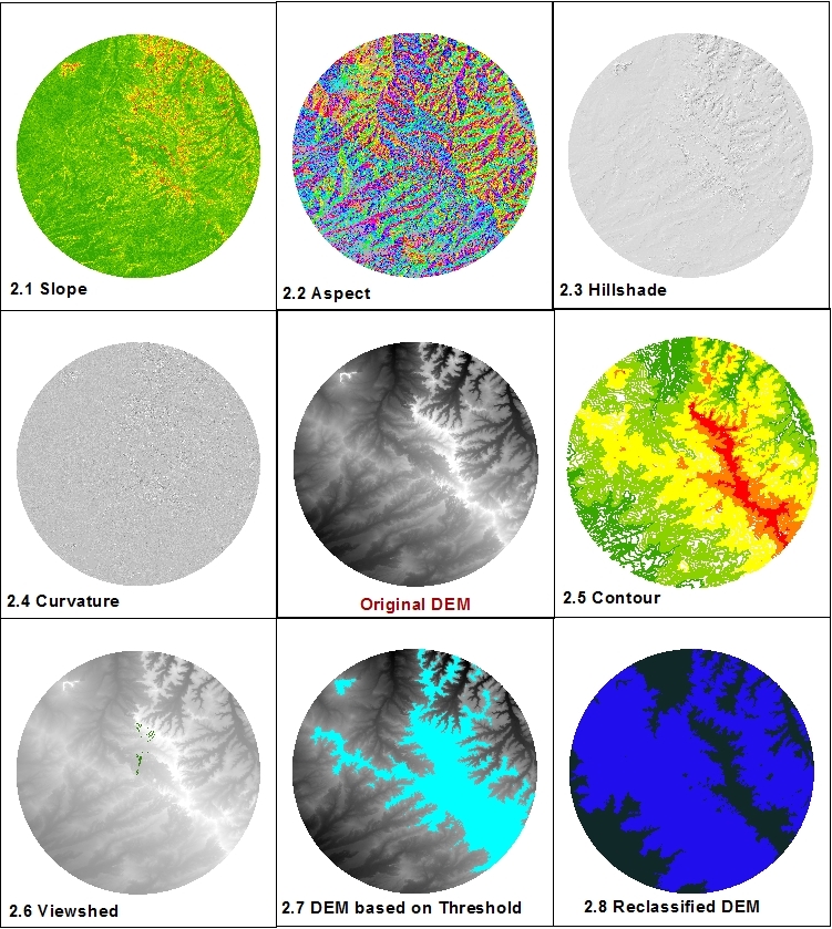
New Mexico Lidar Status (Interactive Map) Increasingly, New Mexico’s key geospatial data needs must be met with high-quality, high-resolution, and current elevation data. Enhanced elevation data are essential to a broad and cross-cutting range of applications, analyses and evaluations, and established programs such as emergency preparedness, resource management, natural hazard… Continue reading