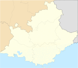
Aspres-sur-Buëch
Appearance
Aspres-sur-Buëch | |
|---|---|
 A view of Aspres-sur-Buëch, with the clock tower overlooking the village | |
| Coordinates: 44°31′28″N 5°45′01″E / 44.5244°N 5.7503°E | |
| Country | France |
| Region | Provence-Alpes-Côte d'Azur |
| Department | Hautes-Alpes |
| Arrondissement | Gap |
| Canton | Serres |
| Intercommunality | Buëch Dévoluy |
| Government | |
| • Mayor (2014-2020) | Françoise Pinet[1] |
| Area 1 | 42.65 km2 (16.47 sq mi) |
| Population (Jan. 2019)[2] | 803 |
| • Density | 19/km2 (49/sq mi) |
| Time zone | UTC+01:00 (CET) |
| • Summer (DST) | UTC+02:00 (CEST) |
| INSEE/Postal code | 05010 /05140 |
| Elevation | 727–2,063 m (2,385–6,768 ft) (avg. 761 m or 2,497 ft) |
| 1 French Land Register data, which excludes lakes, ponds, glaciers > 1 km2 (0.386 sq mi or 247 acres) and river estuaries. | |
Aspres-sur-Buëch is a commune in the Hautes-Alpes department and Provence-Alpes-Côte d'Azur region in southeastern France.
Transport
[change | change source]Road
[change | change source]The D993, D994A, D994B, D994 and D1075 roads pass through the commune.
The D1075 road is part of European route E712 at this point.
Rail
[change | change source]Aspres-sur-Buëch has a station.[3]
Geography
[change | change source]The area surrounding Aspres-sur-Buëch is quite hilly.
Population
[change | change source]| Year | Pop. | ±% |
|---|---|---|
| 2004 | 725 | — |
| 2006 | 722 | −0.4% |
| 2007 | 752 | +4.2% |
| 2008 | 778 | +3.5% |
| 2009 | 804 | +3.3% |
| 2010 | 819 | +1.9% |
| 2011 | 826 | +0.9% |
| 2012 | 824 | −0.2% |
| 2013 | 827 | +0.4% |
| 2014 | 830 | +0.4% |
| 2015 | 832 | +0.2% |
| 2016 | 830 | −0.2% |
References
[change | change source]- ↑ "List of mayors of the Hautes-Alpes department". Prefecture of Hautes-Alpes (in French). 3 June 2014. Archived from the original on 10 January 2015. Retrieved 20 March 2015.
- ↑ "Populations légales 2019". The National Institute of Statistics and Economic Studies. 29 December 2021.
- ↑ "TER Sud-Provence-Alpes-Côte d'Azur - Horaires et informations pratiques au départ de la gare de Aspres-sur-Buech". www.ter.sncf.com. Archived from the original on 2021-11-06. Retrieved 2021-01-03.


