Papers by Matteo Bigongiari
Digital Cultural Heritage
 Bookmarks Related papers MentionsView impact
42th INTERNATIONAL CONFERENCE OF REPRESENTATION DISCIPLINES TEACHERS. CONGRESS OF UNIONE ITALIANA PER IL DISEGNO. PROCEEDINGS 2020. LINGUAGGI, DISTANZE, TECNOLOGIE
Bookmarks Related papers MentionsView impact Athens Journal of Architecture
Bookmarks Related papers MentionsView impact 
Heritage
This paper concerns the path of knowledge that leads to the understanding of the morphology and e... more This paper concerns the path of knowledge that leads to the understanding of the morphology and evolution of the archaeological area discovered in the 1960s below the parish church of Gropina (AR). By dealing with archaeological surveying methods, the attention is focused on the digital survey technologies used, integrating data from laser scanner instruments with photogrammetric ones. The morphological base was necessary for the preparation of stratigraphic analyses, and allowed us to check the previous studies carried out on the building to extract a periodized planimetry. Finally, the digital drawing technologies have allowed us to hypothesize the schematic evolutionary models of the different phases of the building, and to use the digital survey to create a virtual platform through which to interact with the archaeological site, which is now closed to visitors.
Bookmarks Related papers MentionsView impact 
DISEGNARECON, 2019
The design and representation of the landscape, through the tools provided by the survey, are irr... more The design and representation of the landscape, through the tools provided by the survey, are irreplaceable means of knowledge of the territory, therefore they present themselves as indispensable elements to start any path of analysis or project of the spaces. This paper aims to show some documentation experiences of the territory, through different techniques of digital survey and graphic representation, which, starting from the survey, develop with different purposes: on the one hand the project for the documentation of the basin area of the streams that flow into the Fiumetto, a watercourse between Pietrasanta and Forte dei Marmi, which aims to experiment modern digital surveying techniques on the coastal landscape of Versilia to use the data for hydraulic modeling; the vastness of the area to be surveyed requires high reliability at sufficiently detailed restitution scales (1:100), with the aim of creating a three-dimensional model of points from which to
http://disegnarecon.univaq.it
extract the morphology of the watercourses and the various crossings, in order to provide hydraulic engineers with all the tools useful for simulating on hydraulic software the flooding scenarios; on the other the documentation project of the system of routes within the municipality of Garfagnana with the aim of enhancing and promoting the route, not only from the point of view of historical preservation but also from future tourist use. To make this possible the University of Florence collaborates with Italian Cycling Federation, in the belief that the care of widespread cycling routes can make the most of the territory, also correctly responding to the current needs of environmental sustainability. The proposal to recover ancient routes and medieval and sixteenth-century bridges is to be considered foundational: there is the possibility of bringing out an impressive number of architecturally important structures to cross and visit along the route.
Bookmarks Related papers MentionsView impact 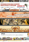
APEGA 2019 De la línea a la nube, 2019
The recent earthquake of September 19, 2017, in Mexico mainly concerned the residential construct... more The recent earthquake of September 19, 2017, in Mexico mainly concerned the residential construction and heritage of towns and villages of the state of Morelos. The Mexican monuments protection agency (INAH) has started a laser scanner survey of the main buildings of the heritage at risk. The DiDA Survey Laboratory, which for years has experience both in the field of architectural surveying of monuments damaged by earthquakes, started, through the Italian Embassy and the UNAM of the City of Mexico, to document some sample cases. In March 2018 a digital surveying campaign was carried out that involved the urban fronts of a block of the historic center of Mexico City, between the Plaza Mayor and the archaeological site of the Templo Major, where it was the ancient Azteca capital of Tenochtitlan, until the Spanish conquest, built over the lake of Texcoco with palified structures; its elevated position, on strongly seismic mountains at a height of more than 2000 meters, and the geological characteristics, built on a lacustrine area above the remains of the foundations of the Aztec temples, make the buildings built on it very vulnerable. The paper analyzes the theme of methods of using digital surveys for the conservation and restoration of architecture; in the urban case, paying particular attention to the analysis of the plastic deformations and of the resistant structures, in order to evaluate the value of misalignment of the fronts of the buildings from the vertical plane and the interactions between masonries of different building units. In the case study related to Heritage, instead, attention was focused on the documentation, on the analysis of the structural conservation status, on the identification and classification of the cracks, on the verification of the main structural instabilities, and on the states of collapse. The project, still in the process of completion, presents interesting ideas for assessing and classifying risk in historic centers and in asset-value environments. The documents produced have two different purposes: on the one hand, to provide local administrations with a document through which they can establish the degree of risk that buildings incur in relation to preventive analyzes on the study of deformations; as for the monastery, instead, the construction of a structural consolidation project preliminary to the necessary architectural restoration.
Bookmarks Related papers MentionsView impact
Bookmarks Related papers MentionsView impact 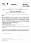
Art Collections 2020, Safety Issue (ARCO 2020, SAFETY), 2020
The paper deals with the documentation project of the Rocca della Verruca, a medieval fortress bu... more The paper deals with the documentation project of the Rocca della Verruca, a medieval fortress built on top of one of the peaks of the Pisan Mountains to control the valley of the Arno river; the fortress was fortified in modern times by the Florentines and was visited by important architects such as Giuliano da Sangallo and Leonardo da Vinci. The path of knowledge undertaken in the documentation of the structures, which are no w in a state of ruin, are aimed at analyzing the superficial and structural conservative state of the fortress. The survey operations were carried out using the most recent digital instruments: laser scanner, aerial photogrammetry and ground photogrammetry. The resulting three-dimensional model, highly reliable, was useful for carrying out analyzes on the structure, from morphological to diagnostic and structural ones. A careful mapping of the cracking framework was performed and through the analysis of the real based models coming from the relief of the wall deformations; the cognitive overview has made it possible to clarify the state of structural conservation of the building.
Bookmarks Related papers MentionsView impact 
Defensive Architecture of the Mediterranean / Vol X / Navarro Palazón, García-Pulido (eds.), 2020
This paper deals with the documentation and digital survey of fortifications in the historic city... more This paper deals with the documentation and digital survey of fortifications in the historic city of Piombino. During the Renaissance the fortified perimeter of the city was considerably enlarged, both because of the will of the Lords of Piombino, the Appiani, to build a fortified citadel, deeming the previous urban palace inadequate for the ruling family, and to improve the defenses by land with the construction of a rivellino in front of the north door and of a fortress to the east. The defenses, conquered by Valentino's troops in 1502, were redesigned by Leonardo da Vinci, as documented in the pages of Code II of Madrid, which contains drawings and calculations for the construction of the works. The present project, started in April 2018, plans to carry out an accurate digital survey of fortifications, in order to provide the basis for graphic documentation on which to base further cognitive investigations, from archaeological ones to diagnostic ones. The survey operations were carried out with today's digital technologies, laser scanners and cameras, creating reliable point clouds and three-dimensional models mapped with texture, from which to extract 2D drawings. The study of the sources, of the texts of Leonardo's scholars and accurate archaeological investigations will provide the opportunity to further analyze Leonardo's intervention on the still existing structures.
Bookmarks Related papers MentionsView impact 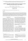
The International Archives of the Photogrammetry, Remote Sensing and Spatial Information Sciences, Volume XLIV-M-1-2020, 2020 HERITAGE2020 (3DPast | RISK-Terra) International Conference, 9–12 September 2020, Valencia, Spain, 2020
This paper describes the digital survey activities carried out in Brazil, in the state of São Pau... more This paper describes the digital survey activities carried out in Brazil, in the state of São Paulo, in order to document historical architectures and his vernacular features. After introducing the researches performed in Brazil in the last years, the Brazilian state-of-art of architecture is summarised, so that it is possible to understand the complexities and the referential typological and cultural models. Typical Paulistano vernacular building techniques are thereafter deepened, before outlining the case-study of the Jesuit mission of Carapicuiba, one of the few rammed earths building in existence in São Paulo. Quick digital survey techniques, like aerial photogrammetry, make possible for architects and scholars to rapidly record the building's morphology and state of preservation, for future cultural heritage conservation. Research findings permitted to update the settlement's survey data, specifically the ones linked to surfaces, colors, and materials.
Bookmarks Related papers MentionsView impact 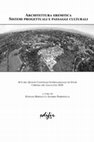
Architettura eremitica Sistemi progettuali e paesaggi culturali, 2020
Dopo gli effetti rovinosi del sisma del settembre 2018, gran parte dei monumenti degli stati mess... more Dopo gli effetti rovinosi del sisma del settembre 2018, gran parte dei monumenti degli stati messicani di Oaxaca e Morelos sono stati gravemente danneggiati. Il governo del Messico, a seguito di tali eventi, ha richiesto l’intervento internazionale a sostegno della ricostruzione post sisma, ed in particolare l’aiuto per conservare e restaurare gli edifici di interesse patrimoniale. L’Unione Europea ha risposto favorevolmente ed ha finanziato la mobilità di esperti da diversi paesi per valutare i danni causati e i metodi di intervento sul costruito1. In questo scenario è iniziata la collaborazione tra il DiDA dell’Università degli studi di Firenze e l’UNAM, con un progetto di ricerca che prevede l’utilizzo delle moderne tecniche di rilievo digitale per la documentazione speditiva e la valutazione dello stato di conservazione strutturale degli edifici di carattere storico2, riprendendo un tema che aveva fortemente interessato il nostro paese dopo il terremoto aquilano3. In particolare, in questo contributo, si vuole raccontare l’esperienza nella documentazione del Monastero di Totolapan, nello stato di Morelos, non distante dall’epicentro del sisma e fortemente danneggiato, al punto da non essere agibile per la comunità. Questo monastero rappresenta uno dei più antichi modelli delle missioni evangelizzatrici che dal XVI secolo si sono diffuse sul territorio messicano con il fine di convertire le popolazioni locali: caratteristiche che hanno fatto sì che dal 1994 Totolapan, altri dieci monasteri dello stato di Morelos, ed altri tre dello stato di Puebla, fossero inseriti dal 1994 nelle liste del Patrimonio Unesco, sotto la dicitura “Primi monasteri del XVI secolo alle pendici del Popocatepetl”.
Bookmarks Related papers MentionsView impact 
Connettere. Un disegno per annodare e tessere. Atti del 42° Convegno Internazionale dei Docenti delle Discipline della Rappresentazione/Connecting. Drawing for weaving relationships. Proceedings of the 42th International Conference of Representation Disciplines Teachers., 2020
The paper presents the general lines of research, still in progress, on Leonardo’s activity as a ... more The paper presents the general lines of research, still in progress, on Leonardo’s activity as a military architect in Piombino in Tuscany, in the early sixteenth century, employed first by Valentino and then by the Republic of Florence.Through the study of the historical documentation relating to the development of the Tuscan city and the scientific survey of the fortified structures that remain, even if they are partially modified, an attempt was made to give a scientific foundation to the analysis of the numerous drawings by Leonardo that are mainly preserved in the collection of Code II of the National Library of Madrid.
This research is based on the hypothesis of using modern digital surveying technologies to try to recognize, together with the analyzes conducted on historical-documentary sources and through the reliable archaeological analyzes and the analysis of the stratigraphies that the wall surfaces present, the portions that currently survive of what could have been the fortified system of the town in the early sixteenth century. These results were finally compared with Leonardo da Vinci's drawings that illustrate the surveys and projects for the defenses of the Lordship of Piombino obtaining several interesting findings.
Bookmarks Related papers MentionsView impact 
Scires, 2020
This paper reports preliminary results of ongoing interdisciplinary research in digital humanitie... more This paper reports preliminary results of ongoing interdisciplinary research in digital humanities and animation. This research explores visualisation techniques (e.g., motion graphics, 3D animation, Non-Photorealistic Rendering) to empower the study of depicted objects in Renaissance treatises on architecture and engineering. The aim is to pioneer a method that can be adopted by both scholars in the humanities and practitioners in animation to 1) take advantage of available editions and scholarship via interactive online systems (e.g., Engineering Historical Memory); 2) map and decode visual information and knowledge embodied in manuscripts; 3) create philologically correct 3D models and storytelling to unfold narratives embedded in drawings. As a showcase, this paper used Francesco di Giorgio Martini's drawings of the Corinthian capital in the manuscripts Ashburnham 361 (Biblioteca Medicea Laurenziana, Florence) and Saluzzo 148 (Musei Reali, Turin).
Bookmarks Related papers MentionsView impact Books by Matteo Bigongiari
Intervenire sul Patrimonio costruito, specialmente nel caso di edifici monumentali, richiede all’... more Intervenire sul Patrimonio costruito, specialmente nel caso di edifici monumentali, richiede all’architetto una preliminare fase di conoscenza che necessario a comprendere la natura dell’oggetto in analisi; il percorso di conoscenza da intraprendere comporta un approfondito studio delle fonti storiche, della morfologia dell’edificio attraverso un rilievo architettonico affidabile, analisi materiche e strutturali che consentano di dimensionare gli elementi architettonici per eseguire le opportune verifiche statiche.Questo lavoro prende in analisi un importante monumento spagnolo, la chiesa di Santa Maria la Reál nel borgo di Sasamón lungo il cammino di pellegrinaggio verso Santiago de Compostela, e mostra lo sviluppo di queste teorie, che ha come fine la realizzazione di un pacchetto di elaborati, che raccolgono la conoscenza del fabbricato, insieme alle problematiche che lo interessano, necessari al progettista e al restauratore.
Particolare attenzione è stata posta alla rappresentazione dell’edificio e alla realizzazione di un database di misurazioni tridimensionali, le moderne nuvole di punti, affidabile, studiando protocolli metodologici per verificare e certificare il mantenimento dell’affidabilità della misura dalle fasi di acquisizione del rilievo alla restituzione grafica degli elaborati tecnici bidimensionali, su cui sono state avanzate le successive analisi diagnostiche e strutturali.
Bookmarks Related papers MentionsView impact Thesis Chapters by Matteo Bigongiari
Bookmarks Related papers MentionsView impact Tesi di Dottorato
Anni 2016/2019
Settore disciplinare ICAR 17
Dottorando Dott. Matteo BIGONGIA... more Tesi di Dottorato
Anni 2016/2019
Settore disciplinare ICAR 17
Dottorando Dott. Matteo BIGONGIARI
Tutor Prof. Stefano BERTOCCI
Co-Tutore Prof. Pilar CHIAS NAVARRO
Bookmarks Related papers MentionsView impact 
Uploads
Papers by Matteo Bigongiari
http://disegnarecon.univaq.it
extract the morphology of the watercourses and the various crossings, in order to provide hydraulic engineers with all the tools useful for simulating on hydraulic software the flooding scenarios; on the other the documentation project of the system of routes within the municipality of Garfagnana with the aim of enhancing and promoting the route, not only from the point of view of historical preservation but also from future tourist use. To make this possible the University of Florence collaborates with Italian Cycling Federation, in the belief that the care of widespread cycling routes can make the most of the territory, also correctly responding to the current needs of environmental sustainability. The proposal to recover ancient routes and medieval and sixteenth-century bridges is to be considered foundational: there is the possibility of bringing out an impressive number of architecturally important structures to cross and visit along the route.
This research is based on the hypothesis of using modern digital surveying technologies to try to recognize, together with the analyzes conducted on historical-documentary sources and through the reliable archaeological analyzes and the analysis of the stratigraphies that the wall surfaces present, the portions that currently survive of what could have been the fortified system of the town in the early sixteenth century. These results were finally compared with Leonardo da Vinci's drawings that illustrate the surveys and projects for the defenses of the Lordship of Piombino obtaining several interesting findings.
Books by Matteo Bigongiari
Particolare attenzione è stata posta alla rappresentazione dell’edificio e alla realizzazione di un database di misurazioni tridimensionali, le moderne nuvole di punti, affidabile, studiando protocolli metodologici per verificare e certificare il mantenimento dell’affidabilità della misura dalle fasi di acquisizione del rilievo alla restituzione grafica degli elaborati tecnici bidimensionali, su cui sono state avanzate le successive analisi diagnostiche e strutturali.
Thesis Chapters by Matteo Bigongiari
Anni 2016/2019
Settore disciplinare ICAR 17
Dottorando Dott. Matteo BIGONGIARI
Tutor Prof. Stefano BERTOCCI
Co-Tutore Prof. Pilar CHIAS NAVARRO
http://disegnarecon.univaq.it
extract the morphology of the watercourses and the various crossings, in order to provide hydraulic engineers with all the tools useful for simulating on hydraulic software the flooding scenarios; on the other the documentation project of the system of routes within the municipality of Garfagnana with the aim of enhancing and promoting the route, not only from the point of view of historical preservation but also from future tourist use. To make this possible the University of Florence collaborates with Italian Cycling Federation, in the belief that the care of widespread cycling routes can make the most of the territory, also correctly responding to the current needs of environmental sustainability. The proposal to recover ancient routes and medieval and sixteenth-century bridges is to be considered foundational: there is the possibility of bringing out an impressive number of architecturally important structures to cross and visit along the route.
This research is based on the hypothesis of using modern digital surveying technologies to try to recognize, together with the analyzes conducted on historical-documentary sources and through the reliable archaeological analyzes and the analysis of the stratigraphies that the wall surfaces present, the portions that currently survive of what could have been the fortified system of the town in the early sixteenth century. These results were finally compared with Leonardo da Vinci's drawings that illustrate the surveys and projects for the defenses of the Lordship of Piombino obtaining several interesting findings.
Particolare attenzione è stata posta alla rappresentazione dell’edificio e alla realizzazione di un database di misurazioni tridimensionali, le moderne nuvole di punti, affidabile, studiando protocolli metodologici per verificare e certificare il mantenimento dell’affidabilità della misura dalle fasi di acquisizione del rilievo alla restituzione grafica degli elaborati tecnici bidimensionali, su cui sono state avanzate le successive analisi diagnostiche e strutturali.
Anni 2016/2019
Settore disciplinare ICAR 17
Dottorando Dott. Matteo BIGONGIARI
Tutor Prof. Stefano BERTOCCI
Co-Tutore Prof. Pilar CHIAS NAVARRO