�
C Springer 2005
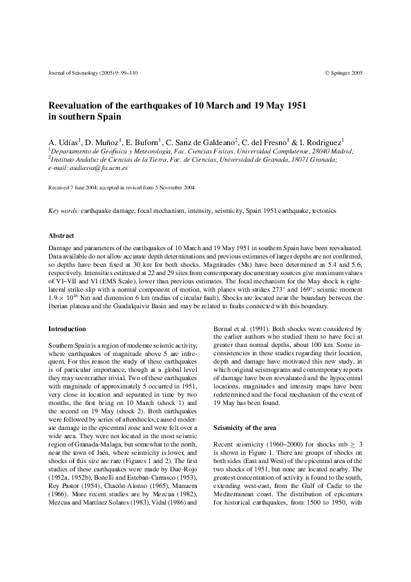
Journal of Seismology (2005) 9: 99–110
Reevaluation of the earthquakes of 10 March and 19 May 1951
in southern Spain
A. Udı́as1 , D. Muñoz1 , E. Buforn1 , C. Sanz de Galdeano2 , C. del Fresno1 & I. Rodriguez1
1
Departamento de Geofı́sica y Meteorologı́a, Fac. Ciencias Fı́sicas. Universidad Complutense, 28040 Madrid;
Instituto Andaluz de Ciencias de la Tierra, Fac. de Ciencias, Universidad de Granada, 18071 Granada;
e-mail: audiasva@fis.ucm.es
2
Received 7 June 2004; accepted in revised form 5 November 2004
Key words: earthquake damage, focal mechanism, intensity, seismicity, Spain 1951 earthquake, tectonics
Abstract
Damage and parameters of the earthquakes of 10 March and 19 May 1951 in southern Spain have been reevaluated.
Data available do not allow accurate depth determinations and previous estimates of larger depths are not confirmed,
so depths have been fixed at 30 km for both shocks. Magnitudes (Ms) have been determined as 5.4 and 5.6,
respectively. Intensities estimated at 22 and 29 sites from contemporary documentary sources give maximum values
of VI–VII and VI (EMS Scale), lower than previous estimates. The focal mechanism for the May shock is rightlateral strike-slip with a normal component of motion, with planes with strikes 273◦ and 169◦ ; seismic moment
1.9 × 10¹⁶ Nm and dimension 6 km (radius of circular fault). Shocks are located near the boundary between the
Iberian plateau and the Guadalquivir Basin and may be related to faults connected with this boundary.
Introduction
Southern Spain is a region of moderate seismic activity,
where earthquakes of magnitude above 5 are infrequent. For this reason the study of these earthquakes
is of particular importance, though at a global level
they may seem rather trivial. Two of these earthquakes
with magnitude of approximately 5 occurred in 1951,
very close in location and separated in time by two
months, the first being on 10 March (shock 1) and
the second on 19 May (shock 2). Both earthquakes
were followed by series of aftershocks, caused moderate damage in the epicentral zone and were felt over a
wide area. They were not located in the most seismic
region of Granada-Malaga, but somewhat to the north,
near the town of Jaén, where seismicity is lower, and
shocks of this size are rare (Figures 1 and 2). The first
studies of these earthquakes were made by Due-Rojo
(1952a, 1952b), Bonelli and Esteban-Carrasco (1953),
Rey Pastor (1954), Chacón-Alonso (1965), Munuera
(1966). More recent studies are by Mezcua (1982),
Mezcua and Martı́nez Solares (1983), Vidal (1986) and
Bernal et al. (1991). Both shocks were considered by
the earlier authors who studied them to have foci at
greater than normal depths, about 100 km. Some inconsistencies in these studies regarding their location,
depth and damage have motivated this new study, in
which original seismograms and contemporary reports
of damage have been reevaluated and the hypocentral
locations, magnitudes and intensity maps have been
redetermined and the focal mechanism of the event of
19 May has been found.
Seismicity of the area
Recent seismicity (1960–2000) for shocks mb ≥ 3
is shown in Figure 1. There are groups of shocks on
both sides (East and West) of the epicentral area of the
two shocks of 1951, but none are located nearby. The
greatest concentration of activity is found to the south,
extending west-east, from the Gulf of Cadiz to the
Mediterranean coast. The distribution of epicenters
for historical earthquakes, from 1500 to 1950, with
�100
Figure 1. Epicenter location of earthquakes for 1960–2000, h < 40 km, M ≥ 4 (IGN Earthquake Data File). Sizes of dots are proportional to
magnitudes, the smallest represent shocks of magnitude 4. Stars correspond to epicenters of 10-3-1951 and 19-5-1951.
Figure 2. Epicenter location of historical earthquakes with maximum intensity greater than or equal to 6, for the period 1500–1950 (IGN
Earthquake Data File). Intensities: circles 9, squares 8, triangles 7, rhombuses 6. Stars correspond to epicenters of 10-3-1951 and 19-5-1951.
The area corresponds to that marked in Figure 1.
maximum intensities (MSK) (Mezcua, 1982) equal and
larger than 6 (VI, Arabic numerals rather than Roman
will be used here for intensity degrees; Bormann,
2002), near the epicentral area of the two shocks
studied here, is shown in Figure 2. Greater activity is
concentrated to the south, near the city of Granada,
where earthquakes with maximum intensities 8 (1806)
and 10 (1884) have occurred. The only earthquakes
�101
near Jaén are those of 1582 (Imax . = 7) (no day given),
27-2-1712 (Imax = 6) and 21-12-1944 (Imax = 6). The
1582 earthquake has been recently added to the Spanish Earthquakes Catalogue of the Instituto Geográfico
Nacional (IGN), Madrid, Spain; it is not mentioned
by Galbis-Rodriguez (1932), the classic reference for
historical seismicity in Spain. The occurrence of this
earthquake is based on only one contemporary reference about an earthquake in Alcalá la Real (Figure 2)
mentioning “fall of towers and walls”; no more details
are given and there is no other reference to it. It is questionable if the shock really occurred and if its maximum
intensity was 7. The earthquake of 1712, south of Jaén,
was the largest of a sequence, which lasted between
2 February and 11 March. This earthquake caused some
light damage in some houses in Jaén (Figure 2), but
none have to be abandoned; a maximum intensity of 6
seems to be a reasonable estimation. The earthquake of
1944 has been assigned by IGN a magnitude of mb = 4.
The observatories of Cartuja, Almerı́a and Ebro, which
recorded it, assigned a maximum intensity between 5
and 6 in Huelma (Figure 2). Thus, the shocks of 1951
appear to be the only ones which reached intensity 7
(MSK) for the Jaén region in the last 500 years.
Hypocentral locations
The epicenter locations, focal depths and magnitudes
determined by different authors for the two earthquakes
are given in Table 1. The epicenter locations are shown
in Figures 3 and 4. The first determination of the epicenters was made by Due-Rojo (1952a, 1952b); he gave
the same location for both shocks. Due-Rojo stated that
the epicenters had been determined using data from
near stations, but did not give the details of his determinations. The depths were given as 80 km; this
depth, considered to be uncommon for earthquakes in
southern Spain, was justified as based on the distributions of intensities and the P wave arrival times at the
station of Cartuja (Granada). No details of the use of
these arrival times are given, so that we cannot verify the argument. Due-Rojo’s epicentral determination
was reported by the Bulletin of the International Seismological Summary (ISS; 1951). New determinations
of the hypocenters were made by Bonelli and EstebanCarrasco (1953), using a least squares numerical procedure, and considering straight rays from the source to
eight local stations. They were forced to disregard the
arrival times of the stations Cartuja (CRT) and Málaga
(MAL), the two nearest stations, which did not fit the
Table 1. Hypocentral locations and magnitudes
Date
Origin
time
Lat.
(◦ N)
Long. Depth
(◦ W) (km) M
Author
38.1
3.7
(80)
1
38.1
3.6
117
2
10: 38: 32
38.1
3.6
100
7.4 (mb ) 3
10: 38: 36
38.18 3.82
10-3-1951 10: 38: 32
4.8 (MD ) 4
10: 38: 24.5 38.12 3.99
25
5.0 (mb ) 5
10: 38: 27.1 37.98 3.86
30
5.4 (Ms ) 6
19-5-1951 15: 54: 24
38.1
3.7
(80)
37.6
4.1
140
1
2
15: 54: 19
37.8
4.0
140
7.5 (mb ) 3
15: 54: 19
37.58 3.93
5.1 (MD ) 4
15: 54: 24.6 37.58 4.01
60
5.5 (mb ) 5
15: 54: 23.6 37.69 4.12
30
5.6 (Ms ) 6
15: 54: 23.0 37.50 4.12
90
6
1. Due-Rojo (1951).
2. Bonelli and Esteban-Carrasco (1953).
3. Munuera (1966).
4. Mezcua and Martı́nez Solares (1983).
5. Vidal (1986).
6. This study.
rest of the observations. The solutions gave an epicenter similar to that of Due Rojo for the first shock, and
one displaced southwest for the second, with depths of
117 and 140 km. Though the method is questionable,
because of its use of a half-space with constant velocity
and direct arrivals for all distances, the epicentral locations, with shock 1 about 50 km northeast of shock 2,
are similar to those found by more recent determinations. Munuera (1966), in a study of intermediate depth
earthquakes in southern Spain, gave similar results for
the epicenters and found depths of 100 km and 140 km
(no details of his determinations are presented).
The epicenters were recalculated for the Spanish
Earthquake Catalogue of IGN by Mezcua and Martı́nez
Solares (1983). The calculation were made by means
of the HYPO71 program, using 8 and 10 observations (P and S arrival times) for shocks 1 and 2, respectively. Two different epicenters are given, with
shock 2 about 60 km to the south-west of shock 1.
No focal depths are given for either shock. A more
recent determination by Vidal (1986) gave epicenters for both shocks slightly displaced to the west
with respect to those of the IGN Catalogue. Focal
depths were given as 25 km for shock 1 and 60 km
for shock 2. This is the first time the first shock
was given a normal depth. No details are given of
�102
Figure 3. Intensity map for the earthquake of 10 March 1951 and location of epicenter according to several authors.
Figure 4. Intensity map for the earthquake of 19 May 1951 and location of epicenter according to several authors.
this determination, or what data have been used to
change the determination of the IGN Catalogue, nor,
more important, how the focal depths were determined.
The greater depth of shock 2 was said to correspond
to the form of the isoseismal lines, with no further
discussion.
We have recalculated the two hypocenters using
the readings taken from the stations catalogues and
�103
original readings from some of the seismograms from
near stations. The epicenters obtained are not far from
those given in the IGN Catalogue. For the calculation
we used the program HYPOINVERSE-2000 (Klein,
2000) and a 7 layer crustal structure for the South Spain
region (Dañobeitia et al., 1998). In this determination
readings with residuals larger than 7 s (all far stations
and most S) were eliminated, which left only P and
S arrival times from local stations. The final solution
was obtained from readings of 7 stations (7 P and 2 S).
The stations used in each event, with their corresponding distances and azimuths, are listed in Table 2. For
both events the distribution of stations does not allow
a good determination of depth, since there is only one
station (CRT, Cartuja) at a distance less than 100 km.
The residuals for shock 2 are considerably lower (1 s)
than those of shock 1 (5 s). We must keep in mind that
all seismograms of local stations are of smoked paper
with paper velocity of 30 mm/min, so that readings,
at best, are only accurate to 0.5 s. With depth free in
the determination, the program did not converge. With
the depth fixed from 10 to 110 km, at 5 km intervals,
the root mean square error (RMSE) of the residuals decreases from 5.7 s to 5.6 s (shock 1) and from 1.5 s to 0.6
s, (shock 2). For both events the epicenter move systematically to the south, away from the center of maximum
intensity (Figures 5, and Figures 3 and 4). For shock 1,
changing the depth of the focus, the RMSE values were
Table 2. Epicentral distances and azimuths of stations used in
hypocentral determination
Azimuth (◦ )
Station
Distance (km)
CRT
MAL
ALM
TOL
ALI
LIS
EBR
AVE
77.6
138.2
167.8
222.0
298.6
473.7
495.6
603.7
183
202
132
356
78
283
47
214
CRT
MAL
ALM
TOL
ALI
LIS
EBR
19 May 1951
44.1
93.1
166.1
260.4
332.4
460.0
540.7
150
196
116
2
73
289
46
10 March 1951
practically constant (5.65). Hence, we have selected the
solution for a fixed depth of 30 km, in agreement with
depth obtained from the intensity attenuation, as will
be seen later. For shock 2, a minimum RMSE between
0.8 s and 0.6 s corresponds to depths between 75 km
and 100 km. For depths less than 30 km the RMSE
are larger than 1.5 s. In Table 1 we have chosen the
solutions for fixed depths of 30 km (RMSE = 1.5)
and 90 km (RMSE = 0.63). Though the argument is
not conclusive, owing to the poor distribution of the
available stations, most of them to the south of the epicenter, shock 2 may, in fact, have been a deeper event.
However, the distribution of intensities larger than 6
for shock 2 (Figure 4) is concentrated around the calculated epicentral area, similarly as for shock 1 (Figure 3), suggesting rather a shock of normal depth. As
will be seen later, the attenuation of intensities agrees
well with a focal depth of 30 km for both shocks. We
may conclude that, with the arrival-time data available,
we cannot clearly decide on the depth of the foci. It is
probable that both shocks have focal depth at the base
of the crust, though shock 2 may be deeper. Both shocks
were recorded also at teleseismic distances, ISS Bulletin lists 74 readings for shock 1 and 97 for shock 2,
including observations from North American stations.
These readings have not been used in the epicentral
determination due to their very large residuals.
A number of aftershocks were recorded at Cartuja
(CRT), the closest station. The seismograms of this station have been lost, so we could not check them. According to Due-Rojo (1953) there were 35 aftershocks
recorded at CRT between 10 March and 8 April and
64 between 19 May and 26 July. The number of aftershocks supports the assumption of a crustal focus for
both events.
Magnitude determination
The first estimates gave the same maximum intensity 8
in the Forel–Mercalli scale to both shocks (Due-Rojo,
1952a). The first magnitudes determined by Munuera
(1966) gives values of mb equal to 7.4 and 7.5 for shocks
1 and 2, respectively (Table 1). No details are given of
how these magnitudes were determined and they are
obviously too large in comparison with the damage
caused. Different formulas were used by Munuera for
magnitude determination and we do not know which
one was used in this case (Lopez and Muñoz, 2003).
However, this is the first indication that shock 2 was
slightly larger than shock 1. Mezcua and Martinez
�104
Figure 5. Change in the epicenter location of the earthquakes of 10-3-1951 and 19-5-1951, for different focal depths.
Solares (1983) assigned also a smaller magnitude to
shock 1 than to shock 2 (mb = 4.8 and 5.1); their
magnitudes were based on signal duration adjusted to
the values of mb (Lg) (formulas are given in the reference). Vidal (1986) corrected these values to 5.0
and 5.5, but he does not describe how these magnitudes have been determined. In a recent study, Mezcua
et al. (2004), using the isoseismal maps of Bernal et
al. (1991), have determined a value of MW = 6.1 for
both shocks (based on the distribution of intensities).
This value is too high and does not agree with magnitudes obtained from instrumental data prior to and in
this study.
Seismograms from the near stations in Spain were
all out of scale, so they could not be used for magnitude determination. Using the seismograms from
Strasbourg, De Bilt and Clermont Ferrand, with the
IASPEI-1964 formula, we have calculated the Ms
Figure 6. Seismograms of the N-S component of the 19 tons horizontal inverted pendulum seismograph at Strasbourg for the earthquakes of 10
March 1951 (top) and 19 May 1951 (bottom).
�105
values, with the results of 5.4 and 5.6. The only station where we have found good seismograms for both
events, with the same instrument, is Strasbourg (19
Tons inverted pendulum horizontal seismograph). The
seismograms are shown in Figure 6; showing clearly
that shock 2 was larger than shock 1; the difference in
the logarithms of the maximum amplitudes of surface
waves of the two shocks is 0.21. This agree with the
damage, number of aftershocks and number of station
reporting to ISS.
Damage and intensity maps
Due-Rojo (1952b), using the Forel–Mercalli scale, presented the first evaluation of seismic intensities with a
single isoseismal map, corresponding to the combined
damage produced by both shocks. The Forel–Mercalli
scale, used by Spanish authors, is a 12 degree scale
similar to the Mercalli–Cancani–Sieberg scale (MCS).
Table 3. Intensities—10 March 1951
A
B
C
Alcaudete
6–7
6–7
7
Baena
6–7
7
7
Carolina, La
6–7
5–6
7
Jaén
6–7
6
7
Montefrı́o
6
7
5
Vilches
6
–
8
Andujar
5–6
5–6
8
Linares
5–6
7
8
Úbeda
5–6
6
6
Alcalá la Real
5
6–7
6
Baeza
5
5–6
7
Córdoba
5
5–6
6
Málaga
5
4–5
4
Granada
4–5
5–6
4
Iznajar
4–5
5–6
5
Sevilla
4–5
4–5
5
Alhama de Granada
4
5
5
Antequera
4
–
4
Bélmez de la M.
4
4–5
5
Madrid
4
3–4
3
Martos
4
5
7
Torredonjimeno
4
5
6
A: This study.
B: Bernal et al. (1991).
C: Mezcua (1982).
Most 12 degree scales are roughly equivalent to one
another in actual values (Gruenthal, 1993). Maximum
intensity was 8, and there was a large area covered by
intensities 5 and 4, up to north of Madrid. The large
extent of these two intensity areas led him to assign a
large focal depth to both shocks. Mezcua (1982), using
Table 4. Intensities—19 May 1951
Alcalá la Real
Jaén
Baena
Martos
Montefrı́o
Alcaudete
Córdoba
Almadén
Andujar
Arcos de la F.
Bélmez de la M.
Carchalejo
Huelma
Pozo Alcón
Cabra
Doña Mencı́a
Mancha Real
Antequera
Carolina, La
Cazorla
Granada
Guadix
Linares
Loja
Lucena
Madrid
Marmolejo
Torredonjimeno
Úbeda
A
B
C
7
6–7
6
6
6
5–6
5–6
5
5
5
5
5
5
5
4–5
4–5
4–5
4
4
4
4
4
4
4
4
4
4
4
4
7
6
–
–
4
–
6
6
–
5–6
6
4
5
5
–
–
4
6
–
5
5
–
4
–
4
–
4
–
8
8
7
8
7
8
6
4
6
5
6
5
7
6
7
6
7
5
5
6
6
6
7
6
6
3
5
7
6
A: This study.
B: Bernal et al. (1991).
C: Mezcua (1982).
Table 5. Fault plane solution of earthquake of 19 May, 1951
Plane A:
Plane B:
T-axis
P-axis
Strike
Dip
Slip
273 ± 35
169 ± 30
Plunge
7±3
31 ± 8
58 ± 6
69 ± 5
Trend
223 ± 33
128 ± 31
−155 ± 5
−35 ± 6
�106
the MSK scale, presented two isoseismal maps based
on the data collected in the Archives of the Instituto Geográfico Nacional (Madrid). The maps do not specify
the locations where the intensities were assigned. It is
not clear, whether values of intensity were estimated at
each of the location given in the maps. For both shocks
the highest intensity is 8 (MSK), over an area of about
60 by 30 km.
Bernal et al. (1991), using the reports which
appeared in four contemporary newspapers, for 40
locations for shock 1, and in three newspapers for
25 locations for shock 2, reevaluated the intensities.
Their intensities are, in general, lower than those
of Mezcua (1982). For both shocks the maximum
observed intensity was 7 (MSK).
We have reevaluated seismic intensities for each
shock, using contemporary information from up to ten
different local newspapers, from administrative reports
of town halls and from church documents. From this
information we have been able to get a better estimate
of the damage at a larger number of towns and villages than in the previous studies. We estimated intensities for each shock, using EMS-1992 scale (Gruenthal,
1993); These are shown in Figures 3 and 4. The
Figure 7. Attenuation of intensity with distance. (a) 10 March 1951. (b) 15 May 1951. Dashed line shows the attenuation corresponding to
values: a = 6, h = 30 km.
�107
distribution of intensities is very similar for both events
and the maximum values coincide with the instrumental epicentral area.
For shock 1 greater damage happened at the following localities: At Alcaudete the Church of El Carmen,
suffered large cracks and the fall of part of the roof, and
many houses suffered damage in roofs and chimneys.
In Baena several houses suffered fall of parts of the
facade and fall of staircases. In Jaén the Cathedral had
cracks in the central vault and in several arches, with
fall of stones and plaster; and similar damage happened
in the church of San Ildefonso; in old buildings many
cracks were formed. In La Carolina, some roofs suffered failures and on walls many cracks developed. We
estimated the intensity at these localities to be between
6 and 7 (EMS).
For shock 2, greatest damage happened at the following localities: In Alcalá la Real, the top of the tower
of the church of San Antón, which had already some
damage from shock 1, fell; a corner of the wall of the
castle of La Mota fell, part of the wall of the bullring
fell, in the church of La Consolación cracks occurred
and large pieces of plaster fell; cracks, fall of plasters
and light damage occurred in many houses. In Jaén,
plaster and ornamentation of the cathedral fell; two
large stones of the tower of the church of San Ildefonso
fell and an abandoned house collapsed. We estimated
the intensities at these locations to be grades 6 and 7
(EMS), respectively.
In Figure 3 we can see that shock 1 has two distinct
regions of highest intensity (6–7), the first in its epicentral area and the second to the southwest, in the towns
of Baena, Alcaudete and Montefrio; this latter region
corresponds to the epicentral area of shock 2 (Figure 4).
This is not so for shock 2, which has a single area of
intensity between 6 and 7, in its epicentral area. In this
area surface rocks are unconsolidated sediments of the
Subbetic formations, in contrast to more consolidated
sediments to the north (see Figure 9). Therefore, the
intensities felt at Baena, Alcaudete and Montefrı́o can
be considered a site effect, with motion being amplified
by the unconsolidated sediments. This would explain
both, the presence of the second area of intensity 6–7
in shock 1, and the slightly higher intensities (7) estimated for shock 2. Another possibility for the slight
higher intensities estimated for shock 2 is the weakening effects of the first shock on the structures. Both
effects are probably present.
Tables 3 and 4 present for both shocks the localities
with intensities I ≥ 4 of our evaluation, those of Bernal
et al. (1991) and those of Mezcua (1982). Bernal et al.
(1991) and Mezcua (1982) used MSK scale, while we
have used EMS, but the degrees of both scales correspond to each other (Gruenthal, 1993). Mezcua’s values
are taken from his isoseismal maps, since no values are
given for individual locations. We have assumed that
the locations indicated in the map have intensity values
corresponding to the isoseismal areas in which they are
located. When we compare our evaluations with those
from Bernal, there is fairly good agreement, with only
a few values lower in our estimations. Most of the values derived from Mezcua’s isoseismal maps appear to
be overestimated by one or two units, compared to our
values and of Bernal et al. (1991). In particular, for
shock 1, intensity 8 is given to Linares, Andujar and
Vilches, while our estimates are only 5–6, and 6. For
shock 2, intensity 8 is given to Alcalá la Real, Jaén,
Martos and Alcaudete, while our estimates are 7, 6–
7, 6 and 5–6. Mezcua gives maximum intensity 8, for
both shocks, while our estimation is 6–7 and 7, and
that of Bernal et al. (1991) is 7 for both. We have also
found that Bernal et al. (1991) mistake Bélmez de la
Moraleda (Jaén) with Belmez (Cordoba), thereby distorting the intensity 6 area to the west in the map of
shock 2.
Figure 7 shows the distribution of intensities with
distance for both shocks. Attenuation of intensities in
both events is similar, decreasing from the maximum
values (6–7) to intensity 4 over about 200 km distance.
The decrease of intensities have been fitted with the
Figure 8. Focal mechanism of the earthquake of 19 May 1951.
�108
relation (Ergin, 1969).
�
�
I0 − I = a log( x 2 + h 2 / h) + b( x 2 + h 2 − h)
The second term (anelastic attenuation) was neglected, because their influence on the calculated values
for this range of distances was very small. The values
of a and h fitted, for the two earthquakes give: a = 6,
h = 30 km. The fit of the curve has been made by
taking first average values of intensity along the same
azimuths from the epicenter. In spite of the dispersion
of the data, the obtained values for the depth confirm
that these earthquakes were not deep (of the order of
100 km), as proposed by earlier authors (see the discussion above). Moreover, similar values of a and h have
been also found for the intensity attenuation of other
earthquakes in southern Spain (Muñoz, 1974).
Focal mechanism and tectonics
The focal mechanism of shock 2 was first calculated
by Chacon-Alonso (1965) using P wave polarities. He
used Byerly’s method of extended distances, but not
properly and he gave non-orthogonal nodal planes. He
Figure 9. Tectonic map of the region with the epicenter location of earthquakes of 10-3-1951 and 19-5-1951 and the focal mechanism of
19-5-1951.
�109
used data from bulletins from 18 stations. We tried a
solution from the same set of data, but it has a low score
0.61 (11 out of 18 correct readings). Therefore, we
have not used these data in our study, but have obtained
copies from seismograms and read directly the P wave
polarities. The solution for only clear polarities (17),
using the algorithm of Brillinger et al. (1980), has a
score of 0.88 (Table 5 and Figure 8). It corresponds
to normal faulting with a right-lateral component of
strike-slip.
We have calculated the scalar seismic moment and
dimension from the spectra of body waves of records
from stations, Scorbysund, Pasadena and Weston, obtaining a seismic moment of Mo = 1.9 × 10¹⁶ Nm and
from the corner frequency a radius of 6 km. The corresponding moment magnitude is Mw = 4.8. This value
is lower than 5.7 which is obtained from the value of
Ms (5.6) using the relation MW = 0.796MS + 1.280,
derived for southern Europe (Bungum et al., 2003) and
much lower than MW = 6.1, given by Mezcua et al.
(2004).
Figure 9 shows the location of the epicenters of the
two shocks and the focal mechanism of shock 2 on a
tectonic map of the area. No earthquakes of intermediate depth have been ever detected there, and the 100
km depth for shock 2 does not fit with the tectonics
of the area. All deep earthquakes in South Spain are
located further south of this area, near the coast and in
the Alboran Sea, and are related to a subduction zone
located there (Buforn et al., 1997). If we accept, then,
a depth of 30 km for both shocks, we place the foci
the base of the crust, near the southern boundary of
the Iberian Plateau relating them to faults connected to
that boundary. The Paleozoic basement here dips to the
south under the sedimentary cover of the Guadalquivir
Basin, and the different geological units of the Betic
Cordillera; the shocks could be related to the bending
of the basement. Both shocks are located to the north of
the Cadiz-Alicante system of faults (lower right hand
side of Figure 9), while the greatest part of the seismicity of southern Spain is located to the south of this
system of faults (Figure 1). The mechanism of shock
2, has a nodal plane with strike east-west; this approximately agrees with the orientation of the contact between the Iberian Plateau and the Guadalquivir Basin
and may be associated with faults related to the contact. Another possibility is that the second nodal plane,
with strike north-south, is related to short faults with
this orientation, also present in the area. The horizontal pressure axis, trending NW-SE, agrees well with the
regional direction of stresses in southern Spain related
with the convergent motion between Iberia and Africa
(Buforn et al., 2004).
Conclusions
The focal parameters and damage of the earthquakes
of 10 March and 19 May, 1951, near Jaén in southern
Spain, have been reevaluated, in view of the different estimations given by previous authors. The focal
depths, a controversial issue in previous studies, cannot be resolved only by the available first arrivals times.
The depths of both earthquakes have been fixed at 30
km for both shocks, also on the evidence of the intensity distribution and attenuation, though the May
earthquake could have been somewhat deeper. Values
of magnitude, Ms = 5.4 and 5.6, have been calculated.
Damage have been reevaluated from new contemporary documents giving maximum intensities estimated
as 6–7 and 7 in the EMS scale, respectively, lower than
previous estimates. The focal mechanism from polarities of first motions of the second shock shows normal faulting with right-lateral component of strike-slip
motion. This mechanism may be correlated with the
mapped faults at the southern boundary of the Iberian
plateau. This study shows the difficulties encountered
in the reevaluation of earthquakes of moderate magnitude from this epoch (1950s) for which the number and
quality of available instrumental data are low.
Acknowledgments
The authors wish to thank Dr. J.M. Martinez Solares
of the Instituto Geográfico Nacional (Madrid) for providing important information and data, the directors of
the stations of De Bilt (Holland), Strasbourg (France),
Weston (USA), Pasadena (USA) and others agencies
which have provided data for this study and to Dr.
L. Drake who revised text. This work has been supported in part by the Ministerio de Ciencia y Tecnologı́a
(Spain) project REN 2003-05178-C03-01.
References
Bernal, A., Barrera, T. and Santiago, J. L., 1991, The earthquakes
of March 10th and May 19th 1951 occurred in the province of
Jaén, Spain. In: Mezcua, J. and Udı́as, A. (eds.), Seismicity, Seismotectonics and Seismic Risk of the Ibero-Magrehbian Region.
Instituto Geográfico Nacional, Madrid, 149–161.
Bonelli, J. and Esteban-Carrasco, L., 1953, Resultados provisionales
del estudio del carácter sı́smico de la falla del Guadalquivir.
Instituto Geográfico Catastral, Madrid.
�110
Bormann, P., 2002. IASPEI New Manual of Observatory Practice
(Vol. 1). GeoforschungZentrum, Potsdam.
Brillinger, D. R., Udı́as, A. and Bolt, B. A., 1980, A probability
model for regional focal mechanism solutions, Bull. Seis. Soc.
Am. 70, 140–179.
Buforn, E., Coca, P., Udı́as, A. and Lasa, C., 1997, Source mechanism
of intermediate and deep earthquakes in southern Spain, J. Seis.
1, 113–130.
Buforn, E., Bezzeghoud, M., Udı́as, A. and Pro, C., 2004, Seismic
sources in the Iberian-African plate boundary and their tectonic
implications, Pageoph 161, 623–646.
Bungum, H., Lindholm, C. D. and Dahle, A., 2003, Long-period
ground motion for large European earthquakes, 1905–1992 and
comparison with stochastic prediction, J. Seis. 7, 377–396.
Chacon-Alonso, L., 1965. Ensayo del método de Byerly para la determinación de fallas sı́smicas aplicado a la zona de MartosAlcaudete (Jaén), utilizando el terremoto de 19 de Mayo de 1951.
Instituto Geográfico y Catastral, Madrid.
Dañobeitia, J. J., Sallares, V. and Gallart, J., 1998, Local earthquakes seismic tomography in the Betic Cordillera (South Spain),
Tectonophysics 160, 225–239.
Due-Rojo, A., 1952a, Die südspanischen Erdbeben von
März bis August 1951. Neues Jahrbuch für Geologie und
Palëantologie/Monatheften 1, 4–5.
Due-Rojo, A., 1952b, El periodo sı́smico de la provincia de Jaén
(marzo-agosto de 1951), Las Ciencias 17(1), 49–54.
Due-Rojo, A., 1953, Movimientos sı́smicos en España durante el año
1951, Bull. Real Soc. Española Historia Natural 50, 59–71.
Ergin, K., 1969, Observed intensity-epicentral distance relations in
earthquakes, Bull. Seis. Soc. Am. 59, 1227–1238.
Galbis-Rodriguez, J. 1932, Catálogo sı́smico de la zona comprendida
entre los meridianos 5 E y 20 W de Greenwich y los paralelos 45 y
25 N. Instituto Geográfico, Catastral y de Estadı́stica. Madrid.
Gruenthal, G. (ed.), 1993, European Macroseismic Scale 1992 (updated MSK-scale). Conseil de l’Europe, Cahiers du Centre Européen de Géodynamique et de Séismologie 7, 79 p.
Klein, K. W., 2000, User’s guide to HYPOINVERSE-2000, a Fortran
program to solve for earthquake location and magnitude. U.S.
Geological Survey, Open File report (preliminary 0.99).
Lopez, C. and Muñoz, D., 2003, Fórmulas de magnitud en los boletines y catálogos españoles, Fı́sica de la Tierra 15, 49–71.
Mezcua, J., 1982, Catálogo general de isosistas de la penı́nsula
Ibérica. Instituto Geográfico Nacional, Madrid, Publ. 202, 261 p.
Mezcua, J. and Martı́nez Solares, J. M., 1983, Sismicidad del área
Ibero-Mogrebı́. Instituto Geográfico Nacional, Madrid, Publ. 203,
299 p.
Mezcua, J., Rueda, J. and Garcı́a-Blanco, R.M., 2004, Reevaluation of historic earthquakes in Spain, Seism. Research Letters 75,
75–81.
Munuera, J. M., 1966, Dos secuencias de sismos Ibéricos, posiblemente de foco intermedio, Revista de Geofı́sica 99–100, 167–185.
Muñoz, D., 1974, Curvas medias de variación de la intensidad
sı́smica con la distancia epicentral. Tesis Licenciatura. Universidad Complutense de Madrid. 50 p.
Rey Pastor, A., 1954, Estudio morfo-tectónico de la falla del
Guadalquivir. Instituto Geográfico y Catastral, Madrid, 48 p.
�
 Agustin Udias