Archeologia e Calcolatori
28.2, 2017, 353-360
NEW METHODOLOGIES TO ANALYZE AND STUDY
THE HELLENISTIC-ROMAN QUARTER IN AGRIGENTO
The Agrigento: insula III Project began in 2016 thanks to a convention
between Parco Archeologico e Paesaggistico Valle dei Templi in Agrigento and
the DiSCi of Bologna University. In three years’ time, this project shall aim to
complete the documentation of an entire sector of the so-called Hellenistic-Roman quarter, a large inhabited area in the center of the colonial settlement.
The intention of the team is to start a new systematic study of house
building procedures in the Archaic and Late Archaic Age, and at the same time
to give a new critique of urban planning in a sector of the city still lacking in
modern archaeological and topographical documentation.
All the Authors
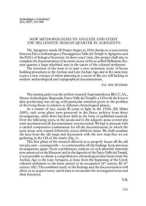
The starting point was the archive research (Soprintendenza BB.CC.AA.,
Museo Archeologico Regionale, Parco Valle dei Templi): a GIS with the known
data positioning was set up, with particular attention given to the problem
of the living loors in relation to different chronological phases.
As a matter of fact, insula III came to light in the 1950s (De Miro
2009): only some plans were preserved in the Parco archives from those
investigations, while there has been little in the form of published material.
Over the following years, in the insula and in the adjacent areas several pits
were examined and all documentation was recovered. We had to proceed with
a careful comparative examination for all the documentation, in which the
same areas were named differently across different times. We shall combine
the data from the old maps and documents with the new map that we are
gathering in the GIS of the insula (Fig. 1).
This irst phase of the research allowed us to properly locate all the old
test pits and – consequently – to contextualize all the indings from previous
investigations again. From a preliminary analysis of such plentiful materials
now preserved in the Museum and in the deposits of the Parco Valle dei Templi,
it was possible to obtain a comprehensive chronological time frame from the
Archaic Age to the Late Antiquity, at least from the beginning of the Greek
colonial settlement to the latest period of its occupation (6th century BC-6th
century AD). The combined study of the indings and the documentation will
allow us to acquire many useful data to reconsider the investigated areas and
their functions.
V.B.
353
�G. Lepore, E. Giorgi, V. Baldoni, F. Boschi, M.C. Parello, M.S. Rizzo
Fig. 1 – Map of the 1950s excavation in
the insula III (particular). Archivio Parco
Archeologico e Paesaggistico “Valle dei
Templi”, Agrigento.
The second step of the research was the survey of the structure, using
a new stratigraphic analysis as a means to examine the deterioration of the
antique walls.
The survey was referred to – from a topographical perspective – a framework of networks prepared by the technicians of the Parco Valle dei Templi
(Belvedere, Burgio 2012).
354
�New methodologies to analyze and study the Hellenistic-Roman quarter in Agrigento
Fig. 2 – Laser-scanning of the insula III.
The documentation system was modeled on the 2015 experience in
participation with the Piano della Conoscenza in Pompeii (Silani et al. in
this volume).
We therefore decided to proceed with a relief Laser Scanner Leica P30
with a dual-axis compensator and angular accuracy for single measurement
of 8 inches. Scans were acquired with a density point of 6 mm and they were
processed during pre-alignment through the target or natural point recognition. Afterwards we proceeded with the registration of point clouds with the
ICP algorithm. The software used was Leica Cyclone 9.1.4.
Point texturization was obtained through the inside camera of the
Laser Scanner (Leica P30) or in association with the NcTech ISTAR 360
panoramic camera. The entire cloud we obtained was 50% decimated and
exported for further modeling. We therefore advanced with cloud cleansing,
and currently the creation for Digital Surface Model (DSM) is in progress
through the 3D Reshaper software, that is always texturized starting from
the images obtained through the laser scanner’s internal camera. Moreover,
the laser scanner data processing is still being carried out: it will allow us to
draw a new updated map, in addition to perspective drawing, axonometric
projection, and orthophotos of the surveyed context. The inal objective is to
obtain new documentation drawn to a 1:50 scale including: a georeferenced
plan, an integrated longitudinal section along the central axes of the block,
integrated transverse sections in correspondence with different habitations,
orthophotos of all the wall views and of the more signiicant loor surfaces
(Fig. 2).
355
�G. Lepore, E. Giorgi, V. Baldoni, F. Boschi, M.C. Parello, M.S. Rizzo
These drawings will be the base for proceeding further with an understanding of the elevations, with the acknowledgement of the techniques and
the building materials used, according to the archaeology of architecture
criteria, and with the interpretation of degrade mapping and static risk. This
information will be catalogued in a database to be shared amongst colleagues
and Parco technicians and is intended for study purposes.
E.G.
Before the beginning of the new archaeological excavations, planned for
the October 2017, we have carried out a systematic campaign of geophysical
surveys. Even the use of integrated non-invasive methods was aimed at a
better understanding of the insula III in the Hellenistic-Roman quarter, with
particular attention to its genetic phases and its evolution.
As such, a high-resolution Ground Penetrating Radar (GPR) mapping
all the accessible spaces inside the standing buildings in the insula is in progress, in order to attempt the analysis and the 3D description of those not
yet excavated underground spaces.
Simultaneously, through a geomagnetic survey, we undertook the exploration of the now open ields, starting from the eastern area of the quarter, to
acquire new data on the extension and the articulation of the residential area,
in those partially known or unknown sectors. On the whole, we believe that
this work can be potentially useful for the reconstruction of the cityscape and
of the urban planning. The collected data is being processed and interpreted,
on the basis of integration with all the available sources of information. In
particular, we are working with feedbacks between the stratigraphic information from previous excavations and that which was obtained through GPR
slice-maps related to speciic depths (see on this Conyers, Goodman 1997;
Conyers 2004; Boschi 2009). We shall preliminarily point out that, in many
of the surveyed spaces within the insula, we can observe the detection of levels of frequentation and traces of walls-foundations quite regularly, attested
between 0.30 and 1.50 m in depth, which are potentially referable to living
phases earlier than those that are currently visible (Fig. 3).
F.B.
In conclusion, it is possible to make some archaeological considerations.
The internal articulation of living buildings, as it seems today, is datable to
a building phase of the early/middle Roman Imperial period during which
some more or less incisive changes in Late Antiquity were laid out, in most
cases intended to re-functionalize the living areas for artisanal and commercial purposes (Parello et al. 2016). Numerous test pits carried out under
the houses in insulae I and II showed different structures referring to the
356
�New methodologies to analyze and study the Hellenistic-Roman quarter in Agrigento
Fig. 3 – 3D slice-map of the pastas of the House III A (insula III).
occupation of the Hellenistic-Roman quarter during the Archaic Age; their
depth is variable when compared to the Hellenistic-Roman surface area, due
to the geomorphological features of the area, being marked by a gradient
both in the NS and the EW (De Miro 2009; Parello, Rizzo 2015). It is not
yet clear what kind of building they refer to, although the new examination
allowed us to emphasize the positioning of outside walls (set exactly on the
block half) and the presence of a small diagonal ambitus tract. Nothing is yet
known about the most ancient phases of insula III, where the investigation
has never gone further than the Hellenistic ones. However, it is interesting to
note that in one of the studies, carried out under the mosaic of the House III
H (so-called Casa delle Pelte), a terracing wall set in NS direction was detected
and is datable, according to excavators, to between 3rd and 2nd century BC, its
function probably being to allow an enlargement of the terrace where houses
were eventually built (De Miro 2009, 369-370).
The present division of lots inside the block, according to what E. De
Miro claims, should relect an unequal distribution realized in late Hellenistic
period (end of the 2nd century BC-Augustan Age), when a great part of the
diagonal and longitudinal ambitus were knocked down to create big houses
of the Greek-Hellenistic type (perystile), which would occupy the entire width
of the block.
357
�G. Lepore, E. Giorgi, V. Baldoni, F. Boschi, M.C. Parello, M.S. Rizzo
Such transformations are less clear inside insula III, where the longitudinal ambitus is preserved entirely (probably because the function of the terraced
wall), even if it is unbalanced towards the W for 50 cm along the northern
edge of the block. Here, houses maintain a more conservative planimetric
aspect and their articulation inside the insula, characterized by the succession
of squared and rectangular lots (today only partially visible due to successive
modiications), seems to refer to those visible ones in the inhabited areas in
“Porta II” in Agrigento or the acropolis of “Molino a Vento” in Gela (De Orsola 1991; De Miro 1996). This suggestion, however, would be conirmed,
or otherwise disproved, only after new stratigraphic studies alongside a more
accurate reading on the emerging matters of “Porta II”.
The pastas house is the most common shape inside the insula III, recognized even after important structural transformations made during imperial
period. This shape is linked to a building technique in which isodomic dry
stone blocks are all set at uniform sizes (1.36 m in length, 0.45/0.50 in height,
0.55 in width), of which have not been used in successive developments. At
the present state of research, it is not possible to establish which chronological phase or phases the pastas house refers to. Nevertheless, the preliminary
analysis of architectural elements and decorative devices lead to a following
phase, when the pastades colonnade was taken advantage of in order to create
the peristyle: it is possible to roughly place the terminus ante quem, to the
second half of the 2nd century BC.
G.L.
The presence of cement loors with decorated clay bases, Sicilian-Ionic
capitals, Sicilian-Corinthian capitals and Doric capitals with a compacted
echinus inserted inside houses that have small or long porches with four
columns, allow us to consider the Hellenistic-Roman quarter inside an artistic and architectural koine well documented during the Hellenistic phase
of public and private architecture in the prosperous cities of the Tyrrhenian
coast (such as Segesta, Soluntum, Panormus, Thermae, Halaesa, etc.), which,
according to almost unanimous opinion among scholars in the last decade,
would have developed starting from the second half of the 2nd century BC, in
particular during the inal quarter (Campagna 2006; Portale 2015). Such an
assumption contrasts with previously held beliefs, which considered the age
of Timoleon to be the last season for the lourishing of insular Hellenism, to
be extended to the 3rd century BC only within the boundaries of the Siracuse’s
reign (Belvedere, Termine 2005; Monte in press).
However, as evident as it might be that the development of Hellenic-matrix artistic culture does not wear out after the Roman conquest, on the
contrary, it would have received new drives and motivations from it, thanks
to connections created with the Hellenistic West. It is relevant to note the
358
�New methodologies to analyze and study the Hellenistic-Roman quarter in Agrigento
apparent restrictiveness in compressing all the indings into such a short
chronological phase, especially when we consider that, in most cases, this
chronology is exclusively based on the stylistic analysis of decorative sets.
All the Authors
Giuseppe Lepore, Enrico Giorgi, Vincenzo Baldoni, Federica Boschi
Alma Mater Studiorum – Università di Bologna
Dipartimento di Storia Culture Civiltà
giuseppe.lepore4@unibo.it, enrico.giorgi@unibo.it, vincenzo.baldoni@unibo.it,
federica.boschi5@unibo.it
Maria Concetta Parello, Maria Serena Rizzo
Parco Archeologico e Paesaggistico Valle dei Templi di Agrigento
mariaconcetta.parello@regione.sicilia.it, mariaserena.rizzo@regione.sicilia.it
REFERENCES
Belvedere O., Burgio A. 2012, Carta Archeologica e Sistema Informativo Territoriale del
Parco Archeologico e Paesaggistico della Valle dei Templi di Agrigento, Palermo, Regione
siciliana-Assessorato dei beni culturali e dell’identità siciliana.
Belvedere O., Termine E. 2005, L’urbanizzazione della costa nord-orientale della Sicilia e
la struttura urbana di Tindari, in S. Mols, E.M. Moormann (eds.), Omni pede stare.
Saggi architettonici e circumvesuviani in memoriam Jos de Waele, Napoli, Electa, 85-91.
Boschi F. 2009, Introduzione alla geoisica per l’archeologia, in E. Giorgi (ed.), Groma 2. In
profondità senza scavare, Bologna, BraDypUs, 291-315.
Brienza E., Caliò L.M., Furcas G.L., Giannella F., Liuzzo M. 2016, Per una nuova deinizione della griglia urbana della antica Akragas. Contributo preliminare ad una nuova
immagine della città, «Archeologia Classica», 67, 57-109.
Campagna L. 2006, L’architettura di età ellenistica in Sicilia. Per una rilettura del quadro
generale, in M. Osanna, M. Torelli (eds.), Sicilia ellenistica, consuetudo italica. Alle
origini dell’architettura ellenistica d’Occidente. Atti del Convegno (Spoleto 2004), Roma,
Edizioni dell’Ateneo, 15-34.
Conyers L.B. 2004, Ground Penetrating Radar for Archaeology, Walnut Creek, AltaMira Press.
Conyers L.B., Goodman D. 1997, Ground Penetrating Radar: An Introduction for Archaeologists, Walnut Creek, AltaMira Press.
De Miro E. 1996, La casa greca in Sicilia, in F. D’Andria, K. Mannino (eds.), Ricerche sulla casa
in Magna Grecia e in Sicilia. Atti del Colloquio (Lecce 1992), Galatina, Congedo, 17-40.
De Miro E. 2009, Agrigento IV. L’abitato antico. Il Quartiere ellenistico-romano, Roma,
Gangemi.
De Orsola D. 1991, Il quartiere di Porta II ad Agrigento, «Quaderni di archeologia. Università
degli studi di Messina», 6, 71-106.
Monte G. in press, Urbanistica e architettura pubblica a Solunto: nuove considerazioni e confronti con altri centri della Sicilia medio e tardo ellenistica, in Theatroeidèis. L’immagine
della città, la città delle immagini. Atti del Convegno (Bari 2016), in press.
Parello M.C., Rizzo M.S. (eds.) 2015, Agrigento romana. Scavi e ricerche nel quartiere
ellenistico romano. Campagna 2013, Palermo, Regione siciliana, Assessorato dei beni
culturali e identità siciliana, Dipartimento dei beni culturali e dell’identità siciliana.
Parello M.C., Rizzo M.S. (eds.) 2016, Paesaggi urbani tardoantichi. Casi a confronto. Atti
delle Giornate Gregoriane VIII Edizione (Agrigento 2014), Bari, Edipuglia.
359
�G. Lepore, E. Giorgi, V. Baldoni, F. Boschi, M.C. Parello, M.S. Rizzo
Portale E.C. 2015, Un confronto: la Sicilia nel III secolo, in La Magna Grecia da Pirro ad
Annibale. Atti del 52 Convegno di Studi sulla Magna Grecia (Taranto 2012), Taranto,
Istituto per la storia e l’archeologia della Magna Grecia, 697-736.
ABSTRACT
The Agrigento: insula III Project began in 2016 thanks to an agreement between the Parco
Archeologico e Paesaggistico Valle dei Templi di Agrigento and DiSCi - Bologna University;
it aims to document an entire sector of the Hellenistic-Roman quarter, in a three-year period.
The main goal is to start a systematic study of private housing from the Archaic period to
Late Antiquity and, at the same time, provide a critical understanding of the town planning
scheme in this part of the town, which still lacks a modern archaeological and topographical
documentation. The interpretation of the previous documentation is the starting point, along
with new mapping with laser scanning and a systematic campaign of geophysical investigations
to obtain a BIM. As the Bologna University tradition teaches, modern technologies can answer
precise historical and archaeological questions: what are the primary phases of the town map?
Which one is the starting module of each lot and what are the changes in different ages? Is it
possible to reconstruct the original architecture of Hellenistic houses? What is the relationship
between this quarter and the rest of the town? The integration of traditional investigational
techniques with more recent ones is the methodological assumption of the project, in order to
solve the analysis of the complex stratigraphy of the setting, which was inhabited for at least
a millennium, from the Archaic to the Middle Ages.
360
�
 Giuseppe Lepore
 Federica Boschi
 Vincenzo Baldoni