Location via proxy:   [ UP ]  
[Report a bug]   [Manage cookies]                
Next Issue
Volume 3, September
Previous Issue
Volume 3, March


Fire, Volume 3, Issue 2 (June 2020) – 18 articles

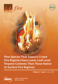
Cover Story (view full-size image): Branchlets of pine needles were assessed for their flammable properties in an iCone Calorimeter as part of research by Dewhirst et al. (2020)m considering the joint influence of leaf volatile content (terpenes) along with plant structure and morphology to their flammability. Dewhirst et al., MDPI Fire issue 2, show that pine trees that dominate in surface fire regimes have leaves that contain a higher volatile content and have higher flammability than those favouring crown fire regimes. View this paper.
  • Issues are regarded as officially published after their release is announced to the table of contents alert mailing list.
  • You may sign up for e-mail alerts to receive table of contents of newly released issues.
  • PDF is the official format for papers published in both, html and pdf forms. To view the papers in pdf format, click on the "PDF Full-text" link, and use the free Adobe Reader to open them.
Order results
Result details
Section
Select all
Export citation of selected articles as:
12 pages, 1208 KiB  
Article
Evaluating the Drought Code Using In Situ Drying Timelags of Feathermoss Duff in Interior Alaska
by Eric A. Miller and Brenda Wilmore
Fire 2020, 3(2), 25; https://doi.org/10.3390/fire3020025 - 25 Jun 2020
Cited by 3 | Viewed by 3614
Abstract
The Drought Code (DC) is a moisture code of the Canadian Forest Fire Weather Index System underlain by a hydrological water balance model in which drying occurs in a negative exponential pattern with a relatively long timelag. The model derives from measurements from [...] Read more.
The Drought Code (DC) is a moisture code of the Canadian Forest Fire Weather Index System underlain by a hydrological water balance model in which drying occurs in a negative exponential pattern with a relatively long timelag. The model derives from measurements from an evaporimeter and no soil parameters are specified, leaving its physical nature uncertain. One way to approximate the attributes of a “DC equivalent soil” is to compare its drying timelag with measurements of known soils. In situ measurements of timelag were made over the course of a fire season in a black spruce-feathermoss forest floor underlain by permafrost in Interior Alaska, USA. On a seasonally averaged basis, timelag was 28 d. The corresponding timelag of the DC water balance model was 60 d. Water storage capacity in a whole duff column 200 mm deep was 31 mm. Using these figures and a relationship between timelag, water storage capacity, and the potential evaporation rate, a “DC equivalent soil” was determined to be capable of storing 66 mm of water. This amount of water would require a soil 366 mm deep, suggesting a revision of the way fire managers in Alaska regard the correspondence between soil and the moisture codes of the FWI. Nearly half of the soil depth would be mineral rather than organic. Much of the soil water necessary to maintain a 60 d timelag characteristic of a “DC equivalent soil” is frozen until after the solstice. Unavailability of frozen water, coupled with a June peak in the potential evaporation rate, appears to shorten in situ timelags early in the season. Full article
(This article belongs to the Special Issue Boreal Fire-Fuels Interactions)
Show Figures

Graphical abstract

16 pages, 5049 KiB  
Article
Preceding Fall Drought Conditions and Overwinter Precipitation Effects on Spring Wildland Fire Activity in Canada
by Chelene Hanes, Mike Wotton, Douglas G. Woolford, David L. Martell and Mike Flannigan
Fire 2020, 3(2), 24; https://doi.org/10.3390/fire3020024 - 23 Jun 2020
Cited by 9 | Viewed by 4459 | Correction
Abstract
Spring fire activity has increased in parts of Canada, particularly in the west, prompting fire managers to seek indicators of potential activity before the fire season starts. The overwintering adjustment of the Canadian Fire Weather Index System’s Drought Code (DC) is a method [...] Read more.
Spring fire activity has increased in parts of Canada, particularly in the west, prompting fire managers to seek indicators of potential activity before the fire season starts. The overwintering adjustment of the Canadian Fire Weather Index System’s Drought Code (DC) is a method to adjust and carry-over the previous season’s drought conditions into the spring and potentially point to what lies ahead. The occurrence of spring fires is most strongly influenced by moisture in fine fuels. We used a zero-inflated Poisson regression model to examine the impact of the previous end of season Drought Code (DCf) and overwinter precipitation (Pow) while accounting for the day-to-day variation in fine fuel moisture that drives ignition potential. Impacts of DCf and Pow on area burned and fire suppression effectiveness were also explored using linear and logistic regression frameworks. Eight fire management regions across the boreal forests were analyzed using data from 1979 to 2018. For the majority of regions, drier fall conditions resulted in more human-caused spring fires, but not in greater area burned or reduced suppression effectiveness. The influence of Pow was much more variable pointing to the conclusion that Pow alone is not a good indicator of spring drought conditions. Full article
(This article belongs to the Special Issue Boreal Fire-Fuels Interactions)
Show Figures

Figure 1

7 pages, 253 KiB  
Article
A Conceptual Interpretation of the Drought Code of the Canadian Forest Fire Weather Index System
by Eric A. Miller
Fire 2020, 3(2), 23; https://doi.org/10.3390/fire3020023 - 22 Jun 2020
Cited by 8 | Viewed by 3963
Abstract
The Drought Code (DC) was developed as part of the Canadian Forest Fire Weather Index System in the early 1970s to represent a deep column of soil that dries relatively slowly. Unlike most other fire danger indices or codes that operate on gravimetric [...] Read more.
The Drought Code (DC) was developed as part of the Canadian Forest Fire Weather Index System in the early 1970s to represent a deep column of soil that dries relatively slowly. Unlike most other fire danger indices or codes that operate on gravimetric moisture content and use the logarithmic drying equation to represent diffusion, the DC is based on a model that balances daily precipitation and evaporation. This conceptually simple water balance model was ultimately implemented using a “shortcut” equation that facilitated ledgering by hand but also mixed the water balance model with the abstraction equation, obscuring the logic of the model and concealing two important variables. An alternative interpretation of the DC is presented that returns the algorithm to an equivalent but conceptual form that offers several advantages: The simplicity of the underlying water balance model is retained with fewer variables, constants, and equations. Two key variables, daily depth of water storage and actual evaporation, are exposed. The English system of units is eliminated and two terms associated with precipitation are no longer needed. The reduced model does not include or depend on any soil attributes, confirming that the nature of the “DC equivalent soil” cannot be precisely known. While the “Conceptual Algorithm” presented here makes it easier to interpret and understand the logic of the DC, users may continue to use the equivalent “Implemented Algorithm” operationally if they wish. Full article
(This article belongs to the Special Issue Boreal Fire-Fuels Interactions)
16 pages, 3486 KiB  
Case Report
A Case Study of Soil Moisture and Infiltration after an Urban Fire
by Quinn Alkin and Alicia M. Kinoshita
Fire 2020, 3(2), 22; https://doi.org/10.3390/fire3020022 - 7 Jun 2020
Cited by 5 | Viewed by 3353
Abstract
There is an increased risk of future fire disturbances due to climate change and anthropogenic activity. These disturbances can impact soil moisture content and infiltration, which are important antecedent conditions for predicting rainfall–runoff processes in semi-arid regions. Yet these conditions are not well [...] Read more.
There is an increased risk of future fire disturbances due to climate change and anthropogenic activity. These disturbances can impact soil moisture content and infiltration, which are important antecedent conditions for predicting rainfall–runoff processes in semi-arid regions. Yet these conditions are not well documented. This case study provides critical field measurements and information, which are needed to improve our understanding of mechanisms such as precipitation and temperature that lead to the variability of soil properties and processes in urban and burned landscapes. In June 2018, a fire burned a portion of the riparian zone in Alvarado Creek, an urban tributary of the San Diego River in California, United States. This fire provided an opportunity to observe soil moisture content and infiltration for one year after the fire. Three transects (one burned and two unburned) were monitored periodically to evaluate the complex spatial and temporal dynamics of soil moisture and infiltration patterns. Average dry season soil moisture content was less than five percent volume water content (%VWC) for all transects, and the burned transect exhibited the lowest %VWC during the wet season. Infiltration rates displayed a high degree of spatial and temporal variability. However, the location with the highest burn severity had the lowest average infiltration rate. The observed differences between the burned and unburned transects indicate that the fire altered hydrologic processes of the landscape and reduced the ability of the soil to retain water during the wet season. This research provides the first high-resolution soil moisture and infiltration field analysis of an urban fire-disturbed stream in southern California and a method to characterize post-fire hydrologic conditions for rainfall–runoff processes. Full article
Show Figures

Figure 1

14 pages, 1729 KiB  
Article
Seismic Lines in Treed Boreal Peatlands as Analogs for Wildfire Fuel Modification Treatments
by Patrick Jeffrey Deane, Sophie Louise Wilkinson, Paul Adrian Moore and James Michael Waddington
Fire 2020, 3(2), 21; https://doi.org/10.3390/fire3020021 - 6 Jun 2020
Cited by 14 | Viewed by 3914
Abstract
Across the Boreal, there is an expansive wildland–society interface (WSI), where communities, infrastructure, and industry border natural ecosystems, exposing them to the impacts of natural disturbances, such as wildfire. Treed peatlands have previously received little attention with regard to wildfire management; however, their [...] Read more.
Across the Boreal, there is an expansive wildland–society interface (WSI), where communities, infrastructure, and industry border natural ecosystems, exposing them to the impacts of natural disturbances, such as wildfire. Treed peatlands have previously received little attention with regard to wildfire management; however, their role in fire spread, and the contribution of peat smouldering to dangerous air pollution, have recently been highlighted. To help develop effective wildfire management techniques in treed peatlands, we use seismic line disturbance as an analog for peatland fuel modification treatments. To delineate below-ground hydrocarbon resources using seismic waves, seismic lines are created by removing above-ground (canopy) fuels using heavy machinery, forming linear disturbances through some treed peatlands. We found significant differences in moisture content and peat bulk density with depth between seismic line and undisturbed plots, where smouldering combustion potential was lower in seismic lines. Sphagnum mosses dominated seismic lines and canopy fuel load was reduced for up to 55 years compared to undisturbed peatlands. Sphagnum mosses had significantly lower smouldering potential than feather mosses (that dominate mature, undisturbed peatlands) in a laboratory drying experiment, suggesting that fuel modification treatments following a strategy based on seismic line analogs would be effective at reducing smouldering potential at the WSI, especially under increasing fire weather. Full article
(This article belongs to the Special Issue Boreal Fire-Fuels Interactions)
Show Figures

Graphical abstract

15 pages, 1732 KiB  
Article
Long-Term Effects of Repeated Prescribed Fire and Fire Surrogate Treatments on Forest Soil Chemistry in the Southern Appalachian Mountains (USA)
by Christopher J. Dukes, T. Adam Coates, Donald L. Hagan, W. Michael Aust, Thomas A. Waldrop and Dean M. Simon
Fire 2020, 3(2), 20; https://doi.org/10.3390/fire3020020 - 6 Jun 2020
Cited by 3 | Viewed by 2929
Abstract
From 2001–2018, a series of fuel reduction and ecosystem restoration treatments were implemented in the southern Appalachian Mountains near Asheville, North Carolina, USA. Treatments consisted of prescribed fire (four burns), mechanical cutting of understory shrubs and mid-story trees (two cuttings), and a combination [...] Read more.
From 2001–2018, a series of fuel reduction and ecosystem restoration treatments were implemented in the southern Appalachian Mountains near Asheville, North Carolina, USA. Treatments consisted of prescribed fire (four burns), mechanical cutting of understory shrubs and mid-story trees (two cuttings), and a combination of both cutting and prescribed fire (two cuts + four burns). Soils were sampled in 2018 to determine potential treatment impacts for O horizon and mineral soil (0–10 cm depth) carbon (C) and nitrogen (N) and mineral soil calcium (Ca), magnesium (Mg), phosphorus (P), potassium (K), and pH. Results suggested that mean changes in O horizon C and N and mineral soil C, N, C:N, Ca, and P from 2001–2018 differed between the treatments, but only mineral soil C, N, C:N, and Ca displayed differences between at least one fuel reduction treatment and the untreated control. One soils-related restoration objective was mineral soil N reduction and the cut + burn treatment best achieved this result. Increased organic matter recalcitrance was another priority, but this was not obtained with any treatment. When paired with previously reported fuels and vegetation results from this site, it appeared that continued use of the cut + burn treatment may best achieve long-term management objectives for this site and other locations being managed for similar long-term restoration and fuels management objectives. Full article
(This article belongs to the Special Issue Unravelling the Diverse Effects of Fire on Soil Processes)
Show Figures

Figure 1

4 pages, 168 KiB  
Perspective
Taking a Tabula Rasa Approach to Wildfire Governance: A Thought Experiment and Call for Papers and an Open Dialogue on the Topical Issue of Fire
by Stephen D. Fillmore and Alistair M.S. Smith
Fire 2020, 3(2), 19; https://doi.org/10.3390/fire3020019 - 5 Jun 2020
Cited by 1 | Viewed by 2608
Abstract
This perspective serves as a preface to the Topical Issue of Fire and presents an opportunity, framed within the classic approach of a thought experiment, to discuss how a new wildfire governance framework may be created from the ground up, if it were [...] Read more.
This perspective serves as a preface to the Topical Issue of Fire and presents an opportunity, framed within the classic approach of a thought experiment, to discuss how a new wildfire governance framework may be created from the ground up, if it were unencumbered by any existing construct, or experiences. It is not specific to any one country or fire regime; rather, it is intended merely to stimulate a wider conversation about where we are at collectively, and where we may want to move to in the future with our policies, organization, science, management, technology; or any of the myriad components that comprise the greater discipline of wildland fire science and management. The authors suggest that loosening the shackles of reality may allow for innovative discussion and the generation of transformative ideas to help ecosystems and communities better coexist with fire. We invite perspectives to submit to this Topical Issue on all aspects of wildfire governance, including reviews and perspectives. We also welcome perspectives on how to adapt wildfire governance in the face of exceptional events such as pandemics, earthquakes, famines, and war. Full article
(This article belongs to the Collection Rethinking Wildland Fire Governance: A Series of Perspectives)
14 pages, 1666 KiB  
Article
The Impact of Fuel Treatments on Wildfire Behavior in North American Boreal Fuels: A Simulation Study Using FIRETEC
by Ginny Marshall, Dan K. Thompson, Kerry Anderson, Brian Simpson, Rodman Linn and Dave Schroeder
Fire 2020, 3(2), 18; https://doi.org/10.3390/fire3020018 - 5 Jun 2020
Cited by 22 | Viewed by 4271
Abstract
Current methods of predicting fire spread in Canadian forests are suited to large wildfires that spread through natural forests. Recently, the use of mechanical and thinning treatments of forests in the wildland-urban interface of Canada has increased. To assist in community wildfire protection [...] Read more.
Current methods of predicting fire spread in Canadian forests are suited to large wildfires that spread through natural forests. Recently, the use of mechanical and thinning treatments of forests in the wildland-urban interface of Canada has increased. To assist in community wildfire protection planning in forests not covered by existing operational fire spread models, we use FIRETEC to simulate fire spread in lowland black spruce fuel structures, the most common tree stand in Canada. The simulated treatments included the mechanical mulching of strips, and larger, irregularly shaped areas. In all cases, the removal of fuel by mulch strips broke up the fuels, but also caused wind speed increases, so little decrease in fire spread rate was modelled. For large irregular clearings, the fire spread slowly through the mulched wood chips, and large decreases in fire spread and intensity were simulated. Furthermore, some treatments in the black spruce forest were found to be effective in decreasing the distance and/or density of firebrands. The simulations conducted can be used alongside experimental fires and documented wildfires to examine the effectiveness of differing fuel treatment options to alter multiple components of fire behavior. Full article
(This article belongs to the Special Issue Boreal Fire-Fuels Interactions)
Show Figures

Figure 1

19 pages, 3594 KiB  
Article
Pine Species That Support Crown Fire Regimes Have Lower Leaf-Level Terpene Contents Than Those Native to Surface Fire Regimes
by Rebecca A Dewhirst, Nicholas Smirnoff and Claire M Belcher
Fire 2020, 3(2), 17; https://doi.org/10.3390/fire3020017 - 5 Jun 2020
Cited by 16 | Viewed by 4655
Abstract
Fire is increasingly being recognised as an important evolutionary driver in fire-prone environments. Biochemical traits such as terpene (volatile isoprenoid) concentration are assumed to influence plant flammability but have often been overlooked as fire adaptations. We have measured the leaf-level flammability and terpene [...] Read more.
Fire is increasingly being recognised as an important evolutionary driver in fire-prone environments. Biochemical traits such as terpene (volatile isoprenoid) concentration are assumed to influence plant flammability but have often been overlooked as fire adaptations. We have measured the leaf-level flammability and terpene content of a selection of Pinus species native to environments with differing fire regimes (crown fire, surface fire and no fire). We demonstrate that this biochemical trait is associated with leaf-level flammability which likely links to fire-proneness and we suggest that this contributes to post-fire seedling survival. We find that surface-fire species have the highest terpene abundance and are intrinsically the most flammable, compared to crown-fire species. We suggest that the biochemical traits of surface fire species may have been under selective pressure to modify the fire environment at the leaf and litter scale to moderate fire spread and intensity. We indicate that litter flammability is driven not only by packing ratios and bulk density, but also by terpene content. Full article
Show Figures

Figure 1

20 pages, 5890 KiB  
Article
Assembling and Customizing Multiple Fire Weather Forecasts for Burn Probability and Other Fire Management Applications in Ontario, Canada
by Den Boychuk, Colin B. McFayden, Jordan Evens, Jerry Shields, Aaron Stacey, Douglas G. Woolford, Mike Wotton, Dan Johnston, Dan Leonard and Darren McLarty
Fire 2020, 3(2), 16; https://doi.org/10.3390/fire3020016 - 29 May 2020
Cited by 4 | Viewed by 3910
Abstract
Weather forecasts are needed in fire management to support risk-based decision-making that considers both the probability of an outcome and its potential impact. These decisions are complicated by the large amount of uncertainty surrounding many aspects of the decision, such as weather forecasts. [...] Read more.
Weather forecasts are needed in fire management to support risk-based decision-making that considers both the probability of an outcome and its potential impact. These decisions are complicated by the large amount of uncertainty surrounding many aspects of the decision, such as weather forecasts. Wildland fires in Ontario, Canada can burn and actively spread for days, weeks, or even months, or be naturally limited or extinguished by rain. Conventional fire weather forecasts have typically been a single scenario for a period of one to five days. These forecasts have two limitations: they are not long enough to inform some fire management decisions, and they do not convey any uncertainty to inform risk-based decision-making. We present an overview of a method for the assembly and customization of forecasts that (1) combines short-, medium-, and long-term forecasts of different types, (2) calculates Fire Weather Indices and Fire Behaviour Predictions, including modelling seasonal weather station start-up and shutdown, (3) resolves differing spatial resolutions, and (4) communicates forecasts. It is used for burn probability modelling and other fire management applications. Full article
(This article belongs to the Special Issue Boreal Fire-Fuels Interactions)
Show Figures

Figure 1

6 pages, 1222 KiB  
Perspective
Classification of Post-Fire Responses of Woody Plants to include Pyrophobic Communities
by Lynda D. Prior and David M. J. S. Bowman
Fire 2020, 3(2), 15; https://doi.org/10.3390/fire3020015 - 20 May 2020
Cited by 18 | Viewed by 4757
Abstract
Developing standardised classification of post-fire responses is essential for globally consistent comparisons of woody vegetation communities. Existing classification systems are based on responses of species growing in fire-prone environments. To accommodate species that occur in rarely burnt environments, we have suggested some important [...] Read more.
Developing standardised classification of post-fire responses is essential for globally consistent comparisons of woody vegetation communities. Existing classification systems are based on responses of species growing in fire-prone environments. To accommodate species that occur in rarely burnt environments, we have suggested some important points of clarification to earlier schemes categorizing post-fire responses. We have illustrated this approach using several Australasian conifer species as examples of pyrophobic species. In particular, we suggest using the term “obligate seeder” for the general category of plants that rely on seed to reproduce, and qualifying this to “post-fire obligate seeder” for the narrower category of species with populations that recover from canopy fire only by seeding; the species are typically fire-cued, with large aerial or soil seed banks that germinate profusely following a fire, and grow and reproduce rapidly in order to renew the seed bank before the next fire. Full article
Show Figures

Figure 1

12 pages, 1624 KiB  
Article
Immediate Effects of Prescribed Fire on Sub-Surface Water Quality in a Managed Yellow Pine Forest
by Kipling Klimas, Patrick Hiesl, Donald Hagan and Dara Park
Fire 2020, 3(2), 14; https://doi.org/10.3390/fire3020014 - 19 May 2020
Cited by 6 | Viewed by 4384
Abstract
Although prescribed fire is a forest management tool annually applied to nearly one million hectares across the southeastern United States, little is known about how prescribed fire influences soil water quality in the region. Sub-surface pools of nitrogen (N) and phosphorous (P) are [...] Read more.
Although prescribed fire is a forest management tool annually applied to nearly one million hectares across the southeastern United States, little is known about how prescribed fire influences soil water quality in the region. Sub-surface pools of nitrogen (N) and phosphorous (P) are important indicators of ecosystem response to disturbance and are likely modified, at least temporarily, by fire. We undertook a five-month study to examine sub-surface nutrient concentrations and pH in a managed yellow pine (Pinus sp.) forest before and after a low-severity dormant season prescribed fire in the Southern Blue Ridge Mountains of South Carolina. Between February and July 2019, soil solution was collected weekly from a 30 cm porous cup suction lysimeters and analyzed for ammonium (NH4+), nitrate (NO3-), and orthophosphate (PO43-), as well as pH. We compared the five-month mean and maximum nutrient concentrations and pH to quantify the immediate effects of prescribed fire. The prescribed fire caused significant pH buffering towards neutrality in burned transects relative to the control. There was no change in soil solution NO3-. The prescribed fire caused a significant increase in maximum NH4+ (18.0 mg/L) and PO43- (6.6 mg/L) concentrations. Post-fire NH4+ concentrations reached a maximum of 18.0 mg/L before declining three weeks post-fire. PO43- concentrations in burned stands reached a maximum of 6.6 mg/L and remained elevated for four weeks post-fire. Nutrient leaching was minimal due to complexion to soil cations and ground water uptake from regenerating vegetation at the onset of the growing season. The PO43- and NH4+ pulses in this study are likely influenced by fire-induced changes to soil chemistry and future studies should examine the homogeneity of pH buffering and nutrient pulses across the burned landscape. Full article
Show Figures

Figure 1

11 pages, 1092 KiB  
Article
RETRACTED: Propensities of Old Growth, Mature and Regrowth Wet Eucalypt Forest, and Eucalyptus nitens Plantation, to Burn During Wildfire and Suffer Fire-Induced Crown Death
by Suyanti Winoto-Lewin, Jennifer C. Sanger and James B. Kirkpatrick
Fire 2020, 3(2), 13; https://doi.org/10.3390/fire3020013 - 14 May 2020
Cited by 5 | Viewed by 7449 | Retraction
Abstract
There are conflicting conclusions on how the flammability of wet eucalypt forests changes in the time after disturbances such as logging or wildfire. Some conclude that forests are most flammable in the decades following disturbance, while others conclude that disturbance has no effect [...] Read more.
There are conflicting conclusions on how the flammability of wet eucalypt forests changes in the time after disturbances such as logging or wildfire. Some conclude that forests are most flammable in the decades following disturbance, while others conclude that disturbance has no effect on flammability. The comparative flammability of Eucalyptus nitens plantations in the same environment as wet eucalypt forest is not known. We determined fire incidence and fire severity in regrowth, mature and old growth wet eucalypt forest, and E. nitens plantation, in the Huon Valley, Tasmania after the January–February 2019 wildfire. To control for topographic variation and fire weather, we randomly selected sites within the fire footprint, then randomly located a paired site for each in different forest types in the same topographic environment within 3 km. Each pair of sites was burned on the same day. Old growth forest and plantations were the least likely to burn. Old growth and mature forest exhibited scorched eucalypt crowns to a much lesser degree than regrowth forests. In a comparison of paired sites, plantation forest was less likely to burn than combined mature and old growth forests, but in all cases of detected ignition the canopy of plantation was scorched. The lower flammability of older forests, and their importance as an increasing store of carbon, suggests that a cessation of logging outside plantations might have considerable benefits. Full article
Show Figures

Figure 1

18 pages, 598 KiB  
Article
Non-Additive Effects of Forest Litter on Flammability
by Angela G. Gormley, Tina L. Bell and Malcolm Possell
Fire 2020, 3(2), 12; https://doi.org/10.3390/fire3020012 - 12 May 2020
Cited by 7 | Viewed by 3332
Abstract
Forest litter is a fuel component that is important for the propagation of fire. Data describing fuel load, structure and fuel condition were gathered for two sites of Sydney Coastal Dry Sclerophyll Forest, a common vegetation type in the Sydney Basin, Australia. Surface [...] Read more.
Forest litter is a fuel component that is important for the propagation of fire. Data describing fuel load, structure and fuel condition were gathered for two sites of Sydney Coastal Dry Sclerophyll Forest, a common vegetation type in the Sydney Basin, Australia. Surface litter from the sites was sorted into its constituent components and used to establish which component or mixture of components were the most flammable using several metrics. A general blending model was used to estimate the effect the different mixtures had on the response of the flammability metrics and identify non-additive effects. Optimisation methods were applied to the models to determine the mixture compositions that were the most or least flammable. Differences in the flammability of the two sites were significant and were driven by Allocasuarina littoralis. The presence of A. littoralis in litter mixtures caused non-additive effects, increasing the rate of flame spread and flame height non-linearly. We discuss how land managers could use these models as a tool to assist in prioritising areas for hazard reduction burns and how the methodology can be extended to other fuel conditions or forest types. Full article
Show Figures

Figure 1

17 pages, 1609 KiB  
Article
Influence of Satellite Sensor Pixel Size and Overpass Time on Undercounting of Cerrado/Savannah Landscape-Scale Fire Radiative Power (FRP): An Assessment Using the MODIS Airborne Simulator
by Samuel Sperling, Martin J. Wooster and Bruce D. Malamud
Fire 2020, 3(2), 11; https://doi.org/10.3390/fire3020011 - 11 May 2020
Cited by 7 | Viewed by 4187
Abstract
The fire radiative power (FRP) of active fires (AFs) is routinely assessed with spaceborne sensors. MODIS is commonly used, and its 1 km nadir pixel size provides a minimum per-pixel FRP detection limit of ~5–8 MW, leading to undercounting of AF pixels with [...] Read more.
The fire radiative power (FRP) of active fires (AFs) is routinely assessed with spaceborne sensors. MODIS is commonly used, and its 1 km nadir pixel size provides a minimum per-pixel FRP detection limit of ~5–8 MW, leading to undercounting of AF pixels with FRPs of less than around 10 MW. Since most biomes show increasing AF pixel frequencies with decreasing FRP, this results in MODIS failing to detect many fires burning when it overpasses. However, the exact magnitude of the landscape-scale FRP underestimation induced by this type of AF undercounting remains poorly understood, as does its sensitivity to sensor pixel size and overpass time. We investigate these issues using both 1 km spaceborne MODIS data and 50 m MODIS Airborne Simulator (MAS) observations of the Brazilian cerrado, a savannah-like environment covering 2 million km2 (>20%) of Brazil where fires are a frequent occurrence. The MAS data were collected during the 1995 SCAR-B experiment, and are able to be spatially degraded to simulate data from sensors with a wide variety of pixel sizes. We explore multiple versions of these MAS data to deliver recommendations for future satellite sensor design, aiming to discover the most effective sensor characteristics that provide negligible pixel-area related FRP underestimation whilst keeping pixels large enough to deliver relatively wide swath widths. We confirm earlier analyses showing 1 km MODIS-type observations fail to detect a very significant number of active fires, and find the degree of undercounting gets worse away from the early afternoon diurnal fire cycle peak (~ 15:00 local time). However, the effect of these undetected fires on the assessment of total landscape-scale FRP is far less significant, since they are mostly low FRP fires. Using two different approaches we estimate that the MODIS-type 1 km data underestimates landscape scale FRP by around a third, and that whilst the degree of underestimation worsens away from the diurnal fire cycle peak the effect of this maybe less important since there are far fewer fires present. MAS data degraded to a 200 m spatial resolution provides landscape-scale FRP totals almost indistinguishable from those calculated with the original 50 m MAS observations, and still provides a pixel size consistent with a wide swath imaging instrument. Our work provides a potentially useful guide for future mission developers aiming at active fire and FRP applications, and we conclude that such missions need operate at spatial resolutions no higher than 200 m if they rely on cooled, low-noise IR detectors. Further work confirming this for fire-affected biomes beyond the savannah-type environments studied here is recommended. Full article
(This article belongs to the Special Issue Remote Sensing of Fire and Its Impact on Land and Atmosphere)
Show Figures

Graphical abstract

21 pages, 9178 KiB  
Article
Analysis of Variation in Distance, Number, and Distribution of Spotting in Southeast Australian Wildfires
by Michael A. Storey, Owen F. Price, Ross A. Bradstock and Jason J. Sharples
Fire 2020, 3(2), 10; https://doi.org/10.3390/fire3020010 - 28 Apr 2020
Cited by 23 | Viewed by 5403
Abstract
Spotting during wildfires can significantly influence the way wildfires spread and reduce the chances of successful containment by fire crews. However, there is little published empirical evidence of the phenomenon. In this study, we have analysed spotting patterns observed from 251 wildfires from [...] Read more.
Spotting during wildfires can significantly influence the way wildfires spread and reduce the chances of successful containment by fire crews. However, there is little published empirical evidence of the phenomenon. In this study, we have analysed spotting patterns observed from 251 wildfires from a database of over 8000 aerial line scan images capturing active wildfire across mainland southeast Australia between 2002 and 2018. The images were used to measure spot fire numbers, number of “long-distance” spot fires (> 500 m), and maximum spotting distance. We describe three types of spotting distance distributions, compare patterns among different regions of southeast Australia, and associate these with broad measures of rainfall, elevation, and fuel type. We found a relatively high correlation between spotting distance and numbers; however, there were also several cases of wildfires with low spot fire numbers producing very long-distance spot fires. Most long-distance spotting was associated with a “multi-modal” distribution type, where high numbers of spot fires ignite close to the source fire and isolated or small clumps of spot fires ignite at longer distances. The multi-modal distribution suggests that current models of spotting distance, which typically follow an exponential-shaped distribution, could underestimate long-distance spotting. We also found considerable regional variation in spotting phenomena that may be associated with significant variation in rainfall, topographic ruggedness, and fuel descriptors. East Victoria was the most spot-fire-prone of the regions, particularly in terms of long-distance spotting. Full article
Show Figures

Graphical abstract

5 pages, 619 KiB  
Perspective
An Integrated Approach to Identify Low-Flammability Plant Species for Green Firebreaks
by Brad R. Murray, Colin Brown, Megan L. Murray, Daniel W. Krix, Leigh J. Martin, Thomas Hawthorne, Molly I. Wallace, Summer A. Potvin and Jonathan K. Webb
Fire 2020, 3(2), 9; https://doi.org/10.3390/fire3020009 - 18 Apr 2020
Cited by 8 | Viewed by 4557
Abstract
With recent and predicted increases in the frequency and intensity of wildfires, there is a pressing need for mitigation strategies to reduce the impacts of wildfires on human lives, infrastructure and biodiversity. One strategy involves the use of low-flammability plants to build green [...] Read more.
With recent and predicted increases in the frequency and intensity of wildfires, there is a pressing need for mitigation strategies to reduce the impacts of wildfires on human lives, infrastructure and biodiversity. One strategy involves the use of low-flammability plants to build green firebreaks at the wildland–urban interface. It is common, however, to encounter uncertainty in a diverse range of stakeholders about the concept of flammability as it applies to plants, which may impede efforts to identify suitable low-flammability plant species. Here, we provide an approach to identify low-flammability plant species that integrates three fundamental and relatively easy-to-measure plant-flammability attributes – ignitibility, sustainability and combustibility – in a way that removes confusion about the concept of plant flammability. These three intrinsic flammability attributes relate to each other such that an ideal low-flammability species is one that is slow to ignite, sustains burning for a short period of time and combusts with low intensity. Consideration is then given to secondary attributes of plants critical to the selection of low-flammability plants, including attributes that influence the volume of fuel available for fires and the vertical and horizontal spread of fires. More work is urgently needed across the world to identify low-flammability plant species using standardised measurement protocols, and our integrated approach provides a transparent way to ensure we are selecting the right species, for the right location, in green firebreaks. Full article
Show Figures

Figure 1

22 pages, 3791 KiB  
Article
Combining the Monthly Drought Code and Paleoecological Data to Assess Holocene Climate Impact on Mediterranean Fire Regime
by Marion Lestienne, Christelle Hély, Thomas Curt, Isabelle Jouffroy-Bapicot and Boris Vannière
Fire 2020, 3(2), 8; https://doi.org/10.3390/fire3020008 - 9 Apr 2020
Cited by 7 | Viewed by 3519
Abstract
Currently, indexes from the Fire Weather Index System (FWI) are used to predict the daily fire hazard, but there is no reliable index available in the Mediterranean region to be compared with paleofire records and check for their long-term reliability. In order to [...] Read more.
Currently, indexes from the Fire Weather Index System (FWI) are used to predict the daily fire hazard, but there is no reliable index available in the Mediterranean region to be compared with paleofire records and check for their long-term reliability. In order to assess the past fire hazard and the fire-season length, based on data availability and requirements for fire index computation, we first chose and tested the efficiency of the Drought Code (DC) in Corsica (the main French Mediterranean fire-prone region) over the current period (1979–2016). We then used DC as a benchmark to assess the efficiency of the Monthly Drought Code (MDC) and used it to assess the Fire-Season Length (FSL), which were both used to characterize the fire hazard. Finally, we computed the Holocene MDC and FSL based on the HadCM3B-M1 climate model (three dimensional, fully dynamic, coupled atmosphere-ocean global climate model without flux adjustment) datasets and compared both index trends with those from proxies of paleofire, vegetation, and land use retrieved from sedimentary records in three Corsican lakes (Bastani, Nino, and Creno). Our strategy was to (i) assess fire hazard without the constraint of the daily weather-data requirement, (ii) reconstruct Holocene fire hazard from a climate perspective, and (iii) discuss the role of climate and human fire drivers based on the MDC-Paleofire proxy comparisons. Using both the Prométhée fire database and the ERA-Interim climate database over Corsica for the current period, we showed that DC values higher than 405 units efficiently discriminated fire-days from no-fire-days. The equivalent threshold value from MDC was set at 300 units. MDC and FSL indexes calculated for each of the past 11 millennia Before Present (11 ka BP) showed high values before 7 ka BP (above 300 units for MDC) and then lower values for the mid- to late Holocene (below 300 units for MDC). Climate appeared as a key driver to predict fire occurrences, promoting fires between 11 and 8 ka BP when summers were warmer than the current ones and reducing fire hazard after 7–6 ka BP due to wetter conditions. Since 5 ka BP, humans have taken control of the fire regime through agro-pastoralism, favoring large and/or frequent events despite less fire-prone climate conditions. The current fire hazard and fire-season length computed over the last few decades (1979–2016) both reported values that were respectively higher and longer than those assessed for the previous six millennia at least and comparable for those before 7 ka BP. For the next decades, due to climate warming associated with land abandonment (fuel accumulation) and the increase in human-related sources of ignition, we can expect an increase in fire hazard and larger fire events. Full article
Show Figures

Figure 1

Previous Issue
Next Issue
Back to TopTop