Grid reference TR1140
near to Stowting, Kent, England
Coverage
We have
47 images
in grid square TR1140
Contribute
Explore gridsquare TR1140
Surrounding area
Maps
 Map © Crown Copyright")
TIP: Click the map for more Large scale mapping
Tip: Click the map to open the coverage map
Sample images
Breakdown list
A sample of 12 photos from 47
for TR1140
- View this square in the Browser >>>
|
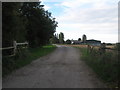
Farm road towards Heminge Farm
This road leads from Southenay Lane.
A footpath leads past the farm towards Cock Ash Lane.
|
|
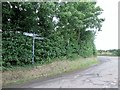
Junction of Fiddling Lane with Southenay Lane
by Martin Dawes
|
|
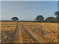
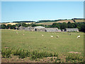
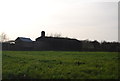
Field next to Broad Street Farm House
by James Emmans
|
|
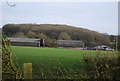
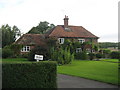
Mill House Farm
by N Chadwick
|
|
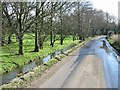
Street and stream, Broad Street
by Nick Smith
|
|
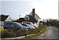
East Brabourne: The Black Horse P.H. from its car park |
|
Mill House Farm |
|
Small stream by the road, Broad Street
by Nick Smith
|
|
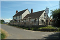
The Black Horse, Broad Street |
|
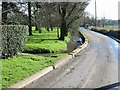
Fiddling Lane
by N Chadwick
|
|
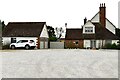
Bitford
House on Broad Street.
|
|
Horton View Farm
by N Chadwick
|
Explore more images in this square: | View Filtering options | View all 47 images page by page >>> |
|