ایست کووز
ظاهر
| East Cowes | |
|---|---|
 East Cowes seafront, showing the Columbine Yard building with its Union Flag doors. | |
| Area | ۵٫۰۹۲۴ km2 (۱٫۹۶۶۲ sq mi) [۱] |
| جمعیت | ۷٬۳۱۴ [۲] |
| • Density | ۱٬۴۳۶/km2 (۳٬۷۲۰/sq mi) |
| OS grid reference | SZ493958 |
| Civil parish |
|
| Unitary authority | |
| Ceremonial county | |
| Region | |
| اؤلکه | England |
| موستقیل دوولت | United Kingdom |
| Post town | EAST COWES |
| Postcode district | PO32 |
| UK Parliament | |
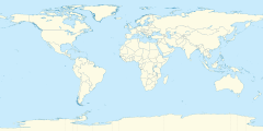
ایست کووز (اینگیلیسیجه: East Cowes) بریتانیادا بیر یاشاییش منطقهسیدیر سوْن نۆفوس تخمینلرینه گؤره 7314 نفر دیر. بۇ شهر اینگیلیس اؤلکهسینده یئرلشیب.
- ^ Office of National Statistics: QS102EW - Population density retrieved 30 May 2017
- ^ Area: East Cowes (parish) - Usual Resident Population, 2011 (KS101EW). Office of National Statistics (30 January 2013). آرشیولنیب اصلی نۆسخهدن on 2017-02-17. یوْخلانیلیب31 July 2015.
- ^ archive copy. آرشیولنیب اصلی نۆسخهدن on 2018-04-13. یوْخلانیلیب2018-05-20.

