Mitchell (rehiyon)
Appearance
- Alang sa ubang mga dapit sa mao gihapon nga ngalan, tan-awa ang Mitchell.
| Mitchell | |
| Rehiyon | |
| Nasod | |
|---|---|
| Estado | State of Victoria |
| Gitas-on | 256 m (840 ft) |
| Tiganos | 37°10′31″S 144°58′48″E / 37.17535°S 144.97999°E |
| Population | 37,366 (2014-07-26) [1] |
| Timezone | AEST (UTC+10) |
| - summer (DST) | AEDT (UTC+11) |
| GeoNames | 7839807 |
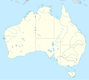
Rehiyon ang Mitchell sa Ostralya.[1] Nahimutang ni sa estado sa State of Victoria, sa habagatan-sidlakang bahin sa nasod, 400 km sa habagatan-kasadpan sa Canberra ang ulohan sa nasod. Adunay 37,366 ka molupyo.[1]
Mga lungsod sa Mitchell:
Sa mosunod nga mga natural nga mga bahin makita sa Mitchell:
- Mga bungtod:
- Bald Hill (bungtod)
- Bald Hills (bungtod)
- Barasse Hill (bungtod)
- Boase Hill (bungtod)
- Bryant Hill (bungtod)
- Conical Hill (bungtod)
- Croughs Hill (bungtod)
- Emu Hill (bungtod)
- Esler Hill (bungtod)
- Falvey Hill (bungtod)
- Fire Hill (bungtod)
- Flatrock Lookout (bungtod)
- Green Hill (bungtod)
- Greenshields Hill (bungtod)
- Hayes Hill (bungtod)
- Hughes Hill (bungtod)
- Ives Hill (bungtod)
- Kinchella Hills (bungtod)
- Larkin Hills (bungtod)
- Latchford Hills (bungtod)
- Lone Tree Hill (bungtod)
- Lookout Hill (bungtod)
- Lyon Hill (bungtod)
- Monument Hill (bungtod)
- Northwood Hill (bungtod)
- One Tree Hill (bungtod)
- Prospect Hill (bungtod)
- Pulpit Rock (bungtod)
- Red Hill (bungtod)
- Round Hill (bungtod)
- Saint Anns Hill (bungtod)
- Scrub Hill (bungtod)
- Seymour Hill (bungtod)
- Sharkeys Hill (bungtod)
- Sheoak Hill (bungtod)
- Shepherd Hill (bungtod)
- Stony Creek Hill (bungtod)
- Strath Lookout (bungtod)
- Tehan Hill (bungtod)
- The Bump (bungtod)
- The Mound (bungtod)
- Tobin Hill (bungtod)
- Tooborac Hill (bungtod)
- Tunnel Hill (bungtod)
- Tyaak Hill (bungtod)
- Wallaby Lookout (bungtod)
- Warfe Hill (bungtod)
- Whiteheads Hill (bungtod)
- Whitelaw Hills (bungtod)
- Vickery Hill (bungtod)
- York Town Hill (bungtod)
- Young Hill (bungtod)
- Kabukiran:
- Chambers Mount (bukid)
- Meadows Hill (bukid)
- Mount Alexina (bukid)
- Mount Eaglehawk (bukid)
- Mount Fraser (bukid)
- Mount Hawdon (bukid)
- Mount Helen (bukid)
- Mount Hickey (bukid)
- Mount Kappe (bukid)
- Mount Koala (bukid)
- Mount Lookout (bukid)
- Mount Mickey (bukid)
- Mount Piper (bukid)
- Mount Puckapunyal (bukid)
- Mount Rose (bukid)
- Mount Stewart (bukid)
- Mount Tallarook (bukid)
- Pretty Sally (bukid)
- Pyalong Hill (bukid)
Hapit nalukop sa kaumahan ang palibot sa Mitchell.[2] Dunay mga 16 ka tawo kada kilometro kwadrado sa palibot sa Mitchell may gamay nga populasyon.[3] Ang klima baybayon.[4] Ang kasarangang giiniton 14 °C. Ang kinainitan nga bulan Enero, sa 25 °C, ug ang kinabugnawan Hulyo, sa 6 °C.[5] Ang kasarangang pag-ulan 1,167 milimetro matag tuig. Ang kinabasaan nga bulan Hulyo, sa 136 milimetro nga ulan, ug ang kinaugahan Enero, sa 46 milimetro.[6]
| ||||||||||||||||||||||||||||||||||||||||||||||||||||||||||||||||||||||||||||||||||||||||||||||||||||||||||||||||||||||||||||
Ang mga gi basihan niini
[usba | usba ang wikitext]- ↑ 1.0 1.1 1.2 Mitchell sa GeoNames.Org (cc-by); post updated 2014-07-26; database download sa 2015-06-27
- ↑ "NASA Earth Observations: Land Cover Classification". NASA/MODIS. Retrieved 30 Enero 2016.
- ↑ "NASA Earth Observations: Population Density". NASA/SEDAC. Retrieved 30 Enero 2016.
- ↑ Peel, M C; Finlayson, B L. "Updated world map of the Köppen-Geiger climate classification". Hydrology and Earth System Sciences. 11: 1633–1644. doi:10.5194/hess-11-1633-2007. Retrieved 30 Enero 2016.
{{cite journal}}: CS1 maint: unflagged free DOI (link) - ↑ 5.0 5.1 "NASA Earth Observations Data Set Index". NASA. Retrieved 30 Enero 2016.
- ↑ "NASA Earth Observations: Rainfall (1 month - TRMM)". NASA/Tropical Rainfall Monitoring Mission. Retrieved 30 Enero 2016.

