Category:1737 maps
Jump to navigation
Jump to search
| ← · 1730 · 1731 · 1732 · 1733 · 1734 · 1735 · 1736 · 1737 · 1738 · 1739 · → |
Deutsch: Karten mit Bezug zum Jahr 1737
English: Maps related to the year 1737
Español: Mapas relativos al año 1737
Français : Cartes concernant l’an 1737
Русский: Карты 1737 года
Subcategories
This category has the following 8 subcategories, out of 8 total.
Media in category "1737 maps"
The following 47 files are in this category, out of 47 total.
-
 A chart of the Caribe Islands (9495452356).jpg 800 × 644; 142 KB
-
 A chart of the iland of Hispaniola (9495452500).jpg 800 × 645; 159 KB
-

-
 A draught of New York from the Hook to New York Town (9495451898).jpg 800 × 638; 121 KB
-
 A draught of the Bay of Honda (9492654209).jpg 508 × 800; 97 KB
-
 A large draft of the island Antegua (9492653741).jpg 512 × 800; 102 KB
-

-

-
 A new mapp of Carolina (9492653817).jpg 800 × 644; 161 KB
-
 A plan of Patomack River, from the mouth of Sherrendo, down to Chapawamsick LOC 88693249.jpg 5,907 × 7,388; 5.91 MB
-
 A plan of Patomack River, from the mouth of Sherrendo, down to Chapawamsick LOC 88693249.tif 5,907 × 7,388; 124.86 MB
-

-
 Anville Nouvel atlas de la Chine - Page15 Chine generale couleur.jpg 2,500 × 1,755; 2.87 MB
-
 Anville Nouvel atlas de la Chine - Page22 Kiang nan.jpg 2,968 × 3,216; 3.11 MB
-
 Bay Bulls (9492653063).jpg 526 × 799; 75 KB
-
 Bermudas (9495452972).jpg 524 × 799; 98 KB
-

-
 Cattalina Harbor (9495451572).jpg 517 × 800; 74 KB
-
 CEM-44-La-Chine-la-Tartarie-Chinoise-et-le-Thibet-1734-2568.jpg 2,552 × 1,832; 2.5 MB
-

-
 Christian Gottfried Hoffmann, Templi Hierosolymitani delineatio (FL6880293 2368077).jpg 3,100 × 2,008; 2.56 MB
-
 Cornelis de Bruijn, A draught of the city of Jerusalem as it is now (FL13735709 3607382).jpg 6,027 × 3,981; 35.18 MB
-
 Douay et fort de Scarpe pour le projet de 1737.jpg 11,264 × 6,400; 27.28 MB
-

-
 Gottfried Jacob Haupt, Danubii Fluminis Pars media (FL36560131 3015254).jpg 16,933 × 14,273; 367.99 MB
-
 Harbor Grace (9492652993).jpg 524 × 799; 74 KB
-
 Henri Scheurleer, Province De Quang-Tong (FL46961898 2470530).jpg 15,185 × 11,950; 218.56 MB
-
 Histoire des Yncas 1737.jpg 3,000 × 2,570; 846 KB
-

-
 Island of St. Peters (9495451802).jpg 514 × 800; 98 KB
-
 Johann Georg Pritius, Palestina seu Terra Sancta (FL45588728 3931136).jpg 2,506 × 3,852; 2.9 MB
-
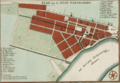 Kaart van Paramaribo.png 1,126 × 776; 1.44 MB
-

-

-
 Map of Suriname in 1737.jpg 5,500 × 3,508; 3.41 MB
-
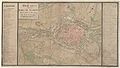
 Map of the Seat of War in Germany c1737.jpg 2,653 × 2,024; 4.08 MB
-
 Memmingen 1737.jpg 15,180 × 11,096; 58.65 MB
-

-

-
 Plan fort et redoute de Scarpe Douai.jpg 2,929 × 1,678; 1.15 MB
-

-

-
 Port Bonavista (9495451698).jpg 520 × 800; 72 KB
-
 UBBasel Map 1737 Kartenslg Schw Cl 121.tif 11,492 × 8,967, 2 pages; 294.85 MB
-
 UBBasel Map 1737 Kartenslg Schw Cl 122.tif 9,795 × 7,385, 2 pages; 206.98 MB
-
 Urbs Hierosolyma (FL45593315 3931138).jpg 3,727 × 2,682; 2.74 MB
-
 William Whiston, Cellarius's, Reland's & Maundrell's Maps of Palestine (FL35084165 3890528).jpg 12,452 × 15,026; 260.96 MB
.jpg)
.jpg)
.jpg)
.jpg)
.jpg)
.jpg)
.jpg)
.jpg)
.jpg)


.jpg)
.jpg)
.jpg)
.jpg)

.jpg)
.jpg)
.jpg)

.jpg)
.jpg)
.jpg)
.jpg)


.jpg)
.jpg)


.jpg)
.jpg)


.jpg)
.jpg)
.jpg)