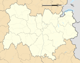
Colombier-Saugnieu (French pronunciation: [kɔlɔ̃bjesoɲø]) is the easternmost commune in the Rhône department, on the border with Isère, in the Auvergne-Rhône-Alpes region in central-eastern France.
Colombier-Saugnieu | |
|---|---|
 The town hall in Colombier-Saugnieu | |
| Coordinates: 45°42′44″N 5°06′46″E / 45.7122°N 5.1128°E | |
| Country | France |
| Region | Auvergne-Rhône-Alpes |
| Department | Rhône |
| Arrondissement | Lyon |
| Canton | Genas |
| Intercommunality | CC de l'Est Lyonnais |
| Government | |
| • Mayor (2020–2026) | Pierre Marmonier[1] |
Area 1 | 27.62 km2 (10.66 sq mi) |
| Population (2022)[2] | 2,859 |
| • Density | 100/km2 (270/sq mi) |
| Demonym | Colombards |
| Time zone | UTC+01:00 (CET) |
| • Summer (DST) | UTC+02:00 (CEST) |
| INSEE/Postal code | 69299 /69124 |
| Elevation | 200–277 m (656–909 ft) |
| Website | www |
| 1 French Land Register data, which excludes lakes, ponds, glaciers > 1 km2 (0.386 sq mi or 247 acres) and river estuaries. | |
Geography
editThe river Bourbre forms part of the commune's eastern border. Lyon-Saint-Exupéry TGV station and most of Lyon–Saint-Exupéry Airport (a small part in the north is in Pusignan) are in the commune. It is part of the public transport zone of Rhônexpress, although the rail link does not serve the villages of Colombier (which houses the town hall), Saugnieu and Montcul east of the airport.
Population
edit| Year | Pop. | ±% p.a. |
|---|---|---|
| 1968 | 812 | — |
| 1975 | 942 | +2.14% |
| 1982 | 1,127 | +2.59% |
| 1990 | 1,833 | +6.27% |
| 1999 | 2,083 | +1.43% |
| 2007 | 2,261 | +1.03% |
| 2012 | 2,495 | +1.99% |
| 2017 | 2,613 | +0.93% |
| Source: INSEE[3] | ||
Education
editThe commune has a primary school, the Groupe Scolaire Jules Ferry.[4]
Politics
editSince 2008, Pierre Marmonier has held the mayorship of Colombier-Saugnieu. He was re-elected in the 2020 municipal election.[1]
See also
editReferences
edit- ^ a b "Répertoire national des élus: les maires". data.gouv.fr, Plateforme ouverte des données publiques françaises (in French). 2 December 2020.
- ^ (in French). The National Institute of Statistics and Economic Studies. 19 December 2024 https://www.insee.fr/fr/statistiques/8288323?geo=COM-69299.
{{cite web}}: Missing or empty|title=(help) - ^ Population en historique depuis 1968, INSEE.
- ^ "Groupe scolaire Jules Ferry." Colombier-Saugnieu. Retrieved on 5 September 2016.
External links
edit- Official website (in French)


