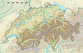
The Hohgrat (also known as Groot) is a mountain located on the border between the Swiss cantons of Thurgau and St. Gallen. Reaching a height of 996 metres above sea level, it is the highest point of the canton of Thurgau.
| Hohgrat | |
|---|---|
 On the summit | |
| Highest point | |
| Elevation | 996 m (3,268 ft) |
| Prominence | 106 m (348 ft)[1] |
| Parent peak | Hörnli |
| Listing | Canton high point |
| Coordinates | 47°23′07.5″N 08°57′58″E / 47.385417°N 8.96611°E |
| Geography | |
| Location | Thurgau/St. Gallen, Switzerland |
| Parent range | Appenzell Alps |
The mountain is densely forested, except the eastern (St. Gallen) side, which includes some limestone cliffs.
References
edit- Canton Thurgau - Geographic Location thurgau-turismus.ch
External links
edit
