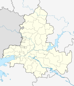
Kuybyshevo (Russian: Куйбышево) is a rural locality (a selo) in Kuybyshevsky District of Rostov Oblast, Russia. Population: 6,145 (2010 Census);[1] 5,799 (2002 Census).[4] It is also the administrative center of Kuybyshevsky District.
Kuybyshevo
Куйбышево | |
|---|---|
| Coordinates: 47°49′06″N 38°54′30″E / 47.81833°N 38.90833°E | |
| Country | Russia |
| Federal subject | Rostov Oblast[1] |
| Administrative district | Kuybyshevsky District[1] |
| Population | |
| • Total | 6,145 |
| Time zone | UTC+3 (MSK |
| Postal code(s)[3] | 346940 |
| OKTMO ID | 60627405101 |
Geography
editKuybyshevo is located on the left bank of Mius River. It is close to the border with Ukraine. The Ukrainian territory on the other side of the border is de facto controlled by self-proclaimed Donetsk People's Republic.
History
editThe predecessor of the modern selo of Kuybyshevo was Golodayevka sloboda, which was founded in 1777 by colonel Dmitry Martynov.[5]
In April 1820, the region was the location of the largest peasant uprising in the 19th century in Russia, the Martynovsky Riot. With about 30,000 participants, it was the second largest insurrection after that of Pugachev.[6] In July of the same year the revolt was suppressed by general Alexander Chernyshyov,[7] and about four thousand peasants were arrested.[5]
During the Russian Civil War the fighting took place in the area. Golodaevka was taken by Red Army forces led by Nikolay Kuibyshev. In 1935 Golodaevka was renamed to Kuybyshevo in his honor, despite the fact that three years later Kuibyshev was executed on charges of spying. The name probably was not changed because of confusion between Nikolay Kuibyshev and his brother Valerian Kuybyshev, a prominent Soviet politician who also died in 1935.[7]
Places of interest
edit- Saint Nicholas Church [ru], a Russian Orthodox church built in 1860.
- Kuybyshevo Forest, a natural monument and a protected area.[8]
References
edit- ^ a b c d e f Russian Federal State Statistics Service (2011). Всероссийская перепись населения 2010 года. Том 1 [2010 All-Russian Population Census, vol. 1]. Всероссийская перепись населения 2010 года [2010 All-Russia Population Census] (in Russian). Federal State Statistics Service.
- ^ "Об исчислении времени". Официальный интернет-портал правовой информации (in Russian). 3 June 2011. Retrieved 19 January 2019.
- ^ Почта России. Информационно-вычислительный центр ОАСУ РПО. (Russian Post). Поиск объектов почтовой связи (Postal Objects Search) (in Russian)
- ^ Federal State Statistics Service (21 May 2004). Численность населения России, субъектов Российской Федерации в составе федеральных округов, районов, городских поселений, сельских населённых пунктов – районных центров и сельских населённых пунктов с населением 3 тысячи и более человек [Population of Russia, Its Federal Districts, Federal Subjects, Districts, Urban Localities, Rural Localities—Administrative Centers, and Rural Localities with Population of Over 3,000] (XLS). Всероссийская перепись населения 2002 года [All-Russia Population Census of 2002] (in Russian).
- ^ a b "Род Мартыновых - основателей нашего села - АНО СЕМЬЯ РОССИИ". semyarossii.ru. Retrieved 2016-03-27.
- ^ В.И. Кузнецов История Дона с древних времён до Великой Октябрьской социалистической революции. Ростов-на-Дону: Издательство Ростовского университета. 1965. pp. гл. V.
- ^ a b "Куйбышевский район". special.donland.ru. Archived from the original on 2016-04-07. Retrieved 2016-03-27.
- ^ dummy. Лес на берегу р. Миус - Заповедная Россия. www.zapoved.net (in Russian). Archived from the original on 2016-04-18. Retrieved 2017-11-08.


