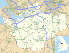
Ledsham is a village and civil parish in the unitary authority of Cheshire West and Chester and the ceremonial county of Cheshire, England. The civil parish includes parts of the hamlets of Badger's Rake and Two Mills.[1] It is located on the Wirral Peninsula, approximately 10 km (6.2 mi) to the north of the city of Chester and 6 km (3.7 mi) to the west of Ellesmere Port.
| Ledsham | |
|---|---|
| Village | |
 Inglewood Manor Hotel, Ledsham | |
Location within Cheshire | |
| Population | 181 (2011 Census) |
| OS grid reference | SJ358745 |
| Civil parish |
|
| Unitary authority | |
| Ceremonial county | |
| Region | |
| Country | England |
| Sovereign state | United Kingdom |
| Post town | ELLESMERE PORT |
| Postcode district | CH66 |
| Dialling code | 0151 |
| Police | Cheshire |
| Fire | Cheshire |
| Ambulance | North West |
| UK Parliament | |
At the 2011 Census, the village had a population of 181.[2]
History
editIn 1085, Ledsham was recorded in the Domesday Book as Levetesham. The landowner was Walter de Vernon.[3] The land passed by will from the Massey family to Sir Thomas Stanley of Hooton in 1715.[4]
Formerly a township in Neston parish of the Wirral Hundred, it became a civil parish in 1866. The population was recorded at 56 in 1801, 94 in 1851, 82 in 1901, 116 in 1951 and 88 in 2001.[1]
The village was served by Ledsham railway station on the former Chester and Birkenhead Railway. A local cottage had been used as the station building, until the provision of more substantial facilities.[5] At its height, Ledsham station had four platforms and was situated at the southern end of the railway's quadrupled section. The station never achieved the commercial potential expected by its owners, primarily due to its remote rural location.[6] Ledsham station closed completely on 20 July 1959.[5] However, two tracks of the line are still part of the Merseyrail network.
Governance
editLedsham is within the Chester North and Neston parliamentary constituency. At local government level the area is divided between Ledsham & Manor[7] and Saughall & Mollington wards.[8] as of 2024.
Geography
editThe village centre is located approximately 1 km (0.62 mi) to the north west of Capenhurst, with the area around the former railway station 2 km (1.2 mi) to the north, in the vicinity of Little Sutton.[9]
Transport
editTo the north and west of Ledsham, the A550 Welsh Road connects the A41 and A540.
The nearest station is Capenhurst railway station on Merseyrail's Wirral line, with services between Liverpool and Chester.
Landmarks
editInglewood is a Grade II listed building in Ledsham, which was built as a private house in 1909.[10] As of 2024 the building is the Inglewood Manor Hotel.[11]
See also
editReferences
edit- ^ a b "Ledsham". GENUKI UK & Ireland Genealogy. Retrieved 22 July 2020.
- ^ "2011 Census". Office for National Statistics. Retrieved 28 May 2015.
- ^ "Cheshire L-Z: Ledsham". Domesday Book Online. Retrieved 22 July 2020.
- ^ Lewis, Samuel (1858). "Ledsham". A Topographical Dictionary of England. UK Genealogy Archives. Retrieved 22 July 2020.
- ^ a b Maund, T.B. (2000). The Birkenhead Railway. The Railway Correspondence & Travel Society. ISBN 0-901115-87-8.
- ^ Merseyside Railway History Group (c. 1994). Railway Stations of Wirral. Ian & Marilyn Boumphrey. ISBN 1-899241-02-7.
- ^ "Ward Profile report: Ledsham & Manor Ward". Cheshire West and Chester Council. 2019. Retrieved 22 July 2020.
- ^ "Ward Profile report: Saughall & Mollington Ward". Cheshire West and Chester Council. 2019. Retrieved 22 July 2020.
- ^ "Side by side maps: OS 25in & Bing 2020 hybrid". National Library of Scotland. Retrieved 22 July 2020.
- ^ Historic England, "Inglewood, Ledsham (1115710)", National Heritage List for England, retrieved 22 July 2020
- ^ "Inglewood Manor Hotel". Boutique Hotels Group. Retrieved 22 July 2020.
