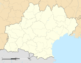
Marsillargues (French pronunciation: [maʁsijaʁɡ]; Provençal: Marsilhargues) is a commune in the Hérault department in southern France.
Marsillargues | |
|---|---|
 An aerial view of Marsillargues | |
| Coordinates: 43°39′54″N 4°10′44″E / 43.6649°N 4.1789°E | |
| Country | France |
| Region | Occitania |
| Department | Hérault |
| Arrondissement | Montpellier |
| Canton | Lunel |
| Intercommunality | Pays de Lunel |
| Government | |
| • Mayor (2020–2026) | Patrice Spéziale[1] |
Area 1 | 42.7 km2 (16.5 sq mi) |
| Population (2021)[2] | 6,587 |
| • Density | 150/km2 (400/sq mi) |
| Time zone | UTC+01:00 (CET) |
| • Summer (DST) | UTC+02:00 (CEST) |
| INSEE/Postal code | 34151 /34590 |
| Elevation | 0–11 m (0–36 ft) |
| 1 French Land Register data, which excludes lakes, ponds, glaciers > 1 km2 (0.386 sq mi or 247 acres) and river estuaries. | |
Its inhabitants are called Marsillarguois.
Geography
editThe city is situated on the Vidourle river, at mid distance of Montpellier and Nîmes. The commune lies on a vast plain, quite marshy in the south part, which is called Petite Camargue. The closest towns to Marsillargues are Lunel, Aimargues and Saint-Laurent-d'Aigouze.
Climate
editMarsillargues has a mediterranean climate (Köppen climate classification Csa). The average annual temperature in Marsillargues is 14.8 °C (58.6 °F). The average annual rainfall is 621.7 mm (24.48 in) with October as the wettest month. The temperatures are highest on average in July, at around 23.6 °C (74.5 °F), and lowest in January, at around 6.9 °C (44.4 °F). The highest temperature ever recorded in Marsillargues was 45.1 °C (113.2 °F) on 28 June 2019; the coldest temperature ever recorded was −9.8 °C (14.4 °F) on 5 February 2012.
| Climate data for Marsillargues (1981–2010 averages, extremes 1988−present) | |||||||||||||
|---|---|---|---|---|---|---|---|---|---|---|---|---|---|
| Month | Jan | Feb | Mar | Apr | May | Jun | Jul | Aug | Sep | Oct | Nov | Dec | Year |
| Record high °C (°F) | 21.7 (71.1) |
24.2 (75.6) |
27.4 (81.3) |
30.8 (87.4) |
35.0 (95.0) |
45.1 (113.2) |
36.9 (98.4) |
39.0 (102.2) |
35.6 (96.1) |
32.5 (90.5) |
26.1 (79.0) |
20.4 (68.7) |
45.1 (113.2) |
| Mean daily maximum °C (°F) | 12.1 (53.8) |
13.6 (56.5) |
16.9 (62.4) |
19.0 (66.2) |
23.5 (74.3) |
27.6 (81.7) |
30.5 (86.9) |
30.4 (86.7) |
25.6 (78.1) |
21.0 (69.8) |
15.5 (59.9) |
12.1 (53.8) |
20.7 (69.3) |
| Daily mean °C (°F) | 6.9 (44.4) |
8.0 (46.4) |
10.8 (51.4) |
13.0 (55.4) |
17.3 (63.1) |
20.9 (69.6) |
23.6 (74.5) |
23.6 (74.5) |
19.4 (66.9) |
15.8 (60.4) |
10.4 (50.7) |
7.3 (45.1) |
14.8 (58.6) |
| Mean daily minimum °C (°F) | 1.8 (35.2) |
2.3 (36.1) |
4.8 (40.6) |
7.1 (44.8) |
11.2 (52.2) |
14.3 (57.7) |
16.7 (62.1) |
16.8 (62.2) |
13.1 (55.6) |
10.5 (50.9) |
5.3 (41.5) |
2.5 (36.5) |
8.9 (48.0) |
| Record low °C (°F) | −8.2 (17.2) |
−9.8 (14.4) |
−9.4 (15.1) |
−2.6 (27.3) |
2.8 (37.0) |
4.3 (39.7) |
8.1 (46.6) |
8.3 (46.9) |
3.0 (37.4) |
−2.2 (28.0) |
−7.9 (17.8) |
−9.5 (14.9) |
−9.8 (14.4) |
| Average precipitation mm (inches) | 55.7 (2.19) |
36.6 (1.44) |
30.6 (1.20) |
62.1 (2.44) |
41.6 (1.64) |
26.2 (1.03) |
15.8 (0.62) |
34.3 (1.35) |
94.4 (3.72) |
102.8 (4.05) |
65.2 (2.57) |
56.4 (2.22) |
621.7 (24.48) |
| Average precipitation days (≥ 1.0 mm) | 5.8 | 4.1 | 4.1 | 6.5 | 4.9 | 3.2 | 2.2 | 3.5 | 5.4 | 7.7 | 6.8 | 5.7 | 60.0 |
| Source: Meteociel[3] | |||||||||||||
Population
edit
|
| ||||||||||||||||||||||||||||||||||||||||||||||||||||||||||||||||||||||||||||||||||||||||||||||||||||||||||||||||||
| Source: EHESS[4] and INSEE (1968-2017)[5] | |||||||||||||||||||||||||||||||||||||||||||||||||||||||||||||||||||||||||||||||||||||||||||||||||||||||||||||||||||
Sights
editGuillaume de Nogaret's Castle
editThe castle was founded in 1305 by Guillaume de Nogaret, who became Lord of Marsillargues, in reward of his services returned to Philip IV, King of France. From the feudal castle, only the basements, the large kitchens and the keep with its square tower remain.
Saint-Sauveur Church
editThe church was built in 1688 by Jacques Cubissol, and houses a remarkable oil painting on canvas "La Nativité" attributed to French painter Charles Errard.
Protestant Temple
editA Temple was first built between 1574 and 1582. During the tragic period of the French Wars of Religion, it was damaged and then repaired in 1599, only to be totally destroyed in 1685 following the revocation of the Edict of Nantes. The Concordat of 1801 allowed a Protestant minister to be installed at Marsillargues in 1803. Ground was broken for a new Temple in 1806, and it was finished in 1818.
Personalities
edit- Jacques Antoine Mourgues, French Interior Minister in 1792, was born in Marsillargues in 1734.
- Paulin Etienne d'Anglas de Praviel, was born in Marsillargues in 1793: The French lieutenant known as the last marooned man of the shipwreck of the French frigate "Medusa".
- Apollon, born Louis Uni (1862–1928) was a French strongman native from Marsillargues.
- Gaston Defferre (1910–1986), French Interior Minister (1981–1984), and Mayor of Marseille (1944–1945, 1953–1986) was born in Marsillargues in 1910.
See also
editReferences
edit- ^ "Répertoire national des élus: les maires" (in French). data.gouv.fr, Plateforme ouverte des données publiques françaises. 13 September 2022.
- ^ "Populations légales 2021" (in French). The National Institute of Statistics and Economic Studies. 28 December 2023.
- ^ "Normales et records pour Marsillargues (34)". Meteociel. Retrieved 5 June 2022.
- ^ Des villages de Cassini aux communes d'aujourd'hui: Commune data sheet Marsillargues, EHESS (in French).
- ^ Population en historique depuis 1968, INSEE


