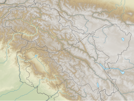
The Spanggur Gap (Chinese: 斯潘古爾山口; pinyin: Sī pān gǔ ěr shānkǒu) is a 4,900 metres (16,100 ft) high mountain pass on the Line of Actual Control between the Ladakh union territory of India and the Rutog County, Ngari Prefecture in the Tibet region of China. It is a gap in the mountains to the south of the Pangong Lake. To the east of the gap is the Spanggur Lake.
| Spanggur Gap | |
|---|---|
| Location | Ladakh, India – Tibet, China |
| Range | Pangong Range–Kailash Range |
| Coordinates | 33°34′23″N 78°46′48″E / 33.573°N 78.78°E |
According to Indian sources, India was in control of the Spanggur Gap during the war of 1962 and there were Indian posts there,[1][2][3] but it was taken over by the Chinese army during the Sino-Indian War as the Indian army withdrew in order to bolster defenses of the nearby Indian village of Chushul. India wants to restore the post and take over the pass.[4][5]


References
edit- ^
Singh, Jasjit (15 March 2013). China's India War, 1962 : looking back to see the future. New Delhi: KW Publishers in association with Centre for Air Power Studies. ISBN 978-93-81904-72-5. Retrieved 2 October 2017.
Holding on to Spanggur Gap and Maggar Hill was now considered futile and the posts were asked to withdraw.
- ^ Thapliyal, SV (April–June 2005). "Battle of Eastern Ladakh : 1962 Sino-Indian Conflict". Journal of the United Service Institution of India. 135 (560): 282–298. Archived from the original on 2021-07-31.
- ^ "存档副本". Archived from the original on 2020-10-19. Retrieved 2020-09-13.
- ^ Praval, Major K.C. (1987). Chapter 9. Lancer Publishers LLC. ISBN 9781935501619. Archived from the original on 2017-03-15. Retrieved 2020-09-13.
- ^ Mohan Guruswamy (19 November 2012). "Don't forget the heroes of Rezang La". The Hindu. Archived from the original on 2014-05-26.

