Buckerell
Appearance
| Buckerell | |
|---|---|
 The Deer Park Country House, near Buckerell. | |
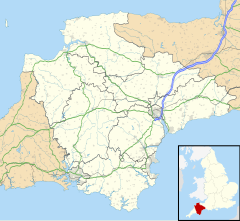
Location within Devon | |
| Population | 270 |
| Shire county | |
| Region | |
| Country | England |
| Sovereign state | United Kingdom |
| Post town | Honiton |
| Postcode district | EX14 |
| Dialling code | 01404 |
| Police | Devon and Cornwall |
| Fire | Devon and Somerset |
| Ambulance | South Western |
| UK Parliament | |
Buckerell is a small village and civil parish in the East Devon district of Devon, England. The village is about 2.5 miles west of the nearest town, Honiton. In the 2001 census a population of 270 was recorded for the parish, which is surrounded clockwise from the north by the parishes of Awliscombe, Honiton, Gittisham, Feniton and Payhembury. [1]
History
The Church of St Mary and St Giles dates from the 13th or 14th century and has been designates as a Grade II* listed building.[2] There is a richly-carved Chancel screen.[3] There is a statue of Britannia by John Bacon, in memory of Admiral Samuel Graves and his wife.[2][4]
References
- ^ "Map of Devon Parishes" (PDF). Devon County Council. Archived from the original (PDF) on 2 November 2013. Retrieved 7 July 2016.
- ^ a b Historic England. "Church of St Mary & St Giles (1333760)". National Heritage List for England. Retrieved 3 August 2020.
- ^ "Buckerell". Devon County Council. Archived from the original on 26 August 2016. Retrieved 12 July 2016.
- ^ "Church". Buckerell Parish Council. Retrieved 12 July 2016.
External links
Wikimedia Commons has media related to Buckerell.


