Colobraro
Colobraro | |
|---|---|
| Comune di Colobraro | |
 | |
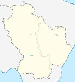
| Coordinates: 40°11′N 16°26′E / 40.183°N 16.433°E | |
| Country | Italy |
| Region | Basilicata |
| Province | Matera (MT) |
| Government | |
| • Mayor | Andrea Bernardo |
| Area | |
• Total | 65.91 km2 (25.45 sq mi) |
| Elevation | 630 m (2,070 ft) |
| Population (December 2009)[2] | |
• Total | 1,408 |
| • Density | 21/km2 (55/sq mi) |
| Demonym | Colobraresi |
| Time zone | UTC+1 (CET) |
| • Summer (DST) | UTC+2 (CEST) |
| Postal code | 75021 |
| Dialing code | 0835 |
| Patron saint | St. Nicholas |
| Saint day | 7 May |
| Website | Official website |
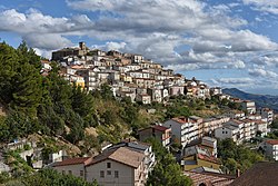
Colobraro (Lucano: Culuvrér) is a town and comune in the province of Matera, in the southern Italian region of Basilicata. The town is positioned on a high hill dominating the valley of river Sinni near the town of Valsinni.
Geography
Colobraro is located in southern Italy in the region of Basilicata. It is one of the agricultural centers in the Sinni River valley. It is located on the southern slopes of Mount Calvario at a height of 630 m, with views of the whole Ionian Sea coast. Colobraro is located near Highway 653, not far from the dam built on the Sinni river and Mount Cotugno. It borders the towns of Valsinni, Tursi, Rotondella, Senise, Sant'Arcangelo and Noepoli. Colobraro is about 80 km from the province's capital of Matera, and about 130 km from the region's capital of Potenza.
History
The hamlet is known as the "village without name":[3][4] its name is considered bringer of bad luck in the towns around, where Colobraro is usually mentioned in the local dialects simply as chillu paese, cudd' puaise or chill' pais,[what language is this?] all simply meaning "that village".
In the 1950s, a “masciara” (a type of local sorceress) got the reputation of being a witch, creating yet another myth thanks to her face lined with wrinkles. It is possible that she was simply a widow who dressed primarily in black.
The reason of being called “that village” or “the unlucky village” is because someone whom no one should mention proclaimed that this was a cursed location and that the chandelier will not fall if my statement is false. At that exact moment, the chandelier fell and shattered.
References
- ^ "Superficie di Comuni Province e Regioni italiane al 9 ottobre 2011". Italian National Institute of Statistics. Retrieved 16 March 2019.
- ^ All demographics and other statistics from the Italian statistical institute (Istat)
- ^ "Il paese che portasfortuna" (in Italian)
- ^ Colobraro Atlas Obscura (in English)


