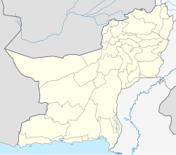
Muslim Bagh
Appearance
This article needs additional citations for verification. (July 2021) |
Muslim Bagh
مسلم باغ | |
|---|---|
| Coordinates: 30°49′31″N 67°44′8″E / 30.82528°N 67.73556°E | |
| Country | |
| Province | |
| District | Killa Saifullah |
| Elevation | 1,787 m (5,863 ft) |
| Population (1998) | |
| • City | 70,361 |
| Time zone | UTC+5 (PST) |
| Postal code | 85500 |
| Highways | |
Muslim Bagh (Pashto/Urdu: مسلم باغ), is a town in Killa Saifullah District, Balochistan, Pakistan. It is located at an altitude of 1,787 metres (5,863 ft). According to the Census of 1998, the population of Muslim Bagh is 70,361 (male 37,303 and female 33,058), with 10,188 households.
Muslim Bagh was formerly called Hindu Bagh; that name is believed to be a reference to an orchard planted by a Hindu saint in ages past.[1][2]
Notable people
References
- ^ Population Census Organisation, Statistics Division, 1998 district census report of Qilla Saifullah, Government of Pakistan, 2000, p. 13,
... Previously it was called Hindu Bagh. It is believed to be named after a garden planted by a Hindu saint ...
- ^ "Killa Saifullah District," Government of Balochistan, 2013, Retrieved on 21 Nov 2017


