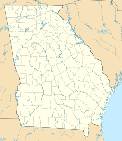
Rock Spring, Georgia
This article needs additional citations for verification. (July 2009) |
Rock Spring | |
|---|---|
 Lookout Mountain from Rock Spring. | |
| Coordinates: 34°48′53″N 85°14′20″W / 34.81472°N 85.23889°W | |
| Country | USA |
| State | Georgia |
| County | Walker County |
| Elevation | 263 m (863 ft) |
| Population | |
• Total | 891 |
| Time zone | UTC-5 (Eastern (EST)) |
| • Summer (DST) | UTC-4 (EDT) |
| GNIS feature ID | 2812702[1] |
Rock Spring is an unincorporated community and census-designated place[2] located in northwest Georgia, United States, approximately 14 miles (23 km) south of Chattanooga, Tennessee. It is in Walker County which resides in Georgia's 14th congressional district. Rock Spring is included in the Chattanooga, TN-GA Metropolitan Statistical Area.
The 2020 Census listed a population of 891.[3]
Highlights
[edit]The nearest major city is Chattanooga, and the nearest incorporated cities are Chickamauga and La Fayette. There is a Georgia Department of Driver Services branch in the community. Rock Spring Elementary School, Saddle Ridge Elementary, and Saddle Ridge Middle School serves the community as part of the Walker County School District. Walker County has relocated its tag and tax office to a former bank building at the intersection of US 27 and Hwy 95.
History
[edit]Northwest Georgia has a significant history tied to the Civil War. The Battle of Chickamauga was fought in the Chickamauga area, and was one of the major battles of the war. Chickamauga and Chattanooga National Military Park spans over 9000 acres and is located in nearby Chickamauga.
Demographics
[edit]| Census | Pop. | Note | %± |
|---|---|---|---|
| 2020 | 891 | — | |
| U.S. Decennial Census[4] 1850-1870[5] 1870-1880[6] 1890-1910[7] 1920-1930[8] 1940[9] 1950[10] 1960[11] 1970[12] 1980[13] 1990[14] 2000[15] 2010[16] 2020[17] | |||
Rock Spring was first listed as a census designated place in the 2020 U.S. Census.[17]
| Race / Ethnicity (NH = Non-Hispanic) | Pop 2020[17] | % 2020 |
|---|---|---|
| White alone (NH) | 818 | 91.81% |
| Black or African American alone (NH) | 14 | 1.57% |
| Native American or Alaska Native alone (NH) | 0 | 0.00% |
| Asian alone (NH) | 6 | 0.67% |
| Pacific Islander alone (NH) | 2 | 0.22% |
| Other race alone (NH) | 7 | 0.79% |
| Mixed race or Multiracial (NH) | 39 | 4.38% |
| Hispanic or Latino (any race) | 5 | 0.56% |
| Total | 891 | 100.00% |
References
[edit]- ^ a b "Rock Spring Census Designated Place". Geographic Names Information System. United States Geological Survey, United States Department of the Interior.
- ^ U.S. Geological Survey Geographic Names Information System: Rock Spring
- ^ "Rock Spring CDP, Georgia". United States Census Bureau. Retrieved March 13, 2022.
- ^ "Decennial Census of Population and Housing by Decade". United States Census Bureau.
- ^ "1870 Census of Population - Georgia - Population of Civil Divisions less than Counties" (PDF). United States Census Bureau. 1870.
- ^ "1880 Census of Population - Georgia - Population of Civil Divisions less than Counties" (PDF). United States Census Bureau. 1880.
- ^ "1910 Census of Population - Georgia" (PDF). United States Census Bureau. 1910.
- ^ "1930 Census of Population - Georgia" (PDF). United States Census Bureau. 1930. pp. 251–256.
- ^ "1940 Census of Population - Georgia" (PDF). United States Census Bureau. 1940.
- ^ "1950 Census of Population - Georgia" (PDF). United States Census Bureau. 1950.
- ^ "1960 Census of Population - Population of County Subdivisions - Georgia" (PDF). United States Census Bureau. 1960.
- ^ "1970 Census of Population - Population of County Subdivisions - Georgia" (PDF). United States Census Bureau. 1970.
- ^ "1980 Census of Population - Number of Inhabitants - Georgia" (PDF). United States Census Bureau. 1980.
- ^ "1990 Census of Population - Summary Social, Economic, and Housing Characteristics - Georgia" (PDF). United States Census Bureau. 1990.
- ^ "2000 Census of Population - General Population Characteristics - Georgia" (PDF). United States Census Bureau. 2000.
- ^ "2010 Census of Population - General Population Characteristics - Georgia" (PDF). United States Census Bureau. 2010.
- ^ a b c "P2 Hispanic or Latino, and Not Hispanic or Latino by Race – 2020: DEC Redistricting Data (PL 94-171) – Rock Spring CDP, Georgia". United States Census Bureau.


