Scandia, Alberta: Difference between revisions
No edit summary |
|||
| Line 122: | Line 122: | ||
As a designated place in the [[Canada 2011 Census|2011 Census]], Scandia had a population of 154 living in 46 of its 55 total dwellings, a 12.4% change from its 2006 population of 137. With a land area of {{convert|0.2|km2|sqmi|abbr=on}}, it had a population density of {{Pop density|154|0.2|km2|sqmi}} in 2011.<ref name=statcan2011dpl>{{cite web | url=http://www12.statcan.gc.ca/census-recensement/2011/dp-pd/hlt-fst/pd-pl/Table-Tableau.cfm?LANG=Eng&T=1302&PR=48&S=51&O=A&RPP=25 | title=Population and dwelling counts, for Canada, provinces and territories, and designated places, 2011 and 2006 censuses (Alberta) | publisher=Statistics Canada | date=2012-02-08 | accessdate=2012-04-07}}</ref> |
As a designated place in the [[Canada 2011 Census|2011 Census]], Scandia had a population of 154 living in 46 of its 55 total dwellings, a 12.4% change from its 2006 population of 137. With a land area of {{convert|0.2|km2|sqmi|abbr=on}}, it had a population density of {{Pop density|154|0.2|km2|sqmi}} in 2011.<ref name=statcan2011dpl>{{cite web | url=http://www12.statcan.gc.ca/census-recensement/2011/dp-pd/hlt-fst/pd-pl/Table-Tableau.cfm?LANG=Eng&T=1302&PR=48&S=51&O=A&RPP=25 | title=Population and dwelling counts, for Canada, provinces and territories, and designated places, 2011 and 2006 censuses (Alberta) | publisher=Statistics Canada | date=2012-02-08 | accessdate=2012-04-07}}</ref> |
||
The 23.4 mile Cassils Southerly Branch of the [[Canadian Pacific Railway]] was built from Cassils to Scandia in 1927-1928.<ref>Grain and Rail in Western Canada Canada. Grain Handling and Transportation Commission - 1977 0660010143 "CP Rail - Cassils Subdivision - From Cassils to Scandia, Alberta - 23.4 miles This line was constructed in 1928. The rail is a mixture of 60 and 85 pound steel with a gross carrying capacity of 177 thousand pounds. There are no elevators on"</ref> |
The 23.4 mile Cassils Southerly Branch of the [[Canadian Pacific Railway]] was built from [[Cassils, Alberta|Cassils]] to Scandia in 1927-1928.<ref>Grain and Rail in Western Canada Canada. Grain Handling and Transportation Commission - 1977 0660010143 "CP Rail - Cassils Subdivision - From Cassils to Scandia, Alberta - 23.4 miles This line was constructed in 1928. The rail is a mixture of 60 and 85 pound steel with a gross carrying capacity of 177 thousand pounds. There are no elevators on"</ref> |
||
== Attractions == |
== Attractions == |
||
* [[Scandia Eastern Irrigation District Museum]]<ref>[https://hermis.alberta.ca/ARHP/Details.aspx?DeptID=1&ObjectID=4665-0602 Scandia Eastern Irrigation District Museum.]</ref> |
* [[Scandia Eastern Irrigation District Museum]]<ref>[https://hermis.alberta.ca/ARHP/Details.aspx?DeptID=1&ObjectID=4665-0602 Scandia Eastern Irrigation District Museum.]</ref> |
||
Revision as of 18:50, 14 August 2017
Scandia | |
|---|---|
 Last remaining prairie grain elevator in the Scandia district. | |
| Coordinates: 50°16′41″N 112°02′48″W / 50.27806°N 112.04667°W | |
| Country | |
| Province | |
| Region | Southern Alberta |
| Census division | 2 |
| Municipal district | County of Newell |
| Government | |
| • Governing body | County of Newell Council |
| Population (2011)[1] | |
• Total | 154 |
| Time zone | UTC-7 (MST) |
| Postal code span | |
| Area code | +1-403 |
| Highways | Highway 36 |
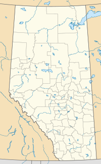
Scandia is a hamlet in Alberta, Canada within the County of Newell.[2] It is located 2 kilometres (1.2 mi) west of Highway 36, approximately 34 kilometres (21 mi) southwest of Brooks.
Demographics
As a designated place in the 2016 Census of Population conducted by Statistics Canada, Scandia recorded a population of 146 living in 43 of its 54 total private dwellings, a change of -5.2% from its 2011 population of 154. With a land area of 0.19 km2 (0.073 sq mi), it had a population density of 768.4/km2 (1,990.2/sq mi) in 2016.[3]
As a designated place in the 2011 Census, Scandia had a population of 154 living in 46 of its 55 total dwellings, a 12.4% change from its 2006 population of 137. With a land area of 0.2 km2 (0.077 sq mi), it had a population density of 770/km2 (2,000/sq mi) in 2011.[1]
The 23.4 mile Cassils Southerly Branch of the Canadian Pacific Railway was built from Cassils to Scandia in 1927-1928.[4]
Attractions
See also
- List of communities in Alberta
- List of designated places in Alberta
- List of hamlets in Alberta
- List of museums in Alberta
- List of provincial historic sites of Alberta
References
- ^ a b "Population and dwelling counts, for Canada, provinces and territories, and designated places, 2011 and 2006 censuses (Alberta)". Statistics Canada. 2012-02-08. Retrieved 2012-04-07.
- ^ Alberta Municipal Affairs (2010-04-01). "Specialized and Rural Municipalities and Their Communities" (PDF). Retrieved 2010-07-03.
- ^ "Population and dwelling counts, for Canada, provinces and territories, and designated places, 2016 and 2011 censuses – 100% data (Alberta)". Statistics Canada. February 8, 2017. Retrieved February 13, 2017.
- ^ Grain and Rail in Western Canada Canada. Grain Handling and Transportation Commission - 1977 0660010143 "CP Rail - Cassils Subdivision - From Cassils to Scandia, Alberta - 23.4 miles This line was constructed in 1928. The rail is a mixture of 60 and 85 pound steel with a gross carrying capacity of 177 thousand pounds. There are no elevators on"
- ^ Scandia Eastern Irrigation District Museum.

