Carway, Alberta
Carway | |
|---|---|
 Border crossing in Carway, Alberta | |
| Coordinates: 49°00′00″N 113°22′45″W / 49.00000°N 113.37917°W | |
| Country | Canada |
| Province | Alberta |
| Region | Southern Alberta |
| Census division | 3 |
| Municipal district | Cardston County |
| Government | |
| • Type | Unincorporated |
| • Governing body | Cardston County Council |
| Population (2008)[1] | |
• Total | 2 |
| Time zone | UTC−07:00 (MST) |
| • Summer (DST) | UTC−06:00 (MDT) |
| Area code(s) | 403, 587, 825 |
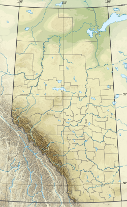
Carway is a hamlet in southern Alberta, Canada within Cardston County.[2] It is a port of entry into the U.S. state of Montana opposite of Port of Piegan.[3] Just on the other side of the border is the Blackfeet Indian Reservation in Glacier County, Montana.
Located approximately 23 km (14 mi) south of Cardston. Carway is on the southernmost point of Highway 2, which becomes U.S. Route 89 in Montana.
The hamlet was named by William Roberts, the first officer in charge of the station, as a portmanteau of Cardston and highway.[4]
Climate
[edit]Carway has a humid continental climate (Dfb) with mild, rainy summers and cold, snowy winters with annual snowfall averaging 250.4 cm (98.6 in).
| Climate data for Carway, Alberta | |||||||||||||
|---|---|---|---|---|---|---|---|---|---|---|---|---|---|
| Month | Jan | Feb | Mar | Apr | May | Jun | Jul | Aug | Sep | Oct | Nov | Dec | Year |
| Record high °C (°F) | 16.7 (62.1) |
19.0 (66.2) |
24.4 (75.9) |
29.4 (84.9) |
30.0 (86.0) |
32.8 (91.0) |
38.0 (100.4) |
36.1 (97.0) |
35.0 (95.0) |
30.0 (86.0) |
24.4 (75.9) |
17.8 (64.0) |
38.0 (100.4) |
| Mean daily maximum °C (°F) | 0.8 (33.4) |
1.0 (33.8) |
4.8 (40.6) |
9.9 (49.8) |
15.0 (59.0) |
18.8 (65.8) |
23.6 (74.5) |
23.5 (74.3) |
17.8 (64.0) |
11.5 (52.7) |
4.0 (39.2) |
0.3 (32.5) |
10.9 (51.6) |
| Daily mean °C (°F) | −5.0 (23.0) |
−4.7 (23.5) |
−0.9 (30.4) |
3.9 (39.0) |
8.5 (47.3) |
12.3 (54.1) |
15.9 (60.6) |
15.5 (59.9) |
10.7 (51.3) |
5.2 (41.4) |
−1.5 (29.3) |
−5.2 (22.6) |
4.6 (40.3) |
| Mean daily minimum °C (°F) | −10.9 (12.4) |
−10.6 (12.9) |
−6.6 (20.1) |
−2.2 (28.0) |
2.0 (35.6) |
5.7 (42.3) |
8.1 (46.6) |
7.5 (45.5) |
3.5 (38.3) |
−1.1 (30.0) |
−7.0 (19.4) |
−10.6 (12.9) |
−1.8 (28.8) |
| Record low °C (°F) | −43.3 (−45.9) |
−39.4 (−38.9) |
−36.1 (−33.0) |
−26.7 (−16.1) |
−14.4 (6.1) |
−4.4 (24.1) |
−3.0 (26.6) |
−7.0 (19.4) |
−15.6 (3.9) |
−26.7 (−16.1) |
−34.0 (−29.2) |
−43.9 (−47.0) |
−43.9 (−47.0) |
| Average precipitation mm (inches) | 25.4 (1.00) |
28.6 (1.13) |
45.9 (1.81) |
53.1 (2.09) |
78.5 (3.09) |
92.9 (3.66) |
39.9 (1.57) |
44.0 (1.73) |
51.2 (2.02) |
29.0 (1.14) |
33.9 (1.33) |
27.8 (1.09) |
550.2 (21.66) |
| Average rainfall mm (inches) | 0.0 (0.0) |
0.0 (0.0) |
0.5 (0.02) |
12.1 (0.48) |
59.0 (2.32) |
91.6 (3.61) |
39.9 (1.57) |
42.9 (1.69) |
45.2 (1.78) |
7.2 (0.28) |
0.9 (0.04) |
0.5 (0.02) |
229.8 (9.05) |
| Average snowfall cm (inches) | 25.4 (10.0) |
28.6 (11.3) |
45.4 (17.9) |
40.9 (16.1) |
19.5 (7.7) |
1.3 (0.5) |
0.0 (0.0) |
1.2 (0.5) |
6.0 (2.4) |
21.8 (8.6) |
32.9 (13.0) |
27.4 (10.8) |
250.4 (98.6) |
| Source: Environment Canada[5] | |||||||||||||
Demographics
[edit]The population of Carway according to the 2008 municipal census conducted by Cardston County is 2.[1]
See also
[edit]- Piegan–Carway Border Crossing
- List of communities in Alberta
- List of hamlets in Alberta
- List of geographic names derived from portmanteaus
References
[edit]- ^ a b "Alberta Population Summary: Alberta's Hamlets Alphabetically, 2010" (PDF). Alberta Population. Archived from the original (PDF) on December 11, 2021. Retrieved September 25, 2021.
- ^ "Specialized and Rural Municipalities and Their Communities" (PDF). Alberta Municipal Affairs. June 3, 2024. Retrieved June 14, 2024.
- ^ Your Official Road Map of Alberta (Map). Alberta Tourism, Parks and Recreation. 2014.
- ^ Marden, Ernest G.; Marden, Austin (2010). Community Place Names of Alberta. Lulu.com. p. 67. ISBN 978-1897472170.
- ^ "Canadian Climate Normals 1981-2010 Station Data - Carway". Environment and Climate Change Canada. Retrieved August 10, 2020.


