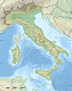
1627 Gargano earthquake
Appearance
| Local date | July 30, 1627 |
|---|---|
| Local time | 10:50[1] |
| Magnitude | 6.7 Mw[2] |
| Epicenter | 41°44′N 15°20′E / 41.74°N 15.34°E[2] |
| Fault | Apricena Fault[3] |
| Total damage | Severe[1] |
| Max. intensity | MMI X (Extreme)[1] |
| Tsunami | Yes[1] |
| Casualties | 5,000 dead |
The 1627 Gargano earthquake struck Gargano and part of Tavoliere, southern Italy, at about mid-day on 30 July 1627. A "very large earthquake" caused a major tsunami, the largest seismic event ever recorded in the Gargano region,[4] which "produced severe damage in the whole promontory", killing about 5,000 people.[5] Four aftershocks were documented. The most extensive damage was noted between San Severo and Lesina.
Some sources describe a large 1626 Naples earthquake,[6] but other have argued that these are misreports of the 1627 event.[7]
References
[edit]- ^ a b c d National Geophysical Data Center / World Data Service (NGDC/WDS) (1972), Significant Earthquake Database (Data Set), National Geophysical Data Center, NOAA, doi:10.7289/V5TD9V7K
- ^ a b Rovida, Andrea; Locati, Mario; Camassi, Romano; Lolli, Barbara; Gasperini, Paolo (2016), "Earthquake catalog", in Rovida, A.; Locati, M.; Camassi, R.; Lolli, B.; Gasperini, P. (eds.), CPTI15, the 2015 version of the Parametric Catalogue of Italian Earthquakes (Data Set), National Institute of Geophysics and Volcanology, doi:10.6092/INGV.IT-CPTI15
- ^ Patacca, E.; Scandone, P. (2004). "The 1627 Gargano earthquake (Southern Italy): Identification and characterization of the causative fault". Journal of Seismology. 8 (2): 259–273. Bibcode:2004JSeis...8..259P. doi:10.1023/B:JOSE.0000021393.77543.1e. S2CID 129298576.
- ^ De Martini, P. M.; Burrato, P.; Pantosti, D.; Maramai, A.; Graziani, L.; Abramson, H. (2003), "Identification of tsunami deposits and liquefaction features in the Gargano area (Italy): paleoseismological implication", Annals of Geophysics, 46 (5), National Institute of Geophysics and Volcanology: 883, 884, 887–897
- ^ "Numerical simulations of the 1627 Gargano Tsunami" (PDF). University of Bologna, accessed via ftp.ingv.it. 1997. Retrieved 19 May 2015.
- ^ Gates, Alexander E.; Ritchie, David (2009). Encyclopedia of Earthquakes and Volcanoes. Infobase Publishing. p. 292. ISBN 978-0-8160-7270-5.
- ^ Wasowski, J; Del Gaudio, V (December 2000). "Evaluating seismically induced mass movement hazard in Caramanico Terme (Italy)". Engineering Geology. 58 (3–4): 291–311. Bibcode:2000EngGe..58..291W. doi:10.1016/S0013-7952(00)00040-5.

