Ácsteszér
Appearance
Ácsteszér Tesier/Zierndorf | |
|---|---|
 The Roman Catholic church | |
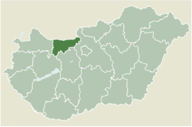
 Location of Komárom-Esztergom county in Hungary | |
| Coordinates: 47°24′32″N 18°00′22″E / 47.40891°N 18.00604°E | |
| Country | |
| County | Komárom-Esztergom |
| Area | |
• Total | 17.73 km2 (6.85 sq mi) |
| Population (2004) | |
• Total | 767 |
| • Density | 43.26/km2 (112.0/sq mi) |
| Time zone | UTC+1 (CET) |
| • Summer (DST) | UTC+2 (CEST) |
| Postal code | 2887 |
| Area code | 34 |
Ácsteszér (Ács-Teszér, German: Tesier, Zierndorf) is a village in Komárom-Esztergom county, Hungary.
Etymology
[edit]The name of the village referred to the profession of the villagers. Hungarian ács and Slavic tesar with the same meaning - a carpenter.[1]
People
[edit]- Mihály Táncsics, born here
References
[edit]- ^ Kiss, Lajos (1978). Földrajzi nevek etimológiai szótára (in Hungarian). Budapest: Akadémiai. p. 38.
External links
[edit]


