Acuff, Texas
Acuff, Texas | |
|---|---|
 Downtown Acuff, Texas | |
| Coordinates: 33°35′42″N 101°37′13″W / 33.59500°N 101.62028°W[1] | |
| Country | United States |
| State | Texas |
| County | Lubbock |
| Region | Llano Estacado |
| Established | 1891 |
| Founded by | Michael S. Acuff |
| Elevation | 3,140 ft (960 m) |
| Population (2010) | |
• Total | 30 |
| Time zone | UTC-6 (CST) |
| ZIP code | 79403 |
| Area code | 806 |
| Website | Handbook of Texas |
Acuff is an unincorporated farming community in northeastern Lubbock County, Texas, United States. According to the Handbook of Texas, the community had a population of 30 in 2000. It is part of the Lubbock metropolitan area.
History
[edit]The community was named for a local man, Michael S. Acuff. A post office operated in Acuff from 1903 to 1912. Baptist and Methodist services were held in the same church building in the 1940s.[2]
Acuff is close to the Lubbock International Dragway.[2]
| Year | 1930 | 1940 | 1950 | 1960 | 1990 |
|---|---|---|---|---|---|
| Population | 25 | 25 | 50 | 50 | 30 |
Geography
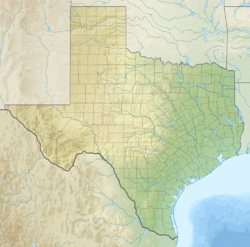
[edit]Acuff is located at the intersection of Farm to Market Roads 40 and 789, 10 mi (16 km) east of Lubbock in east-central Lubbock County.[2]
Education
[edit]The first school at Acuff was built in 1902 and the second was built in 1924. The community was incorporated into the Roosevelt Independent School District in 1947.[2]
Notable people
[edit]References
[edit]- ^ a b "Acuff". Geographic Names Information System. United States Geological Survey, United States Department of the Interior.
- ^ a b c d e Acuff, TX from the Handbook of Texas Online
- ^ Oglesby, Chris. "Chris Oglesby interviews Lloyd Maines". Virtualubbock. Retrieved March 20, 2013.


