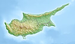
Agridia
Appearance
Agridia | |
|---|---|
 | |
| Coordinates: 34°55′43″N 32°59′40″E / 34.92861°N 32.99444°E | |
| Country | |
| District | Limassol District |
| Population (2011)[1] | |
| • Total | 104 |
| Website | www |
Agridia (Greek: Αγρίδια) is a village in the Limassol District of Cyprus, located 2 kilometres (1.2 mi) south of Chandria.
History
[edit]Agridia is a small village of the Region of Pitsilia, in the Lemesos District. It is the ninth highest village in Cyprus, built on an altitude of 1100 m above sea level.[citation needed]
The village has two churches dedicated to Prophet Elias. These include a small chapel built on a hill, and a large church in the center of the village.[citation needed]
Further reading
[edit]- Giorgos Karouzis, Strolling around Cyprus, Lemesos, City and District, Lefkosia 2001 [ISBN unspecified]
References
[edit]- ^ "Population - Place of Residence, 2011". Statistical Service of Cyprus (CYSTAT). 17 April 2014. Archived from the original on 2014-10-16. Retrieved 2014-11-17.


