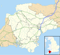
Aller, Devon
Appearance
| Aller | |
|---|---|
Location within Devon | |
| OS grid reference | ST0506 |
| Civil parish | |
| District | |
| Shire county | |
| Region | |
| Country | England |
| Sovereign state | United Kingdom |
| Police | Devon and Cornwall |
| Fire | Devon and Somerset |
| Ambulance | South Western |
Aller is a village in the civil parish of Kentisbeare in the historic county of Devon, England.[1][2] Aller is situated about 2 miles (3.2 km) east of Cullompton.
Historically, it has been known by other names, such as Aulers during the 15th century. Alre, Alra, Avra, and Avvra have all been used since the 10th century.[3]
References
[edit]- ^ Ordnance Survey: 1:50,000 Scale Gazetteer (Map). Ordnance Survey. 1 January 2016.
- ^ Ordnance Survey: Landranger map sheet 192 Exeter & Sidmouth (Map). Ordnance Survey. 2013. ISBN 978-0-319-23139-5.
- ^ "TGN Full Record Display, English (Getty Research)". www.getty.edu. Retrieved 11 October 2017.
External links
[edit]- Aller in the Domesday Book

