Ancona Point, Ontario
Appearance
This article has multiple issues. Please help improve it or discuss these issues on the talk page. (Learn how and when to remove these messages)
|
Ancona Point | |
|---|---|
Community | |
| Coordinates: 44°30′11″N 78°36′51″W / 44.50306°N 78.61417°W | |
| Country | |
| Province | |
| Municipality | Kawartha Lakes |
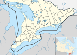
Ancona Point, Ontario is located in the former Township of Verulam, Ontario within the city of Kawartha Lakes, Ontario, Canada, and lies on Sturgeon Lake, 8 kilometres (5 mi) along County Road 24 south-west of Bobcaygeon.
This stop on the former Canadian Pacific Railway was to have been called Scotch Line, but, after a disagreement between local residents, the completely unrelated Ancona Point was chosen as the station name. [1] Scotch Line Road, which travels south from Ancona Point to Ontario Highway 36, retains the originally mooted name.[2]
References
[edit]- "Topographic Map sheets 31D7 & 31D10". Atlas of Canada. Natural Resources Canada. 2006-02-06. Archived from the original on 22 January 2009. Retrieved 2008-12-21.
44°30′11″N 78°36′51″W / 44.50306°N 78.61417°W
- ^ "Victoria County - Pioneer History". www.ontariogenealogy.com. Retrieved 2024-08-07.
- ^ "The Lost Community of Scotch Line: Thurston Album of Dunsford History: Kawartha Lakes Public Library Digital Archive". vitacollections.ca. Retrieved 2024-08-07.


