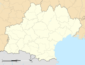
Antin, Hautes-Pyrénées
Appearance
Antin | |
|---|---|
 The church of Antin | |
| Coordinates: 43°20′05″N 0°17′17″E / 43.3347°N 0.2881°E | |
| Country | France |
| Region | Occitania |
| Department | Hautes-Pyrénées |
| Arrondissement | Tarbes |
| Canton | Les Coteaux |
| Government | |
| • Mayor (2020–2026) | Jean Maumus[1] |
Area 1 | 7.46 km2 (2.88 sq mi) |
| Population (2022)[2] | 94 |
| • Density | 13/km2 (33/sq mi) |
| Time zone | UTC+01:00 (CET) |
| • Summer (DST) | UTC+02:00 (CEST) |
| INSEE/Postal code | 65015 /65220 |
| Elevation | 246–404 m (807–1,325 ft) (avg. 330 m or 1,080 ft) |
| 1 French Land Register data, which excludes lakes, ponds, glaciers > 1 km2 (0.386 sq mi or 247 acres) and river estuaries. | |
Antin (French pronunciation: [ɑ̃tɛ̃]) is a commune in the Hautes-Pyrénées department in southwestern France. It was once a duchy owned by the House of Pardaillan de Gondrin, the family which Madame de Montespan married into.
The former Barony then Marquisate, was elevated to a duchy by Louis XIV (former lover of Mme de Montespan) in 1711 for Louis Antoine de Pardaillan de Gondrin and was passed down his family till its extinction in 1757 at the death of Louis Antoine's great grandson Louis de Pardaillan de Gondrin (1727–1757) who died in Breme during the Seven Years' War.
Population
[edit]| Year | Pop. | ±% p.a. |
|---|---|---|
| 1968 | 179 | — |
| 1975 | 170 | −0.73% |
| 1982 | 150 | −1.77% |
| 1990 | 131 | −1.68% |
| 1999 | 136 | +0.42% |
| 2009 | 114 | −1.75% |
| 2014 | 123 | +1.53% |
| 2020 | 101 | −3.23% |
| Source: INSEE[3] | ||
See also
[edit]References
[edit]- ^ "Répertoire national des élus: les maires". data.gouv.fr, Plateforme ouverte des données publiques françaises (in French). 2 December 2020.
- ^ (in French). The National Institute of Statistics and Economic Studies. 19 December 2024 https://www.insee.fr/fr/statistiques/8288323?geo=COM-65015.
{{cite web}}: Missing or empty|title=(help) - ^ Population en historique depuis 1968, INSEE
Wikimedia Commons has media related to Antin.


