Arab al-Bawati
Arab al-Bawati
عرب البواطي/خربة الحكمة | |
|---|---|
Village | |
| Etymology: Kh. el Hakeimîyeh, the ruin of el Hakeimîyeh[1] | |
A series of historical maps of the area around Arab al-Bawati (click the buttons) | |
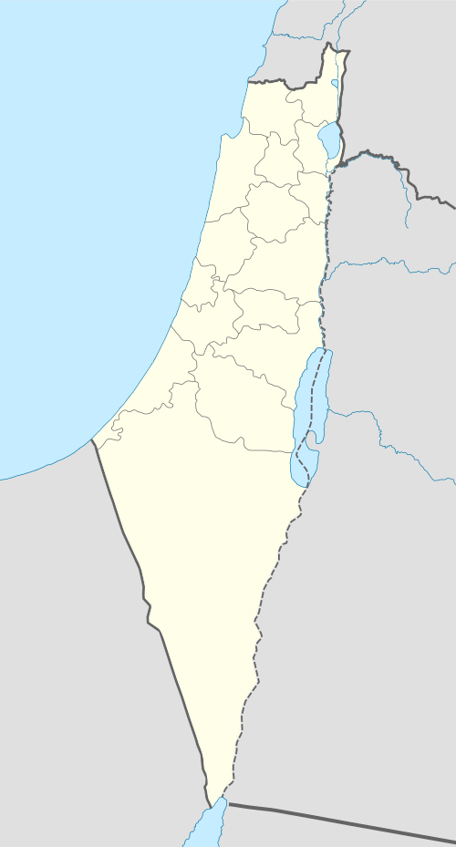
Location within Mandatory Palestine | |
| Coordinates: 32°31′41″N 35°32′21″E / 32.52806°N 35.53917°E | |
| Palestine grid | 200/214 |
| Geopolitical entity | Mandatory Palestine |
| Subdistrict | Baysan |
| Date of depopulation | 16 or 20 May 1948[4] |
| Area | |
| • Total | 10,641 dunams (10.641 km2 or 4.109 sq mi) |
| Population (1945) | |
| • Total | 520[2][3] |
| Cause(s) of depopulation | Influence of nearby town's fall |
Arab al-Bawati (Arabic: عرب البواطي/خربة الحكمة), was a Palestinian Arab village in the District of Baysan. It was depopulated during the 1948 Arab-Israeli War.
It was located 4 kilometres north east of Baysan in the Baysan valley.
History
[edit]In 1882, the PEF's Survey of Western Palestine described Kh. el Hakeimiyeh as having "ruined walls and a few modern deserted houses – a small deserted village".[5]
British Mandate era
[edit]In the 1922 census of Palestine, conducted by the Mandatory Palestine authorities, Bawati had a population of 348 Muslims,[6] increasing in the 1931 census to 461 (under the name of 'Arab Hakamiya), still all Muslims, in 86 houses.[7]
In the 1945 statistics it had a population of 520 Muslims[2] with a total of 10,641 dunums of land.[3] That year Arabs used 2,225 dunams of village lands for plantations and irrigated land, 3,335 for cereals,[8] while 52 dunams were classed as uncultivable.[9]
1948 and aftermath
[edit]Many of the villagers left early in the war, apparently after a Haganah attack.[10][11] The village was destroyed on May 16, or May 20, 1948.[4] Following the war the area was incorporated into the State of Israel and the land was left undeveloped; the nearest village is Hamadia.
In 1992, it was described: "All of the village houses have been demolished. The remains of basalt stone walls and the square and circular foundations of buildings can be seen among the weeds."[12] Evidence of historic occupation includes Roman milestones and ruined buildings at the Khirbat al Bawati.[12]
References
[edit]- ^ Palmer, 1881, p. 162
- ^ a b Department of Statistics, 1945, p. 6
- ^ a b Government of Palestine, Department of Statistics. Village Statistics, April, 1945. Quoted in Hadawi, 1970, p. 43
- ^ a b Morris, 2004, p. xvii, village #135. Also gives cause of depopulation, with a "?"
- ^ Conder and Kitchener, 1882, SWP II, p. 122
- ^ Barron, 1923, Table IX, p. 31
- ^ Mills, 1932, p. 79
- ^ Government of Palestine, Department of Statistics. Village Statistics, April, 1945. Quoted in Hadawi, 1970, p. 84
- ^ Government of Palestine, Department of Statistics. Village Statistics, April, 1945. Quoted in Hadawi, 1970, p. 134
- ^ Morris, 2004, p. 132, note #543
- ^ Morris, 2004, p. 160, note #543
- ^ a b Khalidi, 1992, p. 42
Bibliography
[edit]- Barron, J. B., ed. (1923). Palestine: Report and General Abstracts of the Census of 1922. Government of Palestine.
- Conder, C.R.; Kitchener, H.H. (1882). The Survey of Western Palestine: Memoirs of the Topography, Orography, Hydrography, and Archaeology. Vol. 2. London: Committee of the Palestine Exploration Fund.
- Department of Statistics (1945). Village Statistics, April, 1945. Government of Palestine.
- Hadawi, S. (1970). Village Statistics of 1945: A Classification of Land and Area ownership in Palestine. Palestine Liberation Organization Research Center.
- Khalidi, W. (1992). All That Remains:The Palestinian Villages Occupied and Depopulated by Israel in 1948. Washington D.C.: Institute for Palestine Studies. ISBN 0-88728-224-5.
- Mills, E., ed. (1932). Census of Palestine 1931. Population of Villages, Towns and Administrative Areas. Jerusalem: Government of Palestine.
- Morris, B. (2004). The Birth of the Palestinian Refugee Problem Revisited. Cambridge University Press. ISBN 978-0-521-00967-6.
- Palmer, E.H. (1881). The Survey of Western Palestine: Arabic and English Name Lists Collected During the Survey by Lieutenants Conder and Kitchener, R. E. Transliterated and Explained by E.H. Palmer. Committee of the Palestine Exploration Fund.


