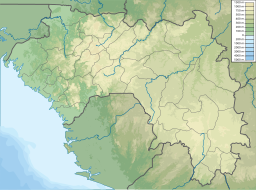
Baie de Sangareya
Appearance
| Sangareya Bay | |
|---|---|
| Baie de Sangareya (French) | |
| Coordinates | 9°38′N 13°45′W / 9.633°N 13.750°W |
| Ocean/sea sources | Atlantic Ocean |
| Basin countries | Guinea |
| Max. length | 15 km (9.3 mi) |
| Max. width | 27 km (17 mi) |
| Islands | Banana Islands |
| Settlements | Conakry |
Sangareya Bay (French: Baie de Sangareya)[1] is a bay in the coast of Guinea on the Atlantic Ocean.
Geography
[edit]The Sangareya Bay opens to the west and is located just to the north of Conakry. The Los Islands (Îles de Los) are located about 2 km off the headland limiting the bay on its southern side.
See also
[edit]References
[edit]- ^ "Baie de Sangareya". Mapcarta. Retrieved 16 October 2016.

