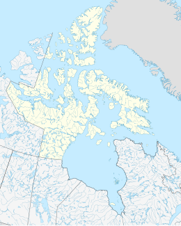
Beacon Island (Ungava Bay)
Appearance
| Geography | |
|---|---|
| Location | Ungava Bay |
| Coordinates | 58°54′02″N 66°20′28″W / 58.90056°N 66.34111°W[1] |
| Archipelago | Arctic Archipelago |
| Highest elevation | 208 m (682 ft) |
| Administration | |
Canada | |
| Territory | Nunavut |
| Region | Qikiqtaaluk |
| Demographics | |
| Ethnic groups | Inuit |
Beacon Island is a small uninhabited island in Ungava Bay, Qikiqtaaluk Region, Nunavut, Canada. It lies just off Cape Naujaat, on the west side of the mouth of the George River, Quebec.
See also
[edit]- Anguttuaq, formerly Beacon Island
- Beacon Island (Hudson Strait)
- Upajjana, formerly Beacon Island
References
[edit]


