Bruunshåb
Appearance
Bruunshåb | |
|---|---|
Town | |
| Coordinates: 56°25′25″N 9°26′40″E / 56.42361°N 9.44444°E | |
| Country | Denmark |
| Region | Central Denmark (Midtjylland) |
| Municipality | Viborg |
| Parish | Asmild Sogn |
| Founded by | Bertel Bruun |
| Area | |
| • Urban | 0.64 km2 (0.25 sq mi) |
| Population (2024)[1] | |
| • Urban | 776 |
| • Urban density | 1,200/km2 (3,100/sq mi) |
| Time zone | UTC+1 (Central European Time) |
| • Summer (DST) | UTC+2 (Central European Summer Time) |
| Postal code | 8800 |
| Area code | Viborg |
| ISO 3166 code | DK |
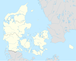
Bruunshåb is a little town in Viborg Municipality, Denmark. The town was established in 1821 around Bruunshaab Gamle Papfabrik.[2][3]
References
[edit]- ^ BY3: Population 1st January by urban areas, area and population density The Mobile Statbank from Statistics Denmark
- ^ Vagn Dybdahl (1953). Seksten Århusrids, tilegnede Svend Unmack Larsen, 23. september 1953 (in Danish). Universitetsforlaget. p. 118.
- ^ Jeff Horn; Leonard N. Rosenband; Merritt Roe Smith (1 January 2010). Reconceptualizing the Industrial Revolution. MIT Press. pp. 139–. ISBN 978-0-262-51562-7.
External links
[edit]- Bruunshaab Gl. Papfabrik (in Danish)
- Bruunshaab Gl. Papfabrik (in Danish)
- Viborg Kommune (in Danish)


