Bufali
Appearance
This article needs additional citations for verification. (May 2024) |
Bufali | |
|---|---|
| Coordinates: 38°52′4″N 0°30′52″W / 38.86778°N 0.51444°W | |
| Country | |
| Autonomous community | |
| Province | Valencia |
| Comarca | Vall d'Albaida |
| Judicial district | Ontinyent |
| Government | |
| • Alcalde | Juan Salvador Jordá Olcina |
| Area | |
• Total | 3.2 km2 (1.2 sq mi) |
| Elevation | 239 m (784 ft) |
| Population (2018)[1] | |
• Total | 159 |
| • Density | 50/km2 (130/sq mi) |
| Demonym(s) | Bufalità, bufalitana |
| Time zone | UTC+1 (CET) |
| • Summer (DST) | UTC+2 (CEST) |
| Postal code | 46891 |
| Official language(s) | Valencian |
| Website | Official website |
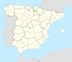
Bufali is a village and municipality about 3 km from Albaida and 78 km from the city of Valencia, Spain. It is situated in the Vall d'Albaida.
In the village itself there is the town hall which also houses the health centre, a small school a local shop and a pharmacy. There are small naves on the edge of the village which house some light industry. Behind the naves is Bufali station (parada), which is a stop on the Xàtiva–Alcoy service operated by Renfe. Bufali holds its Fiesta in August.
References
[edit]- ^ Municipal Register of Spain 2018. National Statistics Institute.


