Burning Cliff
Burning Cliff | |
|---|---|
 View of the cliff | |
| Coordinates: 50°38′00″N 2°20′28″W / 50.63320160°N 2.34103861°W | |
| Grid position | SY762815 |
| Location | Dorset, England |
| Highest elevation | 31.1m[1] |
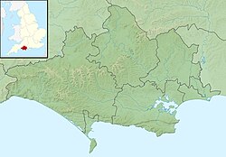
Burning Cliff is a cliff under the White Nothe headland at the eastern end of Ringstead Bay, in Dorset, England. The area is well known for its geology and fossils.
The cliff is to the northwest of White Nothe.[1] From 1826, the cliff smouldered with an underground fire for several years due to bituminous shale, hence the name.[2]
Geologically, Burning Cliff is on a Kimmeridge Clay outcrop.[2] It is immediately west of the fault and Holworth House. The cliff was originally named Holworth Cliff.[3] Today, the cliff consists of landslide, scrubland plants, with the Kimmeridge Clay partially visible. The Kimmeridge Clay above a fault connecting it with the Purbeck Formation to the east under Holworth House. There is a footpath on the cliff.
The 1826 fire in the bituminous shale continued for several years.[4] The fire is thought to have been started by heat caused by decomposing pyrite, common in bituminous shale. It emitted sulphurous fumes.

At the top of the cliff is a Church of England church, St Catherine-by-the-Sea, Holworth. The cliff lies on the South West Coast Path[5] and forms part of the Jurassic Coast World Heritage Site. The surrounding area is owned by the National Trust.[5]
See also
[edit]References
[edit]- ^ a b "Burning Cliff, West Dorset (DT2 8NG)". getoutside.ordnancesurvey.co.uk. UK: Ordnance Survey. Retrieved 20 January 2022.
- ^ a b West, Ian M. (6 June 2014). "Burning Cliff, Holworth, Ringstead Bay, Near Weymouth, 1826". Burning Cliffs of Dorset – Oil-Shale Fires. UK: University of Southampton. Retrieved 21 January 2022.
{{cite book}}:|work=ignored (help) - ^ Damon, R.F. (1884). Geology of Weymouth, Portland and the Coast of Dorsetshire from Swanage to Bridport-on-the-Sea: with Natural History and Archaeological Notes (2nd ed.). Weymouth: R.F. Damon.
- ^ Arkell, W.J. (1947). The Geology of the Country around Weymouth, Swanage, Corfe and Lulworth. London: H.M.S.O.
- ^ a b "Walk – Smugglers Inn – Burning Cliff". UK: South West Coast Path. Retrieved 21 January 2022.
External links
[edit] Media related to Burning Cliff at Wikimedia Commons

